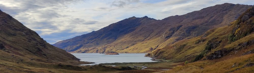
13/10/84 Dale Head from Borrowdale
Route: Grange (Borrowdale) – Manesty – High Spy – Dale Head – Hindscarth – Scope End and back via Newlands valley and over ridge back to Borrowdale
Myself and T. J Walmsley, accompanied by three others from the club, did this walk. It was drizzling as we climbed; and the rain poured as we traipsed drenched along Maiden Moor and Eel Crags. The rain rose to an unpleasant crescendo as we lunched at the head of the Newlands Valley, and then, it stopped. Clouds remained thick as we laboured up Dale Head, and the wind force 7 easily on the summit. My second visit to this top not graced by great views.
In these conditions we had to resort to map and compass bearing to get us safely off this summit; the wind hurled itself at us along the narrow ridge above Buttermere. A sudden gap in the clouds, and the Buttermere valley and the Honister Pass appeared before us in magnificent aspect. But only for a second.
Our route led us onto the next ridge to the right (Hindscarth and Scope End), and down that ridge into the Newlands Valley. Then, over the Cat Bells ridge at Skelgill Bank, back to Borrowdale. A poor day really, fit for little more than a teashop, but not bad use of it made.
[16/1/21: This day, and this area, are the inspiration for some of the setting of my story “Force Crag Mine”]
26/1/85 Stob Coire nan Lochan
Route: Stob Coire nan Lochan (3657’) via C gully starting and finishing from the Lost Valley
This was the “Walking contingent” in SPMC at that time: T. J Walmsey, Alister Durrant, Fiona, myself and Ian, Leaving the minibus in the Lost Valley parking space, we crossed Glen Coe under brilliant blue skies. Alpenglow rendered pink the distant summit of Bidean and the Church Door Buttress. It was –10 C and very clear, promising magnificent work.
Up into the Lost Valley through deep snow, down into the Valley itself through drifts waist deep. All of the high tops were now rosy pink with alpenglow. We moved up the right-hand side of the Valley, in very deep powdery snow. We could see B gully with no snow but a formidable ribbon of ice visible in it.
We continued up into a “shallow couloir” or snow-filled corrie hanging below the summit ridge. The snow was fresh, and footsteps collapsed even as you stepped out of them. It was tiring, uninspiring work. About half-way up we passed from shadow into sunlight, and instantly, it was warm. Snow crystals beckoned. The sky was a blue so deep it almost hurt to look at it. A camera could not have done justice to that blue. As we moved up, we saw more of the high tops, whalebacks and sometimes sharper ridges, against the more delicate pale blue at the edge of the sky.
In due course we noticed frost crystals on the rocks and spindrift being blown over – a sure sign we were approaching the ridge. Over the top and the view opened up in full. Behind us, Bidean and the Church Door Buttress; to the left, Glencoe village, Ballahullish, Loch Leven and every mountain from here to Nevis. I could only gape.
The pleasure was lessened by having to walk through a good foot of powdery snow to the summit, where we lunched in sunshine.
Advice on our progress from another climber saw us moving onward down the ridge. We were spread out; this was good work though tiring. There were so many footprints we had no trouble route-finding. Downwards to the coire nan lochan and onwards in the afternoon light, slow and oddly thirsty work, eventually bringing us back to the Valley and back to Glencoe for about 4.30pm. We then had a four-mile walk-out back to the Clachaig. No matter; we were there by 5.30pm after a glorious day on the hill.
27/1/85 Dinnertime buttress/No. 2 Gully Aonach Dubh
Route: Dinnertime buttress/No.2 Gully of Aonach Dubh. Party: Dr Terry, T, J Walmsley, myself, Fiona
A late Sunday morning start, 10ish or so, with climber “J.T” (Dr Terry) accompanying us walkers on a buttress route from the guide-book. The route looks huge, vertical and very exposed when seen from the road. It was windy and slightly warmer than yesterday. Existing snow was drifting as we crossed the valley floor. As we laboured up the steep walk-in, spindrift became a real nuisance, hiding everything, getting in the eyes, in the clothes, everywhere. I took my glasses off; driven snow made it impossible to see with them on. Over to the right, a gully was avalanching non-stop. Had anyone been in it they would have been “well f**ked” according to J.T.
Spindrift storms and driving wind kept our heads down and our eyes closed as we moved up the deep snow and occasional grass or rock shelf. Clouds gathered and it became apparent that the weather was deteriorating – it was going to snow.
The route unfolded; we moved from the buttress into the gully, over a rock rib and up more snow until J.T stopped. I lead around a rocky bulge until I got to a stop. It was snow at eighty degrees or a rock face. We chose the snow which was quite safe, and quite soon were at the top. A veritable hurricane was channelling over the top of Aonach Dubh. We lunched under a snow drift before walking and glissading back down again.
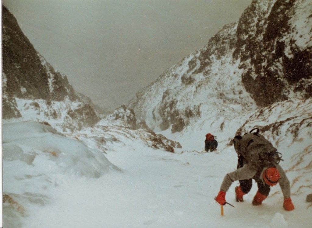
This route inspired me, captured my imagination and whet my appetite for more winter climbing. For a walker it was exciting. For the more experienced ice-climber like Dr Terry, it was “horrendous. I only did it for the tick in the guide-book”. Well!
22/2/85 A failed attempt on Helvellyn; hitching in the 1980s
Route: A failed attempt on Helvellyn in winter – without crampons
Tim W and myself hitched from Durham to Darlington, and had to walk round the centre of Darlington with big bags. Then we hitched to Scotch Corner with a soldier. Two hours late at Scotch Corner, after a false start we got a lift in a Mini 1275GT bound for…Ullswater. Result!
On the Saturday, after a night of driving rain and gale-force winds, we set off for Helvellyn without crampons. Bad idea.
Later, we were on the headwall above Red Tarn (which was frozen) on a surprisingly busy mountain. Grade I/II snow-filled gullies led up to the summit ridge, but we were not in a position to get on that hard snow without crampons. I learned on this weekend never to go on the hill in winter without crampons.
The next day we had to walk out from Patterdale all the way to Penrith, the entire length of Ullswater and more. 13 miles in four hours. We left Patterdale at 8.50a.m and my watch bleeped 1pm as we crossed the central strip of the A66 one mile from the M6 crossover (junction 36).
We hitched from Junction 36 (Penrith) to Scotch Corner with a wealthy Scottish barrister. An opinionated Yorkshireman in a sales rep Vauxhall Carlton estate treated us to his views on Swedish masseuses and Arthur Scargill, all the way to the tunnel entrance at Jarrow, from which we easily took the train home to Sunderland, change at Heworth.
9/3/85 Crib Goch, Snowdon and Y Lliwedd – a reverse Snowdon Horseshoe
Route: Rhydd Ddu, Y Lliwedd, Crib Goch, Yr Wyddfa (Snowdon), down the Clogwyn ridge to Rhydd Ddu – alone
Staying with the SPMC at the Oread Mountaineering Club’s “Snowdon House” (Tan-yr-Wyddfa) I resolved to repeat the reverse Snowdon horseshoe I’d done with A. Mackervoy in the summer of 1982 as Venture during Scout camp in the Lleyn Peninsula. The route would start and end at Rhydd Ddu. My colleagues opted for the more traditional technique of starting and finishing at Pen-y-pass.
Seventy-five minutes of hard walking brought me past the col Bwlch Cwm Llan, crossed the valley beyond and saw me breathless on the Watkin Path. Clouds swirled around as I toiled upward; sometimes dark and oppressive, sometimes the hidden sun brightening things up somewhat. On Y Lliwedd the wind was so strong I had trouble breathing. The scrambling here is good – though the visibility was poor today in these clouds. The snow-spattered cliffs and the edge were all to visible though. One has to take care here, especially alone.
I carved my name in old snow on the east summit, leaving at 1130. As I moved on towards the west summit the weather cleared slightly, and Llyn Lydaw far below, appeared briefly. Still the wind buffeted, save for precious few moments in the lee of the ridge, and so pre-occupied was I struggling, I missed the path down to the causeway. I found the path, rejoined it, and ran down to the causeway in improving weather. It improved still further as I started the climb up to the Pyg track at around 1pm.
The long scramble of Crib Goch was perfect. I could see for miles north and east. The route is technical enough in places to demand all your attention, certainly the best and most difficult scramble in the UK outside Scotland. Crib Goch was all in view, snow-spattered. Snowdon itself remained hidden.
This was good. I was lucky; I later found that my colleagues taking the more traditional route, remained in cloud all day long. All along Crib Goch there was a harsh wind; I was carefree, but not that carefree – it’s a long way down from here. Move to fast on Crib Goch and you’ll spend the rest of your life in Snowdonia – about ninety seconds.
Up onto Crib-y-ddysgl and from there, following the snow covered ridge until it met the railway line – easy work. Thence up the railway line – slow work. On top, a strange “cloud sea” was visible to the west. I looked at it for a while before stampeding down the south ridge in clearing weather. The south corrie, Cwm Tregalan, and the Watkin Path, were visible far below on my left. On the right, the sloping country down to Nant-y-Betws. I reached the slate quarried col at 4pm, and swiftly onto the OMC hut as the sun came out. A very good, even classic day.
