Backpacking the 4000′ tops of the Cairngorms

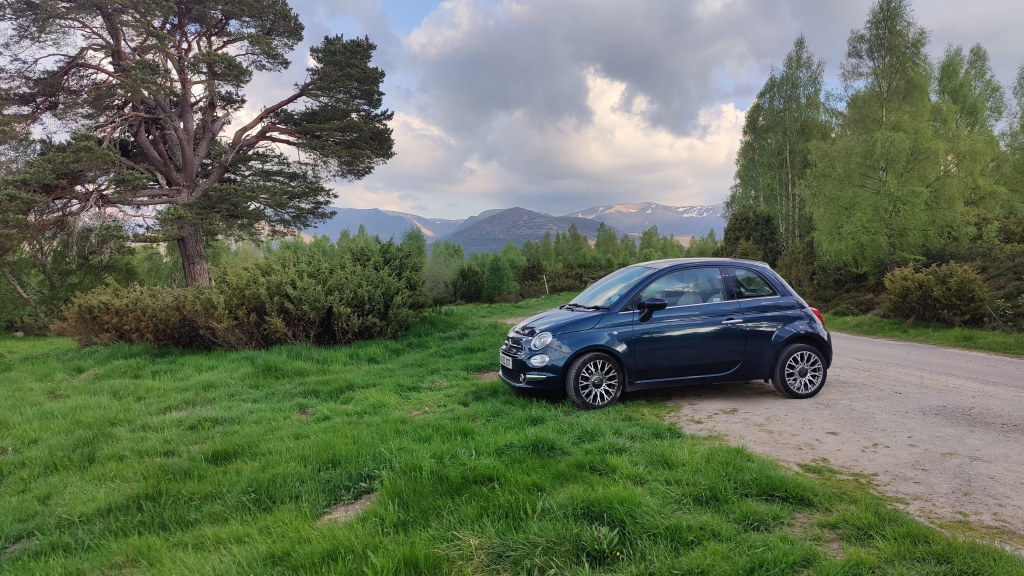
What was I thinking of when I (a man 194cm in height) rented a Fiat 500 to make an eight hundred mile round trip drive to the Cairngorms? It is what it is, as they say: the rental cost was modest enough, at least compared to an equivalent train fare to Aviemore. I set off from my home in the English Midlands at 0458, and parked in the scrubland off the road near Whitewell, at about 1350. I stopped three times – at a service area on the M6, at Lesmahagow on the M74 (where there is a very convenient Tesco store literally at the top of the exit ramp) and at briefly at Blair Atholl in the Highlands. Very briefly – there is nothing there!

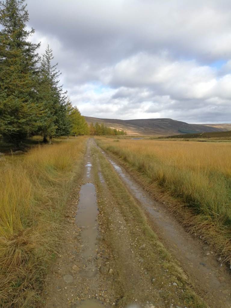
I was onto the hill before 1430 on a warm and hazy afternoon. I had a heavy carry – almost certainly 20kg; 3 kg of food (for three nights), water, and about 15kg of equipment. I was wearing new boots – Lowa Renegade GTX – and these performed superbly; not so much as a blister over 60km of walking. My route led up into Glen Einich, a route much patronised by cyclists. Several of them came whizzing past including one gentleman on one of those reclining contraptions.

View up Glen Einich

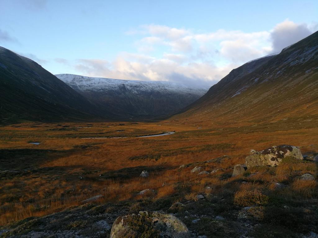
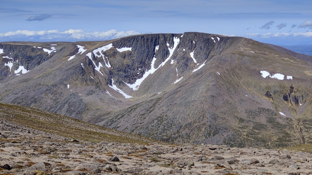
Gradually one leaves Speyside behind and enters a Cairngorm atmosphere. In preparation for this trip I had re-read a favourite of mine, W.H Murray’s excellent “Cairngorm Blizzard“. This is the story of encountering a Cairngorm snowstorm – in May. He writes of Cairn Eilrig as being the “last outpost” of the Cairngorms standing against the pines of the Forest of Rothiemurchus. I passed Cairn Eilrig and eventually could see Loch Einich itself in the distance. The first tactical navigation decision of the trip was upon me. Will I camp down here in Glen Einich, or will I climb into Coire Dhondail, seeking flat ground up there? At this point Coire Dhondail is just a promise on the map, a notch on the distant skyline. At the junction in the path lay two sturdy mountain bikes, completely unlocked.

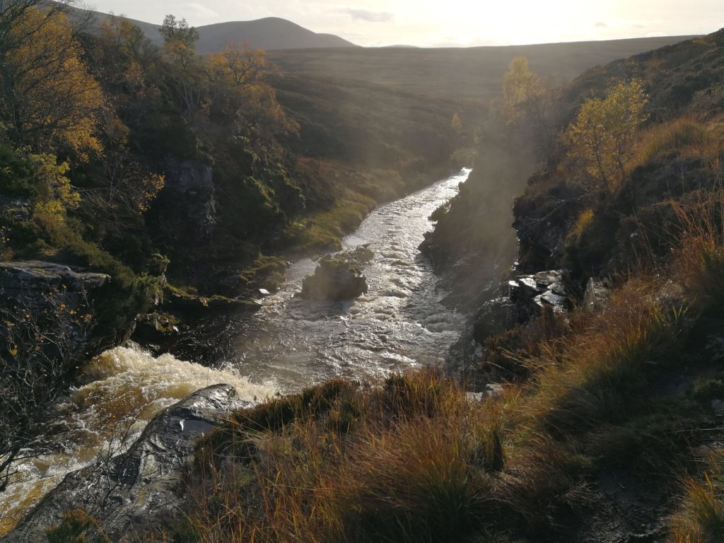
I opted to climb, and up I went. After a time of climbing in the hot afternoon I was into the flatter ground of the corrie, which was sere and dry grass. There is no tarn – or “lochan” as they say in these parts. The cliffs of the headwall contained a pretty waterfall, as well two or three snowfields. It was not at all clear to me that there was a way up the headwall and onto the plateau. A trip report on https://www.walkhighlands.co.uk/ noted that the path “meanders up the headwall”, but was it passable to a man in his late fifties with less than good balance, carrying 20kg?

The headwall of Choire Dondail

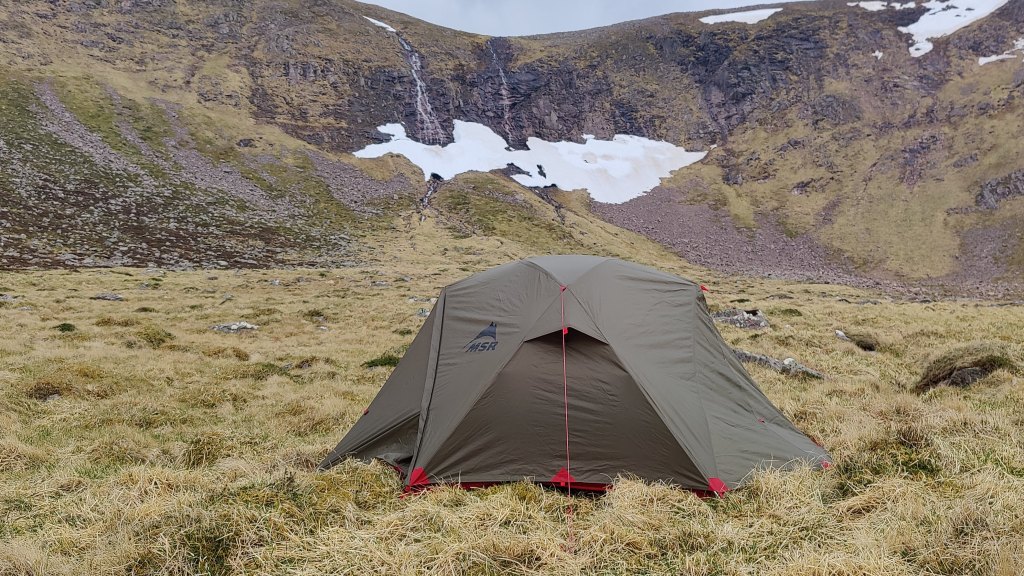
I camped by the babbling brook; there was some light rain and there were occasional violent squalls and gusts of wind, followed by periods of complete silence which weather-wise, worried me more than the wind. I slept well enough – there was a sleep deficit to work off after a busy weekend – and was packed and away before 0700 the next morning.

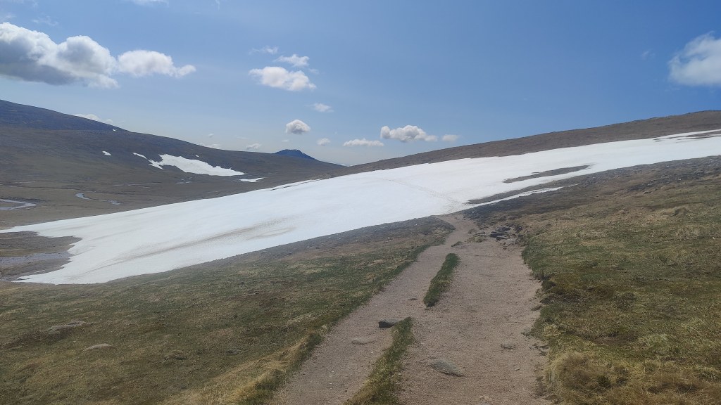
After my breakfast coffee I set off, not finding the path that had seemed so obvious yesterday, and just went up the hillside trusting to luck. I was not hopeful, but fortunately, I soon found the path. Where one can go, another can follow – with care and a measured tread, and judicious use of trail poles. Soon enough I was up on the plateau. The clouds were down and the wind was howling, ripping along, a strong South-easterly. In these conditions up here on the western side of the Cairngorms one finds oneself climbing through an almost featureless landscape, like the surface of Mars or Venus. The only feature is the fact that the land rises. One must avoid cliffs to the left, and there are cliffs far ahead. It was time for the compass. I bore about 65 degrees – that level of accuracy would suffice. I was concerned that the wind would push me constantly to the left, but my subsequent course reveals that this did not happen. To trust the compass at any time is an act of faith in technology rather than human instinct and inclination, but in these conditions, to do so pays dividends and will save your life. In due course the easterly precipice of Braeriach became apparent in front of me, and I then turned left towards the summit. I admit that I did find the actual summit – a cairn in a featureless wasteland – by resort to the GPS on my mobile phone. The wind was harsh and sometimes bore nasty rain showers: at this point I was in full winter gear including woolen hat, snood and winter gloves, and wondering if it was going to get any colder.

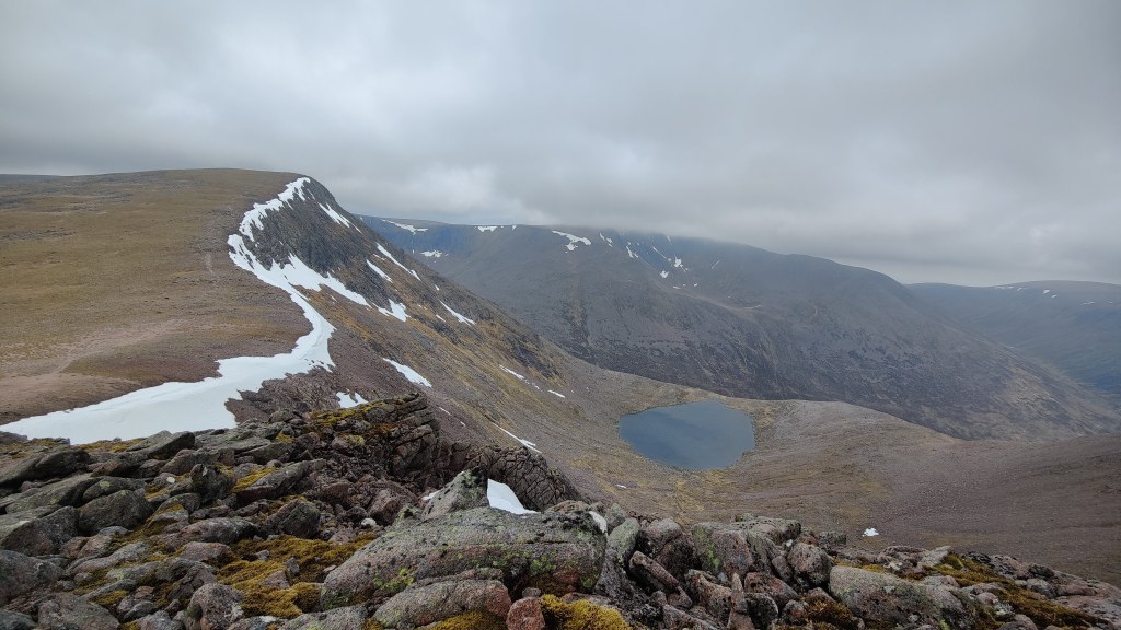
This was the first serious compass work I’ve done in decades. I used a tiny (folding up to fitting in the palm of the hand) Harvey’s 1:25000 map, made of polythene. This was a life-saver. From Braeriach, another bearing, about 30 degrees, through the mist and landscape resembling alien planets, to Cairn Einich, thence broadly south to Carn na Criche and then round the ridge to Angel’s Peak and onto Cairn Toul. As I descended from Angel’s Peak, the weather started to improve, allowing me glimpses of immense cliffs and huge relict snowfields, wild ridges and the distant grey side of the Lairig Ghru.

Angel’s Peak (1258m) and Lochan Uaine

In improving weather I continued down to the col above Coire Odhar. I toyed with the idea of leaving my rucsac there and going light to the summit of the Devil’s Point, but it was so windy that there was a high likelihood that even weighing 18kg and with a fixed hip belt, the rucsac would have rolled away. It was no significant challenge to go from the col up to the summit and back down again.

The view south down the Lairig Ghru from The Devil’s Point

From there, I descended carefully into Coire Odhar – at first the path is steep and nasty, but the slope eases further down. By 4pm I was at Corrour. There were four people at Corrour; two in the bothy, two camping. I had met two people on the hill all day and seen a third person in the distance, so this was a veritable crowd. It was far too early to call it a day – though the people at Corrour clearly did not think so. I had a snack and pushed on, through light rain.

I hiked the broadly level path 5km round to Luibeg bridge, in the grey afternoon, sometimes through rain. Here my mental health failed me for some reason, and I became quite anomalously and deeply depressed. I got to Luibeg bridge grumpy in heavy rain, and with some difficulty managed to fill up my water container before pushing on again up Luibeg burn, looking for somewhere to camp. I just kept putting one step in front of the other. Eventually I found a place to stop not too far from the fords at 012952. I was so close to the burn that I could not hear rain on my tent, and the noise of the rushing water enabled deep and refreshing sleep, something I needed after a long and complex day of over 20km of walking over 11 hours.

I had breakfasted on porridge and coffee, struck camp, was packed and away hiking by seven in the morning. The route went up the ridge of Sron Riach, a geography very similar to The Band in the Lakes. The weather improved, and pretty soon, actual sunshine appeared. The primary difficulty this morning was not going uphill – that was easy enough – it were boulder fields. On a boulder field one might easily fall and bend a trail pole, or even break a leg, or worse.

Sron Riach

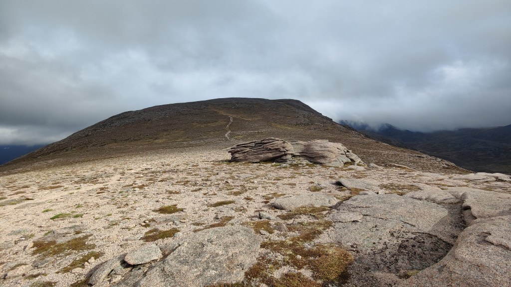
Above Sron Riach, one does not follow the edge – as one might automatically – but trends left and slightly uphill, and gently by degrees up to the summit of Ben Macdui. On the way, I was impressed to find a significant burn – the Allt Clach nan Taillear – quite high up, well over 3000′ above sea level, which enabled me to top up my water. I was on the summit before 0930, and considered myself early on the hill.

View from Ben Macdui across the Lairig Ghru to the western summits. Note improving weather

As I arrived, I saw another person arrive – a young Englishman with a full beard, followed shortly afterwards by a European gent carrying a full sized umbrella strapped to his rucsac. I say European deliberately – I’d suspect he was from somewhere like Alsace-Lorraine, for he sounded both German AND French. Up here on the summit there is excellent phone coverage, even to a 4G data signal, from the mast at the ski station on Cairn Gorm.

Braeriach – the classic view – seen from on Ben Macdui

From Ben Macdui to the March Burn is about 1.6km. I must have passed at least thirty people in that distance – every one of them day-trippers carrying little napsacks and some wearing trainers. It’s maybe 10km km, four hours hike, from the car park to the summit. I had not realised that the Glenmore road up to the big car parks below the ski station had made this part of the Cairngorms so accessible. In my experience over 40 years as a hillwalker and mountaineer in England, Wales and Scotland, everyone politely says hello when passing one another on the hill. That memo must not have been read by these rancid tourists. Mind I’ll give them their due – it was a lovely blue sky day and if as a tourist you’re going to do such a route as this, it would need to be on such a day. But it does irk me to see people wearing training shoes and light jackets wandering round a mountain top 1300m above sea level. It has been noted that the summit of Ben Macdui is one of the hardest in the Cairngorms to get down from safely in heavy weather.

At the March Burn at around 1115, a second decision. Will I go down off the hill now, or will I make a side trip to the summit of Cairn Gorm? From Macdui it did not look so far away – an example of how the scale of the landscape can trick the eye. The map did tell a different story – a good 6.5 km from one top to the other by path. I decided to go down, and set off thus, but then moments later, repented of the decision and turned back. I would never again be here in such great conditions as this. There might never be another opportunity. The only place to be in weather like this is on the tops. So I went up – best decision made today.

My round trip to the summit of Cairn Gorm took around two hours from the March Burn, including time for my lunch break on the summit. I deliberately pushed it along the wide, clear path, through brown, dry and sere moorland, oddly reminiscent of parts of the Dark Peak. But this countryside is 1200m above sea level – it is not the Dark Peak.

The path led across two big snowfields, and the scenery was magnificent. The secret and hidden valley containing Loch Avon over on the right – the wild heart of the Cairngorms. The high jewel of Loch Etchachan. The cliffs, the sky, the rolling fields of Scotland away to the north. I’d been here twice before – in 1990 and in 2005 – but both times, in thick fog.

The trip was all brown grassland, stupendous cliffs, white snowfields and blue skies…and tourists. There were several parties of soldiers, all conspicuously tough looking young men all with tattoos and identical rucsacs, not all of whom looked particularly in their element, particularly crossing a large snowfield. T-shirts at 1200m – and here’s me in four layers. There was a harsh wind blowing, and only in direct sunshine was there any real warmth. Along the path I rather belatedly found my sun hat and sunglasses and put them on.

Summit of Cairn Gorm

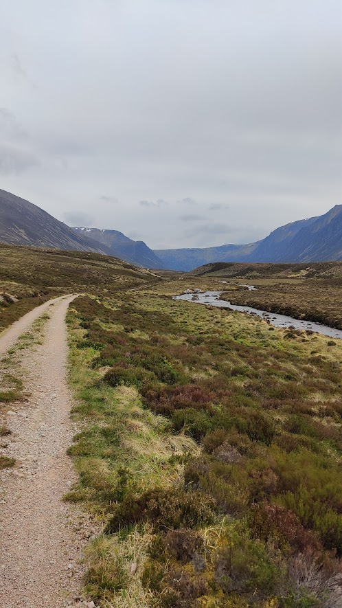
Back at the March Burn by 1400 hours, I started over the shoulder of the descent track, dropping down through the pleasant afternoon to flat ground before Lurcher’s Crag, and then, very steeply downhill into the Lairig Ghru. One might have difficulty spotting that path and keeping to it in heavy cloud – but right now, barely a cloud in the sky. Downwards over grit and rock and boulder field, to the path that leads through the Chalamain Gap. Tired now, left and back up the Lairig Ghru to where the Chalamain Gap path joins the path down the valley itself. The last bit of that was a stone staircase: I was through here in 2005 and I don’t recall that, but that was 19 years ago.

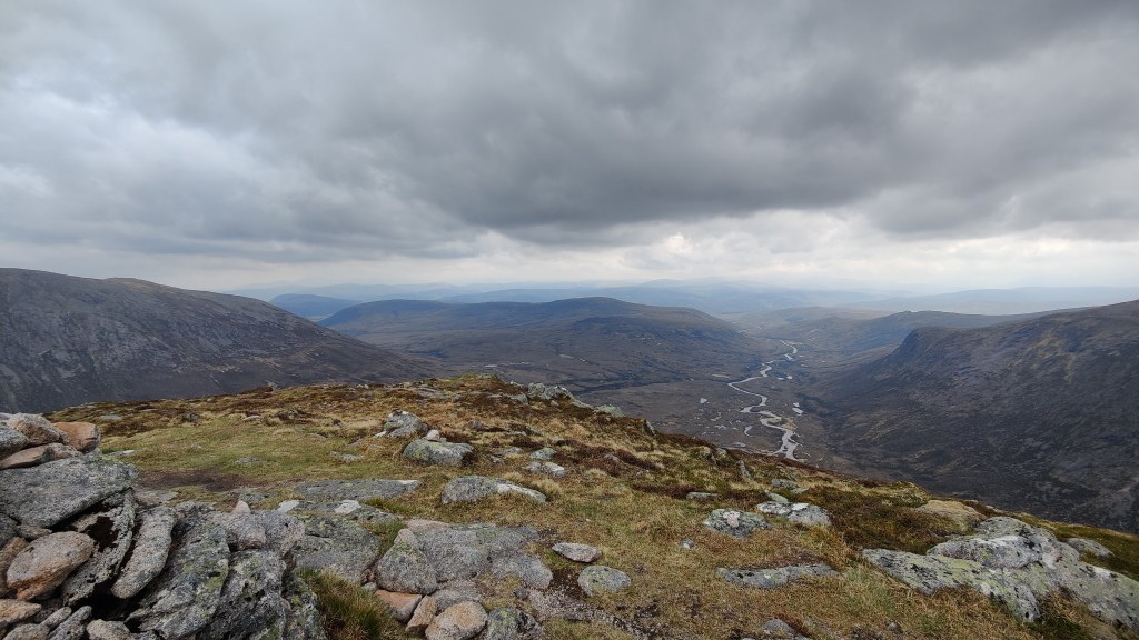
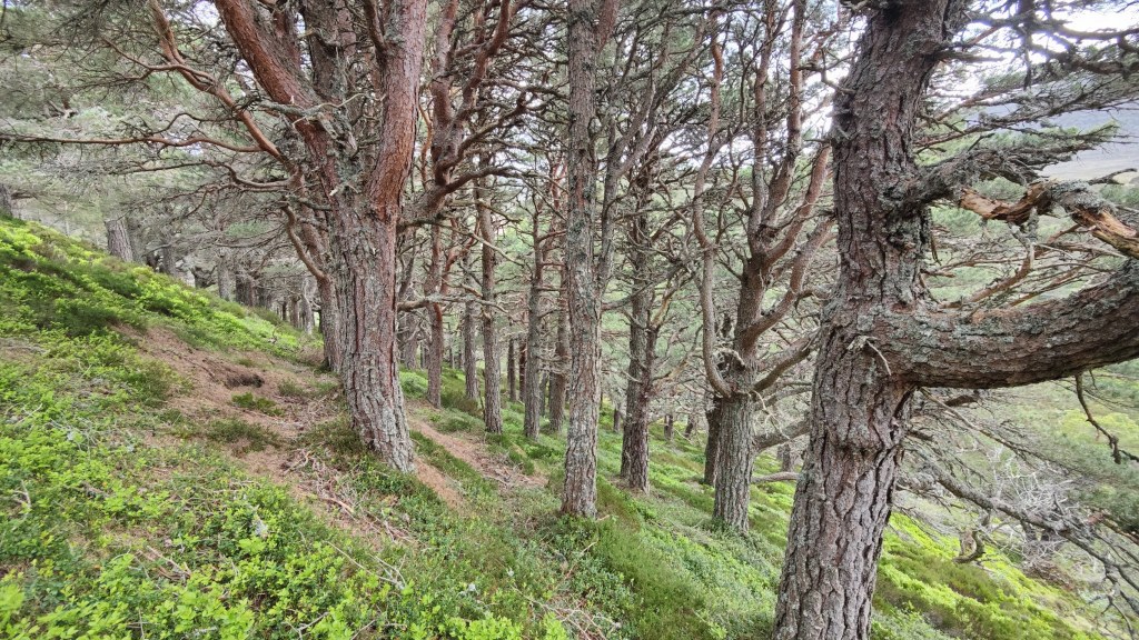
In the Lairig Ghru, off came my boots and I bathed my feet in the stream. I refilled my water container (upstream of my feet, I would add) and pushed on for the last leg back to the car. It was 1700. It had taken me three hours so far to come downhill from the March Burn. Murray wrote of the “nine mile descent to the Spey” as seeming endless. I figured it was 7km from here to the car – all downhill. On the other side of the valley are structures that look like spoil heaps – but there can be no spoil heaps in this wilderness; they are pure glacial moraines. Down and down – eventually one reaches the edge of the woods, and enters once again the Forest of Rothiemurchus, that bastion of ancient and noble Scots Firs and other aboriginal trees.

Forest of Rothiemurchus

I got to the car just before 1900, increasingly footsore, in the delicate light of evening – or late afternoon really, at this latitude and time of year.

At a crossroads in the forest, I’d stopped for a drink of water – and found that I’d left my water container back where I’d stopped up in the Lairig Ghru! Ah well! It could have been worse. Someone will benefit from it. A quick shift of clothes, swig of warm Coca-Cola deliberately left in the car for that purpose, and I was ready for the off. I drove round to the excellent campsite at Glenmore, where I had a long shower, and then, walking quite slowly, returned to my tent to cook my supper, and so to bed.

Geek details

I walked a little over sixty kilometres in a shade over 21 hours, spending from Monday afternoon to Wednesday evening on the hill. The five 4000′ peaks (Braeriach, Angels Peak, Carn Toul, Devil’s Point and Ben Macdui) took me about 24 hours peak to peak but about 48 hours car to car.

I used an Osprey Aether Pro 70 rucsac, one of the lightest expedition bags on the market at about 1.8kg empty. The fabric is unfortunately not robust enough not to get punctured. Everthing is packed in dry bags anyway; it is otherwise an outstanding bag. I have a Rab Skyehigh 700 three-season down sleeping bag, and an Therma-Rest mat. A counsel of perfection is a silk sleeping bag liner. For a few grams, packing down very small, these offer extra warmth and are useful in summer when a three-season sleeping bag has to remain unzipped. I cooked on a Trangia 27 with non-stick pans – heavy and bulky perhaps but so much easier to use on rough ground than any top-heavy miniature gas stove with separate pans. On the hill I wore a merino wool hat, a merino wool base layer and a mid layer, a fleece, walking trousers, and Goretex raincoat, overtrousers and gloves as necessary. Proving unnecessary but had to be carried nonetheless, were spare walking trousers, Goretex gaiters, a torch, and heavy winter mittens. I used Harvey’s excellent polythene Cairngorms 1:40000 and 1:25000 maps. I took two Li-Ion power packs weighing in total about 800g – unavoidable. My mobile remained in flight mode except when needed, and was actually switched off at night. I tracked my hike with a Garmin Vivoactive 4, which will not even last a full day tracking activities without a battery top-up.

I rented a Fiat 500 from Europcar, for a week, at a cost of around £286 including additional (as in beyond the statutory minimum) insurance. I would not have rented such a small car had I thought more deeply when I booked it. The kindest thing I can say about it, is that it was adequate. I burnt fuel worth £101 to drive around 800 miles. Excluding the cost of the various brown food bought to sustain me on the journey, the journey cost around £390 – approximately 50p/mile. As I’ve argued elsewhere, ground-based travel that costs substantially less than 50p/mile, is almost certainly being subsidised, either by the tax-payer, by other passengers, or by the company providing the transport. As an alternative option, the return train fare from Derby to Aviemore (in standard class) is about £220. One has then to add the cost of buses and taxis to get on and off the hill, and take into account the fact that one cannot take additional shoes or clothing without lugging them around on the hill. I also took the opportunity of visiting friends at Ballater whilst I was in Scotland, something that would have been very much more complex, if not impossible within my allowed time frame, had I took the train.

Backpacking in the Cairngorms

Part 1: To the Highlands by Caledonian Sleeper

When I began my journey from East Surrey at 1853 on a Wednesday evening, it was with a heavy heart, for a number of reasons. A lovely old fellow we all knew was dying; he did in fact go home, early on the Thursday morning. A little later, arriving at Euston, I went for a pint in that favoured spot, the Doric Arch at Euston station. This marked the start of my holiday. Later, as I boarded the sleeper train, there was an oddly sudden and very heavy rain shower. My wife informed me that this rain was quite extreme back in Oxted, shorting out house electrics and causing minor flooding.

Arriving in Inverness, I was straight into gloves – it was one of those cold and blustery mornings. The train was almost an hour early. I recommend the Caledonian Sleeper; it is costly, but good value for money when you look at what you’re getting – return travel from London to Scotland, and two nights accommodation. You can of course just buy a seat rather than a berth, and sit up all night. This costs maybe £100 return and would be pretty much the equivalent of taking a 12-hour flight in economy. Sooner you than me: I say, what price money? If a journey’s worth going on, it’s worth going on in comfort.

Inverness is a long way from London and indeed, a long way from Edinburgh. The atmosphere is very different. I started by taking coffee and a breakfast roll in the bus station cafe. You can’t beat a bus station or train station cafe; no-one cares how smart or untidy you are, or how big your bags are. As a very tall man, I do sometimes value not being noticed.

To the co-op to pick up some groceries: I bought bread, butter, cheese, tomatoes, little oranges, an onion, fresh spinach, chocolate, fresh tortellini, and water. I carried in from home, coffee, sugar, spices and salt and pepper, porridge oats, red lentils, gram flour, and chorizo sausage, and also a trail mix of “date, nut and seed balls” – these were absolutely superb. Thence, by cab to the airport to pick up a rental car. Then I motored back into town, swiftly over Slochd and down into Glen Feshie, to park up at the road head and prepare for hiking. Leaving home, my rucsac was 16kg: now with food for three days and water, it must have approached 20kg.

date, nut and seed balls

Part 2: Glen Feshie to Glen Geusachan – across the Great Moss

After a climb through some pleasant woods, the route to Carn Ban Mor goes up the left-hand side valley of the Allt Fhearnaghan. I was feeling very fit and strong as I climbed, and I did notice far more snow than I had thought there would be. This seemed to be more than the Autumn icing-sugar dusting of snow I had anticipated, and was closer to real winter conditions. Up onto the Great Moss, I did not go to Carn Ban Mor, and also made the error of leaving the track, and thus wading through heather and fresh snow occasionally drifting a foot deep. It was blustery, showery weather. One moment, I could see Angel’s Peak and Cairn Toul, the next, there’d be a squall and a snow shower. I made my way to the summit of Tom Dubh – just a slight top in the midst of the Great Moss, though at 918m as high as most Lake District summits.

View from Tom Dubh

From Tom Dubh, downwards into an area of fens, marshes and little tarns where I found myself going in circles and doubling back away from half-frozen watercourses I could not possibly ford. It was an oddly blue-grey world, and the snow started to pile down. I got on down to Loch Stuirteag, where I had hoped to camp! This was a wild and inhospitable place, wholly unsuitable for camping in anything but summer conditions. In any case, a howling wind was at my back; I sought in vain for shelter. Lower down, at the very top of Glen Geusuchan, I thought I found shelter, and laid my tent out in a flat spot. But the outer was nearly torn from my hands in a violent gust. What was I thinking of? I should have been in grave trouble had I stayed there. I packed up again and struggled on downwards into a glen of deep, trackless heather. I fell over and picked myself up again; I found myself on the edge of steep slopes down into the river; my feet fell into hidden water; I stumbled, carrying 20kg. To be fair, I had bought a new rucsac, an Osprey Aether Pro 70, and it was an exceptionally good carry. Nearly 2kg lighter than my previous rucsac, this one sat very comfortably and caused me no problems at all.

I could find nowhere to get out of the wind. I didn’t feel desperate, but it was quite a desperate situation. Darkness was impending; I was already tiring. I could not realistically make it to the Courrour Bothy in daylight. I should have been left floundering uphill through the trackless heather, in the dark and the storm, trying to find Courrour – an unlit speck in the mountain fastness.

Eventually I found a place in the river bed – can I pitch a tent on sand and pebbles? Yes. At least this place was sheltered by an old river bank, a six-foot wall of peat and heather, and was as out of the wind as I could find. I struggled with the wind whilst getting pitched, and pitched the tent outer first, though it wasn’t actually raining at that point. Almost the last thing I did outdoors as darkness fell (apart from getting water from the river) was collecting heavy stones to pile onto the guys and tent pegs. Well that I did so now rather than in the dark. I had a good camp – I cooked dinner, ate, and turned in soon after. I certainly slept some, though the noise of the wind and the frequent rain showers kept me awake much of the time.

I was awake at 5a.m when the storm reached its crescendo. Lucky I was that it had not been earlier. The wind redoubled in strength and tore out the pegs on the windward side of my tent, though the guy-line held. This made the outer tent flap in the wind unto destruction, unless it was fixed. The noise of the tent flapping wildly in the gale, particularly in the dark, could easily induce panic if you allowed it to. I managed to fix it from the inside, with rocks and moist sand. Then the pegs on the lee side came out, then on the windward side again. Four or five times I had to jam the pegs back in again, getting wet sand all over my hands and in the inner tent. By this time I was awake and dressed for the day and had started to pack up against the possibility of ultimate catastrophe. I did manage to make porridge and coffee, and dress a pre-existing cut on my forefinger, whilst using one of my trail poles to keep one peg in place on the lee side of the tent. This was a remarkably difficult moment and I seemed to get through it without too much trouble. The tent flapped; I was somehow able to rise above doing so. Panic, worry or getting things wrong was just not an option in these conditions: everything had to be done quickly, methodically, correctly, and in the right order. I packed up, dropped the inner, and took down the outer, but by this stage as daylight strengthened the storm ebbed; the worst of the squall was over.

From Achlean to my camp on Geusachan Burn at around 974943, was about 17km, which took about six hours. It is a very great shame, but buried somewhere in the sand of that river bank, or blown off into the wilds, there is a small slice of thin flexible polypropylene chopping board, bright blue, about 6″ x 6″ – for I never saw that again. Breaks my heart to leave litter, but the wind must have carried it away. There was some slight damage to the ends of my tent poles, which was easily fixed.

Part 3: Glen Geusachan to Glen Feshie

Let’s look at the positive – remember that bit in “Apollo 13”? “what have we actually got on this spacecraft that works?” …er, let me get back to you on that, chief…actually quite a lot. I was warm, dry, clean, my kit was packed and complete and dry, I’d had a hot breakfast and even some coffee. The world was at my feet.

Glen Guesachan at dawn

In the glorious light of dawn, I walked out of the side glen and round into the Lairig Ghru. Fording streams and rivers is a serious challenge in the Cairngorms – it is rarely an issue in the Lake District. One cannot ford the Dee even this high up, certainly not in cold weather, though one might try in high summer. I had to detour all the way up the the Courrour Bothy to cross the river. It was an uphill slog through heather, with only the occasional hint of a path. I reached Courrour on a bright and pleasant morning, about 10a.m.

Courrour

I crossed the Dee on the footbridge, and had brief converse the only hiker I saw for two days, an older man from Edinburgh. He was in for the day to climb the Devil’s Point and Cairn Toul. Approaching Courrour at 10a.m in late October, he must have made a very early torchlit start from the Linn of Dee – that’s a long walk in. God only knows what time he started from Edinburgh! He did mention that there had been driving rain on the drive in – probably about the time my tent was getting hammered by the gale.

Bod an Deamhain – “the Devil’s Point” (although I understand “point” is a Victorian euphemism for another quite different word beginning with P.)

I powered on down the valley, consciously keeping the pace fast. I was fortunate in being very fit: when backpacking, many issues conspire to slow you down. Hips hurt, shoulders hurt, feet hurt, blisters, hungry, thirsty, exhausted etc etc. The last of these, when you’re very fit, is almost an irrelevance. Walking at 4km/hour all day long while carrying 20kg becomes merely doable rather than requiring a mighty effort.

A chopper searched the surrounding summits as I walked south. Early afternoon, I came into phone range and also into sight of the White Bridge across the Dee. I saw a couple with a pushchair and a dog – I didn’t realise how near the Linn of Dee car park was at that point – about three miles away. I saw two estate workers. The next part of my route lay for many miles along unmetalled roads, and in fact I was passed by a car once.

To the Red House, and on up the Geldie Burn – though no burn this, but another wide and deep river unfordable in cold weather or winter conditions. The Geldie Burn is technically a “misfit stream”. The valley in which it lies is glacial in origin, not carved by this or any river. Geldie Burn has enormous relict banks indicating that at some point in the geological past, when the ice melted, it must have been ten, a hundred times bigger than it is now – a torrent like unto Niagara.

Through the golden afternoon over lovely brown moorland, and endless path, which, once the un-made road ended, was never less than a clear trail. From the White Bridge, up the Geldie Burn and to the unnamed waterfall at the head of Glen Feshie, at least 12 kilometres. I started to experience muscle pain in my left shoulder; I found that Voltarol brought very swift and very effective relief.

Sometime before arriving at the unnamed waterfall, I fell over. I was negotiating some deep and evil-smelling pools of mud in one of the ruts of the road. Whatever…I twisted and slipped. Or I slipped and twisted…carrying 20kg, once you’re going down, you’re going down – there’s no stumble and recover with that kind of weight on your back. I ended up on my back in a foot deep puddle of thick, black runny mud. Desgustang! With some difficulty I got myself up and out again. Strangely enough, I personally was untouched – wearing a Goretex raincoat, gaiters and overtrousers, no actual mud penetrated to my clothes. My rucsac took the brunt of the mud and was very dirty. If I had a minor criticism of the light grey colour of the Aether Pro, it would be that the straps and hip-belt show the dirt very easily.

This remarkable waterfall was, to quote C.S Lewis, “a terror in the woods for miles around”. It was audible long before it could be seen. It has no name on the map; it is comparable to High Force in Teesdale, and were it within a hundred yards of a road in England or Scotland, people would drive 100 miles to see it. In the Cairngorms it is at least five hours walk up-hill from the road head in wild and remote Glen Feshie, and probably five hours walk from the car park at Linn of Dee. So almost impossible to access in a day-trip except in high summer. How remote! How excellent that remoteness is.

I was now in the descent into Glen Feshie and ready to look for somewhere to camp. Trees appeared, larch and other kinds. Suitable places to camp emerged, albeit far from water – the river was running in an inaccessible gorge. I had at this point run out of water, so I needed to camp right by a stream. Better yet, there was no breath of wind. I needed to stop a little earlier to allow enough daylight to ensure that my tent was OK after the beating it took this morning.

I found a place by a ford, and camped right next to the path, in as wild and remote a location as ever I have camped in…except for, oh, last night. The tent went up easily and the ground took the pegs well. Once established, I made a faranata – a pancake of chickpea flour, as recommended by my son. On a Trangia stove it worked a treat. For afters, some chocolate and a sip from the hip-flask. To drink I had litres and litres of stream water: slightly brown from peat. There’s no sheep up here – no need for any purification tablets. Though the colour was off-putting, and the water was so cold as to induce a blinding headache, it was like nectar, like Ambrosia, like ice-cold lager. It is a pleasure to be that thirsty and have a pure mountain stream in which to slake that thirst.

On day 2 I walked 30km in approximately eight hours. I used Black Diamond trail poles, Gore-tex gaiters and over-trousers, walking trousers, merino wool base layers, a thick cotton shirt and Berghaus fleece and waterproof coat. I get cold easily these days: a merino wool hat helps, and gloves are a big deal. I had a thin and a thick pair of gloves, and also some heavy mittens. I wore gloves at all times outdoors when walking; up on the plateau I found it necessary to wear all three pairs at once.

Part 4: Glen Feshie

I packed up in good order as the light started to improve, and was ready to hike by a little after 8a.m. I continued down Glen Feshie, through an absolute Eden, a veritable wilderness paradise. When I was a youth in Derby, I borrowed from the local library, an old book about the Cairngorms. And in that book, there was a snatch of an ancient Gaelic poem, which has remained with me ever since: Glen Feshie of the storms, I had the longing, to be in thy shelter…and now I had the pleasure of walking the whole length of this wild glen.

There were high and low spots to my morning’s walk. It took me until noon to walk out to the car, and on the way I got lost in the woods; there was a rain shower, and there was a washed out bridge over a tributary stream. There was much fording and crossing of streams, brushing through vegetation, and climbing up and down along the side of the gorge. For most – but not all – of the way, the path led along an unmetalled road. In places, where the road had been washed away, the path detoured up the mountainside.

On the walk out I found my hips were very sore under my hip belt. So I stopped on the path and took off my pack, and got out the Voltarol. I dropped my trousers without a moment’s thought, in order to put the gel on my hips. I’ve spent two days on the hill and meet one other hiker; I met no-one all day Thursday, and I met no-one after 10a.m on Friday. I camped in the wildest places where there was absolutely no chance of anyone coming past. Yet, no sooner had I dropped my trousers to apply the medicine, a man and a woman appeared from nowhere to walk past me. They never turned a hair. “Morning!”.

“Morning.”

I arrived at the car at noon: It took just under four hours to hike down the valley – a journey I’d estimated would take at least six hours going uphill. And my hike was over.

Kit

I carried approx. 20kg using an Osprey Aether Pro 70. This rucsac is one of the lightest expedition bags available, weighing 1.8kg – which is why I bought it. It feels lightweight, even flimsy, and I admit I was sceptical when it arrived, particularly given it’s relatively high cost. My scepticism lasted only until I got it packed and set off – on the hill it proved durable and a very comfortable carry, a much easier carry than any other rucsac I’ve ever used. This rucsac has replaced a much older Berghaus C7 1 series 65+10, nearly 2kg heavier, but with a good deal greater carrying capacity. I think we can safely say that when the manufacturer Osprey says 70 litres, that includes the hip-belt pockets.

The hip belt tightening arrangements are particularly inspired, and I liked the pockets on the hip belt. I will say, it’s not quite as clever as the manufacturer thinks it is with regard to attaching things to the outside, in spite of a wide range of straps. I could not easily see how to attach trail poles, and I still can’t obviously see how to put an ice-axe on it – the big first rucsac I’ve ever had where this is not completely obvious. Heavy items – tents, tent poles etc – may have the tendency to slide through the straps eventually. Also – as I found when I fell over – because the rucsac is light grey, it does show the dirt, particularly the straps and the hip belt. Getting it back home, it also became the first rucsac I’ve ever had to strip down and wash. Overall though I would highly recommend it.

I used a Trangia 27 (the smaller Trangia). I’ve been using Trangia stoves since the 1980’s and have never had a problem with them, nor been tempted away from them. Durable and reliable if a little heavy and – at least some say – a little slow. Two things I like about the Trangia – it has a low centre of gravity, and all the pans are included as part of the stove. I slept in an MSR Elixir 2 tent using a Rab Alpine Pro 600 down three-season sleeping bag.

Holy silence

How long can you be alone, and remain happy? A few days? Weeks? or maybe only hours.  I’ve known people who were uncomfortable with their own company for only hours.  Yet, the great hunters and explorers of North America must have spent months alone – think of John Muir, who was a six month in the Yosemite Valley with only a new testament for company.

The Linn of Dee – and the stones of Turin’s pride

At the Linn of Dee, I got out of the car and was struck immediately by the holy silence of the wilderness.  Almost it is like a church; I walk with quiet tread through the woods, mindful that this is God’s front room.

At the falls there is a mighty bridge across the narrowest part of the gorge.  It reminds of me of Ulmo Lord of Waters’ words to Turin in Tolkien: “throw down the stones of your pride”.  For Turin would have things as he would have them, and had caused to be built across the full flood of the Narog river, a mighty bridge, the better to access the entrance of the underground fortress of Nargothrond.  And Ulmo, herald-angel of the Most High, counselled Turin to cast those stones into the water.  For cometh evil that would use that bridge to destroy Turin, lay waste to all that he had created, and bring hideous sack and slaughter to Nargothrond.  And so it happened.

But what means this for us? The bridge at Linn of Dee allows vehicular access more easily so that walkers can get into the remote heart of the Cairngorms – one of Britain’s wildest, purest remaining places.  And rightly so – this bridge should not be thrown down.  But what we might throw down is dependence on stuff – idols.  Technology as our master.  Social media, handsets, tablets, the Cloud – all good things if they are our slaves.  But if we are to hear more clearly what God has to say in the holy silence of the wilderness, then we need to put aside the clamour of our toys, and focus on what is of true value.

More Scottish travels

At the Duke of Gordon Hotel in Kingussie, a brassy and friendly Scots lady presides over the buffet breakfast. She is the queen of ’em all, having a nice word for all comers and a likeable banter. She is everybody’s friend.

Later, I drive past the ruins of Ruthen Barracks, built on a commanding ancient mound much used for castles over the centuries. John Comyn was here in the time of the Wars of Independence. But these barracks remind us of a much more recent conflict. Here in the Highlands, a blunt and brutal reminder of the Jacobite rebellion of 1745 does not sit well to this day.

Past the Insh Marshes, which to my eye as someone who studied geology, is the bed of a huge dried up ribbon lake. Only Loch Insh remains, and the Spey meandering through, rather like the ruined barracks, a misfit in this landscape.

To the top of Cairn Gorm, Britain’s second highest mountain. The little funicular train discounted to £5 return during November. Cheap at three times the price. It is a spectacular mountain railway, but I found it oddly saddening to go be able to go so easily to the summit of a 1200m mountain. All I have written only yesterday about the wild, pure heart of the Cairngorms is arguably undone, at least to a degree, by this development. Yet, it is not crass, not evil, not insensitive. Or at least not too insensitive.

At the top, a sprinkling of early Autumn snow can be seen in the distance. Grey squalls are chasing across the mountains, splashing rain and hail. Far below, Loch Morlich changes in an instant from welcoming cobalt blue to a menacing slate grey, as the rain clouds sweep in. A violently coloured rainbow stops everyone, and everyone peers out, phones ready for that picture. We ought not under-estimate the capricious nature of the weather in these mountains.