A trip to Knoydart – extreme backpacking in October
My trip this October, in the planning these last three months, was to walk from the railway at Glenfinnan, through to Inverie on the Knoydart peninsula. Inverie is one of the most remote places in mainland Britain. The walk itself I understand is part of the so-called “Cape Wrath Trail” though there was nary a sign at any point to indicate that.
I took the 48km walk in three more or less equal stages of about 16km each. From Glenfinnan to Strathan, Strathan to Sourlies, and from Sourlies to Inverie. As I was hiking alone, completely out of phone range, I don’t think I’m exaggerating to call it “extreme” backpacking. Conditions underfoot were absolutely dreadful, wet and deep mud and peat throughout. Across that ground, I was walking at barely 2km per hour averaged over the whole day. I thought I’d meet few people if anyone at all, mid-week in October, but eight other people were on the hill travelling more or less the same route at the same time. We met several times, finishing with drinks in the Old Forge in Inverie.
As in the past, my journey north on the Caledonian Sleeper began with a pint in the Doric Arch at Euston station. Virtually deserted on a Monday night, this railway-themed public house has a giant scale model of “Evening Star”, British Rail’s last steam locomotive, strategically placed behind the bar.

It was really rather pleasant to sit in my berth in the morning, watching the West Highland landscape scroll past the window. Breakfast came as the train rounded the famous Horseshoe Curve near Bridge of Orchy. At Fort William there was ground mist. My eye was caught by a Stanier Black Five stood waiting in the mist for the off with the “Jacobite Express” charter train to Mallaig.

After shopping for some minor groceries in Fort William, I took train a little after noon to Glenfinnan. The mist had burnt off; the skies were clear. The train was absolutely rammed full of tourists, and the officials of the railway company, in consequence perhaps, were a little above-averagely irascible. Passengers must not leave bags here…bicycles must be stored front wheel uppermost…
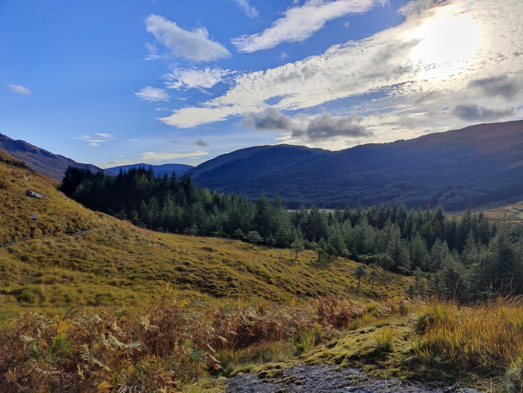
In the most beautiful clear weather, I hiked up through the heather and trees towards the viaduct. It is concrete: anywhere else but in this stunning location it would be ignored as an industrial monstrosity. But here, certainly since Harry Potter, people travel hundreds of miles to visit Glenfinnan viaduct.

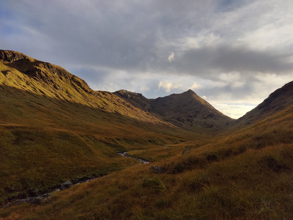
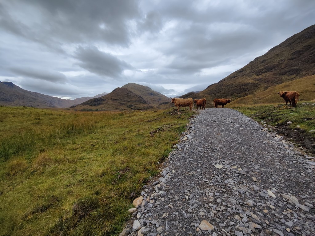
The way ahead lay up a tarmac road through Glenfinnan. As a 10k runner I have learnt much about pacing myself this last year – but not enough. Though I consciously tried to keep the pace down, I still went too fast along the tarmac and in only a few kilometres the hard impacts did more damage to my left heel than in the whole of the next three days, causing a small blister. I continued past the bothy at Corryhully, taking a late lunch, and continuing up to the top, the Bealach a Chaorainn. Here there was a rather surreal gate with no fence on either side of it. Onwards, trending north-east away from the setting sun, down into a wide glacial valley, the long and straight Gleann Chaorainn. As the afternoon wore on, the light grew more delicate.
The ground underfoot became boggier and more complex, and I was starting to tire. As the valley came out into the bigger Glen Pean, I fell over in deep mud and somehow managed to buckle the bottom third of one of my trail poles. Ratty, I crossed the bridge over the Pean and approached a band of forest. Here I met the first of the eight people who were crossing to Inverie at the same time as me, an Englishwoman called Suze and her partner Andy, a Scotsman. After a brief chat I left them in peace and sought somewhere to pitch my tent. But the ground was tussocks and hummocks, dreadful, pathless wet ground wholly inappropriate for camping. In the middle distance I spied some different green, and thought, that might a better campground. It did – but it was on an island in the river. I crossed to the island with only minor difficulties (the boulders in the stream bed were a bit slimy). I deemed the risk of flooding on this particular night, to be negligible, although there was clear evidence that the island could and would flood when the river rose in spate.
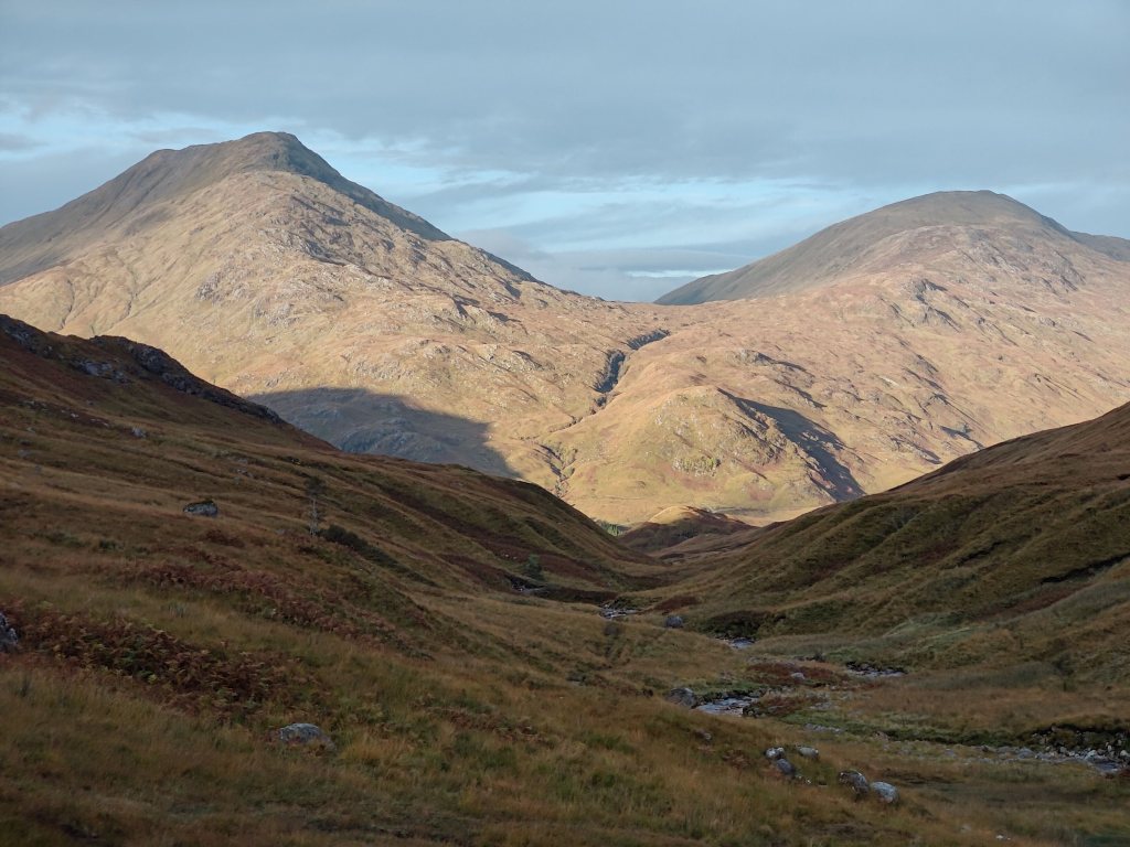
Next day, the tent was wet inside and out with dew and condensation. In packing, I found that I had inadvertently brought onto the hill, over half a kilo of spare cheap tent pegs which had been stored right at the bottom of my rucksack. Rather too much weight to casually carry around – I had to abandon them. I crossed the river again, noting that the river had fallen during the night, and set off into the forest. The route lay along a track that clearly predated the trees (an industrial plantation) by decades if not generations. Round onto a forestry road and onwards; beyond the woods, the sky was clear and blue. A choice presented itself: I could hike up Glen Dessarry in the woods, or in the sunshine. On such a beautiful morning, it had to be the sunshine, at the expense of a short detour.
There is a reasonable unmade road up Glen Dessarry, up which it was my task to toil. I took an early lunch – or maybe it was second breakfast. I am become a creature of Hobbit on the hill: bread and butter, cheese, tomato, Chorizo sausage, chocolate, date/nut/seed trail mix, perhaps an orange. At Upper Glendessarry the path leaves the unmade road and kinks to the right – “Inverie, 17miles” a sign says. Wet and very muddy, the path continues, keeping another industrial plantation on the left. I reached the top edge of these upper woods and found a convenient flat stone on which to have another snack. A mile or so away below I spied two hikers, presumably the Scotsman and Englishwoman. They saw me clearly against the sky, and waved, but I missed that. They must have taken the route through the woods. As I lunched, a single Typhoon fighter roared past in the distance.


The path continues upwards, always wet, muddy and boggy, over Bealach an Lagain Duibh, which to my unschooled eye looks something like “Black Lake Pass”. One arrives in due course at two linked lochans, dark and forbidding in the lost, high hills. That said, the sun was out and though the water was black, the mood was not too bad. Lochan a’ Mhaim, it is called. On the bank of the second of these, a small boat was stashed, having clearly been laboriously carried up from Loch Nevis.

On the way down to Sourlies from this lochan, there was at least one significant ford over the Finiskaig river. One has to take care with fords, hiking alone. The trail poles are a great help in safely crossing a river. It was a lovely walk down through variable terrain, but always muddy and wet underfoot. At times the river meandered as a “misfit stream” through the valley, then it dropped down through a gorge to the valley floor proper at the head of Loch Nevis. After the initial significant ford, the path kept to the right all the way, sometimes high on the hillside above the river, other times, lower. I passed three people, the first of whom I spoke with briefly. In a strong Slav accent, he told me he was making for the roadhead at Strathan, and that his friends were some hours behind him. An hour or more later I passed his companions. A lady with a Husky and an older, less fit looking man, labouring slowly up the hill with stertorous breath and a Cross of St Andrew on the back of his rucksack. They had started from Sourlies – and late indeed was the hour for them to be passing me not even close to half-way to Strathan.


Once on the valley floor I spotted a party of two walking ahead of me. They arrived at the Sourlies bothy a few minutes before I did. Mark and Dave; Dave, a Scotsman, Mark, an older guy from near Manchester. I decided to stay in the bothy and I put my tent up to dry in the stiff breeze, and it dried in minutes. Mark made some tea, and I contributed some milk from the sleeper train. Not long after that, the Englishwoman Suze and her partner Andy arrived, and there was some sociable chat. They opted to camp outside. Then, four Dutchman arrived – going to be crowded tonight! But they also opted to camp, although they prepared their food in the bothy and stayed for a chat. We started a fire, but if there was any wind at all, the chimney didn’t draw properly, and the bothy soon filled with smoke.
I cooked spicy lentils and a “faranata” – a chickpea flour pancake. This impressed everyone, as freeze-dried wilderness meals seem to carry all before them. Just add hot water. But I like cooking, and one-pot cooking in the wilderness is a challenge I cannot resist. It does mean that I have to carry various bits and bobs onto the hill to make such mountain cuisine possible. A small onion perhaps; a clove of garlic, a twist of spices and salt and pepper. It all adds weight but is worth the effort. As I am a big man, today weighing over 90kg, I can afford to carry 20kg on the hill.

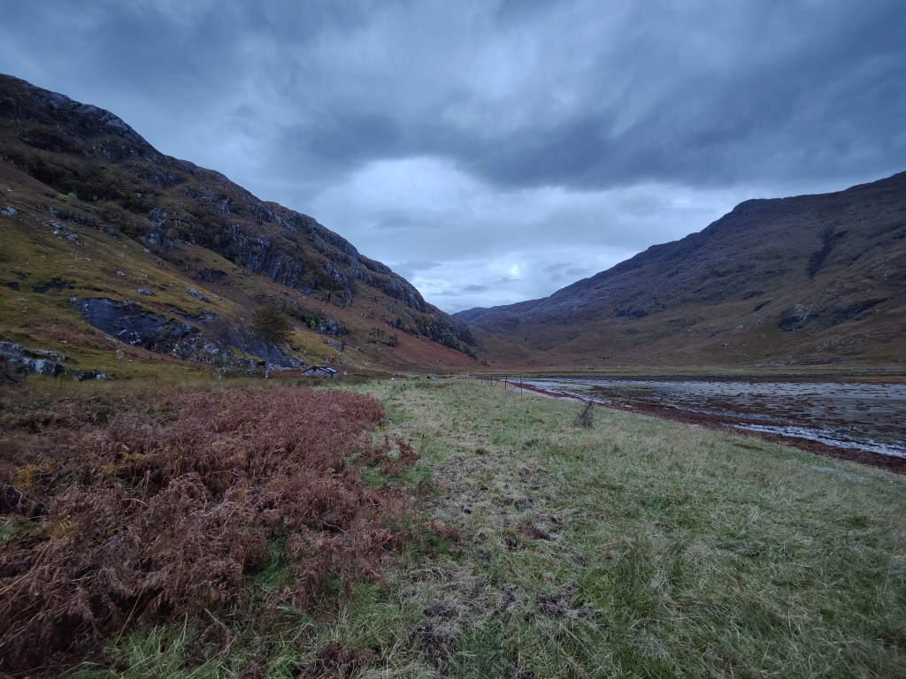
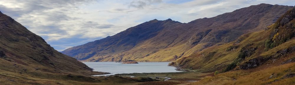
During the night it rained for a time and the wind rose. For some reason I did not sleep well, though i was comfortable enough on a little wooden platform with a couple of mats under me. The Sourlies bothy is in a magnificent wild location at the very head of Loch Nevis, a fjord in all but name. The Fort William to Mallaig road is 15km to the south and about the same to the west, over trackless mountains. To the north, across more trackless mountains 10km to Loch Hourn, itself 15km from Loch Alsh, another fjord or sea-loch. To the east, the route I walked – 13km or so to Strathan at the roadhead on Loch Arkaig. In short, as wild a place as anywhere in Britain.
Next day I was away bright and early, on the hill by 8.15a.m. The couple camping had already set off. The first part of the route lay right along the seashore, quite literally on the beach. Would be tricky at high tide, I would think. The path curves right up onto the headland of Strone Sourlies, and round into Glen Carnoch. One is then presented with a dreadful flat salt marsh to cross. At this point, before nine in the morning, the sky was deeply threatening, lowering grey. There were various paths across the marsh, and the light was good enough, but the going underfoot was really slow and boggy, very, very wet. Without trail poles this would be a really challenging walk.
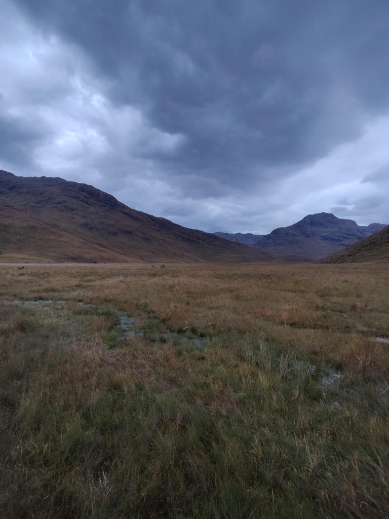
I found crossing the marsh not so much the moral low point of my journey, as the moment when the sheer wildness and remoteness of this terrain, came home to me. Fall over badly here, walking alone, and even sprain your ankle, much less break your leg, and you’d be in a world of hurt. There’s no mobile connectivity. At best, at this time of year there might be twenty-odd people a week through here, and raising the alarm, without satellite telephony, would only be after 6-7 hours walk from here. Last year in the Cairngorms, I found the scale of the wilderness there similarly daunting. This West Highlands terrain is more intimate and familiar than the Cairngorms, resembling as it does the Lake District or North Wales, but this particular stretch was the exception, and that sense of intimacy deserted me. It was almost frightening.
Halfway across the marsh, I spied a stag and his harem of does, right in my path. I was concerned that the stag would get edgy and jealous if I came too close, and I tried to give them a wide berth, which wasn’t easy in a marsh. I’d been hearing rutting stags all the way from Glenfinnan. As I pondered the way forward, the deer moved out of my way. I spotted the footbrdge which I needed to cross. The scale of the landscape was so great that I had not seen it sooner. Soon after, I spotted the Englishwoman and her partner some way off course, keeping to the right up the valley. There was nothing I could do about it. I became conscious that I was not even carrying a whistle.
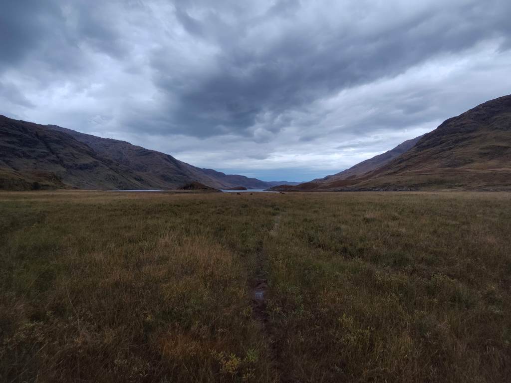
The bridge at Sourlies is new, having been erected in 2019 after the old one presumably collapsed or washed away. In October, one might ford this river only with the greatest possible care, and to do so alone would be foolhardy. Crossing, one then hikes up to the ruins of Carnoch, a substantial village or even township. Strange and ghostly it seemed me under that lowering sky. A substantial community once lived here.


From Carnoch, the path lies slow and steady uphill to 575m, back and forth in neat zigzags, to the col which is marked only by a small cairn. This morning’s walking, from Sourlies to this col, has been the summit, the climax, the crux, of the whole three days from Glenfinnan. A propos of the wilderness situation, the guy Dave had shown me earlier, some form of satellite-based emergency position-indicating device, for use in such country as this. I may have to consider carefully, obtaining something of that nature.
And on down into Mam Meadail and the rough bounds of Knoydart. The path was straight and true, steadily downhill and on the right of the river, but ever wet and muddy underfoot. Quite some way down – it is not obvious on the OS map, and so is a relative innovation of recent times – the path becomes a rather obtrusive unmade road. There is evidence of digging machinery having been here; the road is graded and passable with great care in a 4-wheel drive vehicle.


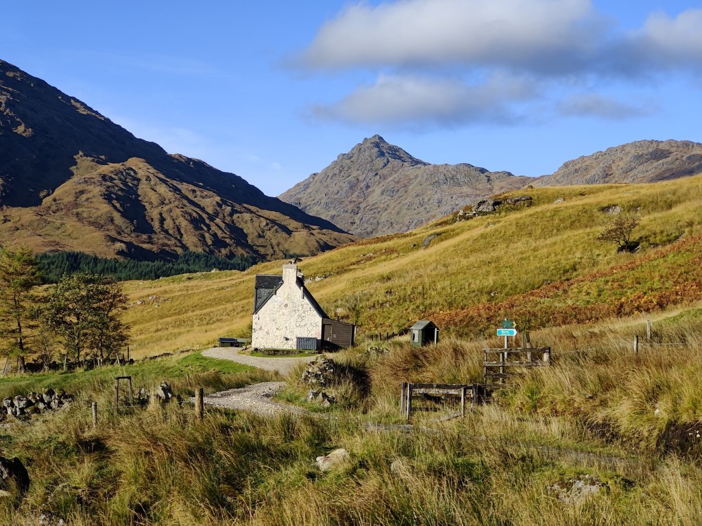
The valley narrows into what is almost a gorge as it passes Torr an Tuircc on the right. There is a footbridge and a ford for the tracked vehicles used to make the road. From here, on the left of the river through pleasant woodland, into the wider valley of the Inverie River, to another more substantial footbridge. Thence onto a pretty useful unmade road, past a monument on a hillside. Then – again the OS map has not caught up with reality – past a blasted wasteland of harvested plantation, all giant grey tree stumps and waste timber. I continued along a high forestry road until reaching the edge of the land owned by the Knoydart community, where there was good signage. Along the side of some woods, which were somehow reminiscent of the Dark Peak, and then left, in spitting rain, down a path beside a babbling brook, down to the road.

The West Coast atmosphere here is very strong. These houses and lanes of Inverie very strongly resemble the settlement at Kinloch on Rum, as well they might. I walked out towards the campsite, passing as I did so, a mobile home. As I passed, two little girls leaned out of the window to tell me that the campsite was cold and wet and that there was a bunkhouse. Bemused, I stopped for a moment, and their father appeared to shush them, telling me that the campsite was fine. This pleasant-mannered Englishman sold me a place in the Knoydart Foundation bunkhouse nonetheless, for £22, and with that I was well pleased. The bunkhouse was great: comfy bed, superb showers. I had a cup of tea and sat in a lovely lounge, very high-ceilinged and gloomy. A fire crackled and two visiting old Lancashiremen sat chatting. I made myself some supper in the kitchen, and then walked out through the damp autumn leaves to the Old Forge, the “most remote pub in mainland Britain”.
Today, to walk through from Glenfinnan, though objectively a tremendous achievement, is not unusual. I was the first of nine people to cross today from the Sourlies bothy. This evening, all nine of those people were in here – myself, the couple from Edinburgh, the two guys from Manchester, and the four Dutchmen. Five of us sat down for drinks, and we had as remarkable and pleasant a time of fellowship with strangers, as ever I had.
“Somebody left us whisky
And the night is very young
I’ve got some to say and more to tell
And the words will soon be spilling from my tongue”
(“When ye go away“, Mike Scott)
Local recommendations: I stayed at the Knoydart Foundation bunkhouse. I had refreshments in the Lochaber Cafe in Fort William. I also had coffee at the Knoydart Pottery and Tearoom. Transport back to the mainland in Mallaig was with the helpful and professional Western Isles Cruises.
I would not recommend going on that route without trail poles, waterproof trousers and gaiters. The weather was unseasonably mild, so I didn’t use gloves or a hat at all. I used a waterproof copy of OS “Outdoor Leisure map” #398, Loch Morar and Mallaig, as there does not appear to be a Harvey’s Mountain map of the area.


