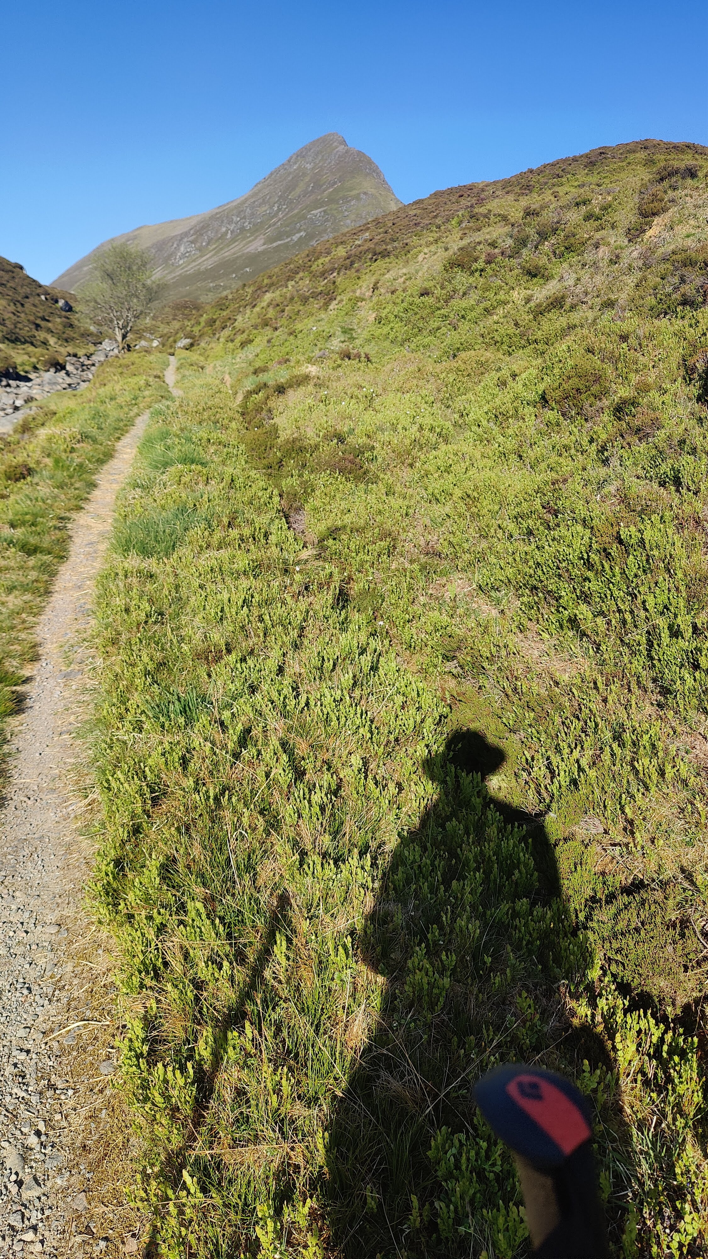
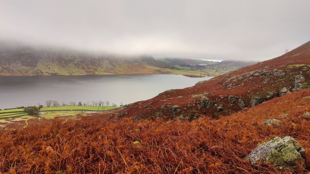
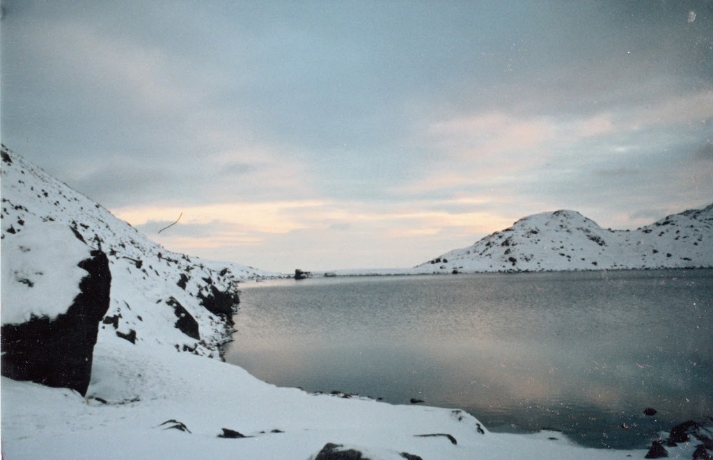
In cold grey clag we set off up Stickle Beck, intending at the least to visit Stickle Tarn, but both of us, I think – though neither of us said it out loud – intending to try for Jack’s Rake. We arrived at the tarn and had a short snack. Some young people were there; the mist was thick and cold. We walked round the side of Stickle Tarn and addressed ourselves to Jack’s Rake. This would be my fourth ascent of Jack’s Rake. I came up here alone, carrying a big bag, in May 1987. I led a party of four up in September 1989, and I brought my son up here in 2014. That took some coaxing and encouragement. I happened to mention to him the principle in scrambling and rock climbing that “hesitate and you’re lost” and he replied that he’d learned that principle from me, on this route.
I write that deliberately, for today, Jack’s Rake was cold and wet and I found it quite difficult – I was “sketched out” as my son might say; in places it was sketchy. Whilst at least the exposure was limited today because of the mist, my fingers, even in gloves, grew very cold. In several places I was stuck for some minutes, hesitating long before committing to upward moves. In wet and greasy conditions underfoot, one wants good handholds. They are generally there on an easy scramble like Jack’s Rake, but in wet gloves I was starting to loose feeling in my fingertips. Loss of handhold would have been catastrophic, whereas slipping and losing a foothold whilst retaining a good handhold, would merely have made my pulse shoot up. We got to the top in good order without really serious difficulty, me going ahead of Nat for my safe-keeping, he herding me up the route whereas on the previous occasion, our roles were reversed. This was fitting. I am not unhappy to say that I have probably gone up Jack’s Rake for the last time. It would have to be a dry summer before I venture back there.
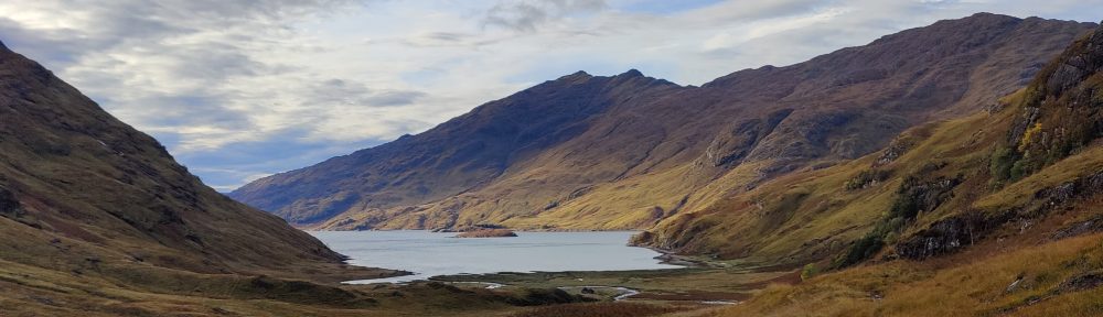
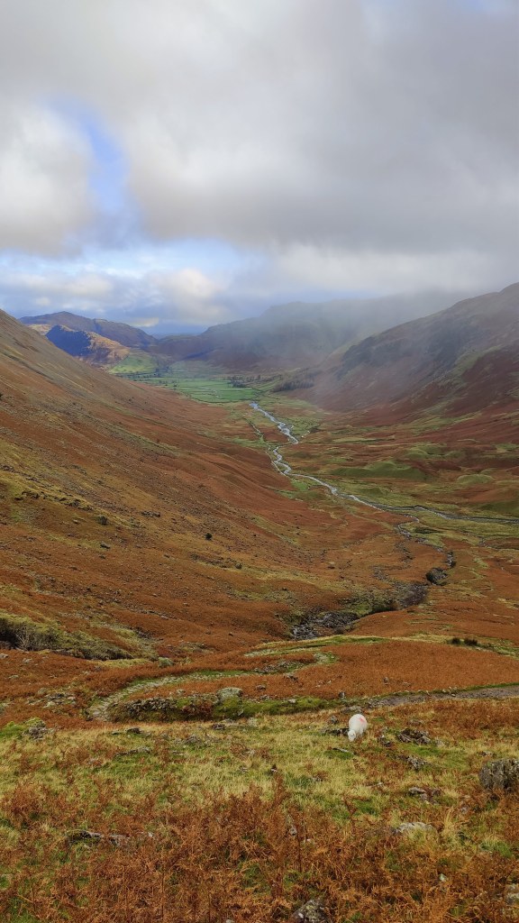
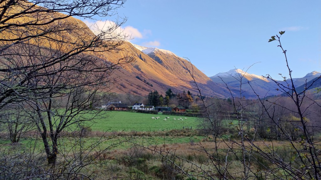
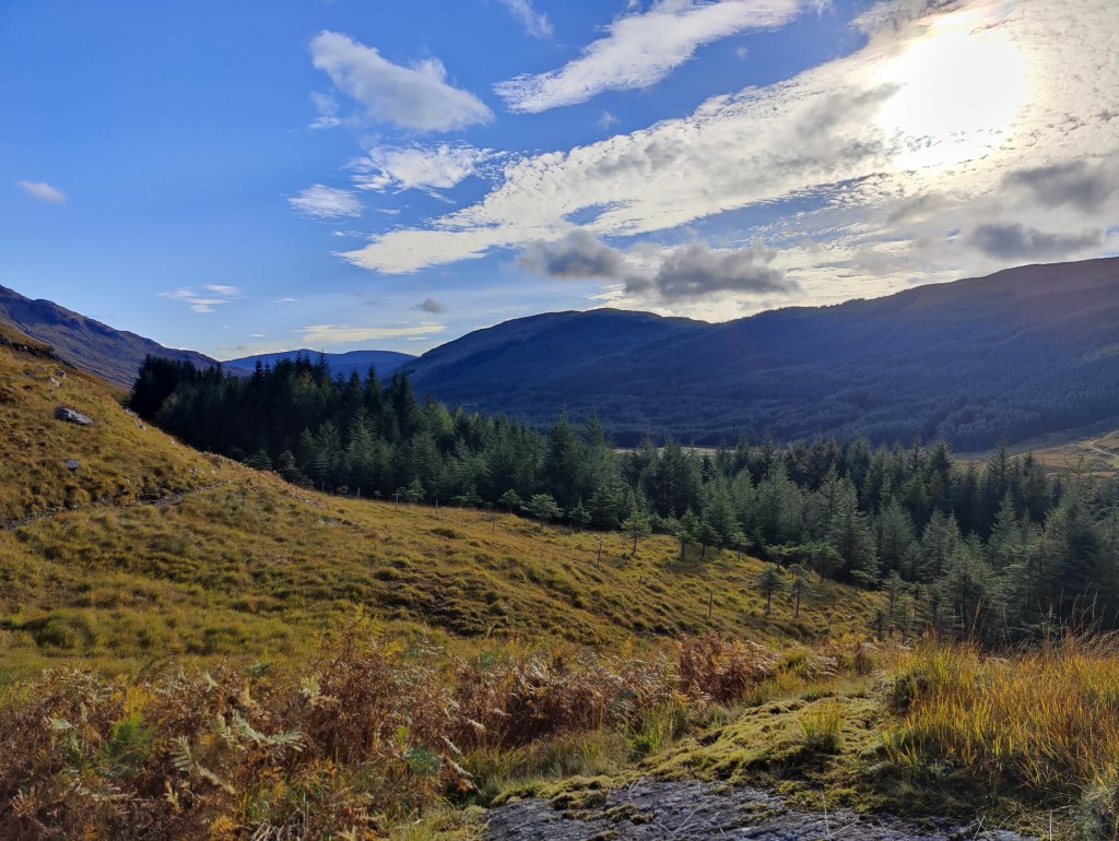
At the top, a short snack, before continuing by compass bearing through cold wind over cloud-strewn brown moor, overblown with rotten snow, down to the top of the Stake Pass. Down the Stake Pass into Mickleden, that most favoured of places, and along the valley of Mickleden in the slowly fading light of a winter afternoon. Even in winter I can’t walk through Mickleden without hearing sheep, without feeling the heat of summer sun on my shoulders. Then, tea for two in the bar of the Old Dungeon Ghyll, before a companionable wander through the gloom across the fields to the car park at the New Dungeon Ghyll. For a short day, a towering achievement. A good scramble, easy fellowship and safe transit over the mountains in poor weather.
After work, in the afternoon, to the shop to buy various bits, and then pack a bag. The rucksack, which had been 13.9kg with equipment less about two kilos of batteries, Kindle, notebook and pens and trail poles, was 22kg on the eve of departure – all up: all clothing, all food, and some water. Heavier than I anticipated, but manageable. Where had that weight crept in from? This was to be my ninth solo backpacking and wild camping adventure. To Cromford then, and by train to London.
Arriving in London I had a bit of time – trains in the UK are just not reliable enough to cut things fine and not leave plenty of time. I was at St Pancras at 19:38 for a 21:15 train out of Euston, up to Scotland. Why was I travelling from the Midlands down to London to go back up to Scotland? Because the alternative was taking the train to Crewe and picking up the sleeper there at midnight. If you’re going to wait for a couple of hours on a draughty railway station platform at night, I don’t recommend Crewe. I did that once; it won’t be happening again. I had a pint and a sausage roll in the Betjeman Arms at St Pancras, then strolled along the Euston Road to join the sleeper to Inverness, the longest train in Britain, and my carriage right at the front of the train.
I slept well enough on the train and had to hurry through my full Scottish breakfast in a paper bag. I found myself on the platform at Newtonmore at 07:15 on a drear and misty morning, barely starting to get light. I dragged on everything I had, to keep warm, and in Goretex over-trousers, gaiters, waterproof jacket, gloves and woolly hat, set off into the pre-dawn gloom. I had in reserve only a thin Rab mid-layer and at that point in the morning wondered if I had come onto the hill ill-clad. I walked out of town up onto the heath; had there been no mist this would have been glorious and scenic. You could tell it was a temperature inversion – there’s a look about the sky when you can sense that radiant blue sky and sunshine are only inches, as it were, above the steel-grey ceiling of mist.
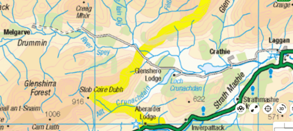
I ascended the Calder River up Glen Banchor, meeting no-one, listening to the fearful noise of stags rutting. This noise reminds me, with my taste in films, of the zombie apocalypse. At one point I needed to take care fording a stream. Late morning, I was approaching a tin hut somewhere round 648984, where the map marks “township” at Dail na Seilg. A stalker strode out to speak with me. We had a polite conversation about my plans, and his plans, and I saw that I needed to change my plans. It suited me to do so, to be fair – it wasn’t simply a matter of me rolling over. That said, this is pure stalker’s country, not at all walker’s country. I followed a tired old land-rover trail and became aware I was going in the wrong direction. I was soon lost and disoriented in the brown upland, stumbling over the heather looking at my compass. It took some close map and compass work to get me onto the right trail, a good and substantial unmade road, which I followed south-west down Strath-an-Eilich.
Early afternoon I came out at Castle Cluny, a nice-looking Scottish Baronial pile in the usual grey granite. Through the delightful autumn colours I trod through the grounds out onto the road. Without a detour, there followed a tiresome 2.5km tramp along the A86, a single track road at this point, but still with a fair amount of traffic. This brought me to Laggan, around about 3pm. From here, another tarmac road tramp of 4.5km brought me to the “Spey Dam”. I had not been aware I was walking up the Spey valley. I met no mountaineers or walkers. At this point, around 4pm, I’d been 7-8km on metalled roads and much of the rest of the distance on good unmade roads. I admit that had I known so much of this route lay along actual roads, I might have chosen differently.
Resting by the dam, I saw a couple of cyclists whizz past. I set off along the road under the dam and arrived at a kind of industrial yard, with piles of rubble and hardcore, and big spotlights ready to be connected to a generator – there’s no mains electricity here, even though this countryside isn’t the ostensible wilderness of the Cairngorms. All around there are very robust and well-maintained deer fences, with proper access for vehicles and pedestrians at the appropriate places. At this point, early though it was, I was looking for a place to camp. I could continue along the unadopted and private metalled road along the north side of the reservoir created by the dam, or I could hike uphill into more wild country further up Glen Markie. I opted for the former. I went through a metal gate, pulling back the bolt. The bolt made a displeasing sound that in the pristine silence of that place, sounded like a lamb being slaughtered. I walked a hundred yards before repenting of my decision and turning back. Such sudden changes of mind have served me well in the past. Being willing and able to change your mind is a virtue, not a vice – don’t let anyone tell you that stubbornness is a virtue.
I detoured uphill into Glen Markie for about an hour, past a wasteland of industrial plantations, until I came across a place where I might camp. I would have to hike back downhill to the reservoir tomorrow morning, but this was more or less where I thought I would end up when planning this trip as a desktop exercise back in June. I camped near the ford of the Allt Tarsuinn Mor, just before it joined the Markie Burn, a substantial river. I had a very cramped and limited pitch, but it had the advantage of being bone-dry heather. I was just below the tributary stream as it flowed down a ravine into the main river. I could hear running water in three different registers: the roaring or rushing of the river, the chuckling of the brook over stones, and the sound of small waterfalls. In spite of the limited pitch, it was supremely comfortable and I took one of the best nights’ sleep for some years, from around 7.30p.m right around until well after 6.30a.m next morning. I had a completely dry strike and was away from camp around 9 o’clock. There was no hurry. In any case, at this time of year in this place, daylight comes late and lingers late. There was little usable daylight much before 7.30a.m.
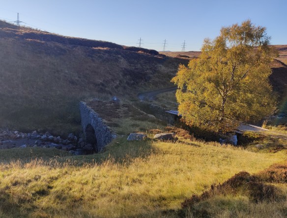
I hiked back down to the bottom of the glen, and turned right, resuming my route of the afternoon before. There followed 12km along metalled road – a single track road through glorious, empty country – but a metalled road all the same. The adopted part of the road (that is, the part coloured in yellow on an OS map) ended at Garva Bridge. Here there was an ancient bridge of 18th century military origin. Two cyclists whizzed past. I stopped for lunch and sat between the road, the woods and the Spey, under the cathedral of a clear blue sky. Today’s weather was better than yesterday’s. The tarmac gave out at a place called Melgarve – an empty house. At this point, in the heart of the Monadliath, you’re about 16km from the main road at Laggan, and perhaps a little further from Fort Augustus.
Beyond Melgarve, first a very conspicuous “Road Closed” sign, secondly, an actual half barrier blocking the way ahead to vehicles. The road itself continues up into Corrie Yairack, though without benefit of tarmac. This is one of “General Wade’s Military Roads”; to walk this route is why I was here. The afternoon’s walking ahead of me was the crux and heart of my trip.
Corrieyairack Pass
To the chagrin of some, a mighty high-tension power line marches up the valley, into the corrie and up and over the pass. All should have access to electricity. I remember in the 1980’s hitch-hiking in the Lake District and getting a lift from an estate agent. He told me that the Friends of the Lake District – every one of them living in a home with electricity – had opposed the building of power lines over a wild valley, which would have brought electricity to houses that did not at that time have access to power. Ever since then I’ve had little patience with the sort of environmentalist who sits in comfort opposing construction that would being the same comforts to others.
One of General Wade’s original bridges
Near the foot of the pass proper, I met a cyclist, the first outdoorsperson I had spoken to in days. I had seen no walkers, nor even so much as a footprint, along this route. The crux of the pass was six zig-zags, six legs of which were at this time of day (mid-afternoon) walking directly into bright sunshine. I was bareheaded. I had not thought to bring a sun hat, though I did have sunglasses. I blazed up the zig-zags barely out of breath. I’ve had eye trouble this year, and for that reason I chose this route because it was not so physically challenging. I also reflected that I have become successively more physically fit, particularly upper body muscle tone, on each one of these nine solo camping expeditions I have undertaken since 2021. I came off the hill on that first trip and had some unpleasant muscle problems in my shoulder, and had to visit a sports physiotherapist at the cost of several hundred pounds. Since then, on the advice of the physio, I try to do regular upper body strength exercises. Coming down to the Dungeon Ghyll last October, after two hard days on the hill, I was absolutely shattered – and part of me, misses that feeling. Being immensely tired sharpens one’s appetite for the simpler comforts in life –a hot shower, clean clothes, a Nice Hot Cup of Tea, a pint of beer and a pie, a warm bed.
At the top, a squalid guard-house stood, with an open door and bunks visible inside. In the long and golden afternoon I followed the path down towards Fort Augustus. I passed a 4WD vehicle with three fellows in it clearly observing deer. Another thing I noticed which I found unusual, was overflight by a small fixed-wing aircraft – repeated overflight, three or four times. Helicopters would be unremarkable, but a light aircraft, I found unusual: this is wild country. It was certainly not a sight-seeing flight. Far more interesting and dramatic mountains are available within a few minutes flight time for even a light aircraft. My best guess, looking at the heading and direction it was taking, was that some form of commercial survey was taking place, probably of the power lines in the valley.
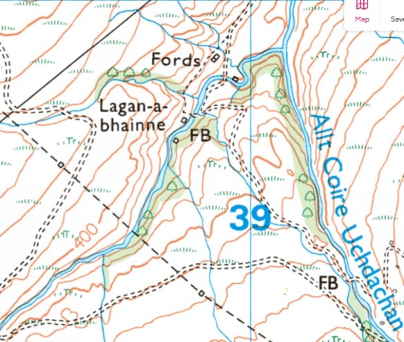
It was my intent to camp at a place called Lagan-a-bhainne, a wooded area of small valleys about 12km out from Fort Augustus. Still in the wilds, but off the high moors. When planning the trip I had spotted the area and thought it looked like a likely spot for a wild camp. My eye as someone with some experience in map-reading, was drawn to it. As on the map, so the reality on the ground: it was indeed a quite magical area where a narrow wooded valley cuts through the high moors. I found a spot to camp, taking quite some care that my tent could not be seen from the dirt road: it seemed to me that the three men I’d seen earlier would be employees of the landowner, and they might be driving through later on. Unlike in England, it is still perfectly legal to camp wild in Scotland, but why draw attention to yourself?
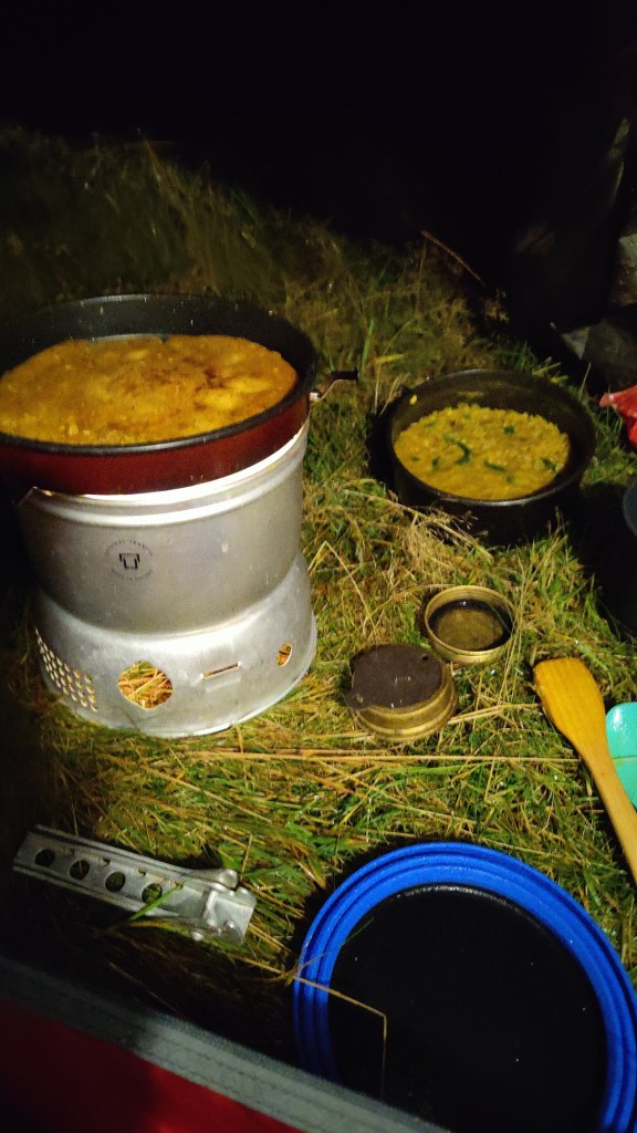
This was my second night by a babbling brook. I find the sound thereof, very restful. For supper I had my usual Indian: a spicy red lentil dhal, chick pea flour pancakes, and fresh spinach, all washed down with about 200ml of rather nice Shiraz. I always say, wild camping does not mean roughing it. Wild camping – any camping for that matter – is not, for me, a means to an end (as in merely low cost accommodation close to the mountain), but an end in itself. It is time spent alone outdoors, time spent in the wild countryside, time to collect your thoughts and prayers, time to be still. I came away carrying probably 22kg, of which 3kg was food and drink. I was not troubled thereby.
Interestingly, though I had picked a reasonably flat place to pitch, I could not settle comfortably at all – there was incipient backache, tossing and turning whichever way I lay. I moved through 180 degrees and slept like a baby. I woke up around 0600, which is too early at this time of year and latitude – there being another ninety minutes of darkness. But I was awake. I got up and prepared for my day. I had a breakfast of champions – cubes of bread, cubes of cheese, and chorizo sausage, all fried in a little olive oil and butter. Porridge of course. Black coffee. I did not have a dry strike, but it was a lovely morning and there was no rain – it was all condensation. I am using three separate dry bags for the different components of my tent – outer, inner and “footprint” (ground sheet), and this technique is a useful convenience, making the tent easier to pack in my rucksack, and ensuring that the wettest bit (generally the outer) doesn’t get the drier bits wet during the day.
Around 0800 then, onwards through the grey morning, trending ever downhill on a good road across the moor. After an hour or so, Loch Ness and Fort Augustus came into sight, and my heart fell – was it so close? I didn’t want to arrive there mid-morning. Actually the route has not so much a sting in the tail, as the walk-out is longer than it looks on the ground. On the map it was 12km; it just didn’t look that far. On my way down I passed an estate 4WD rumbling uphill, and a cyclist labouring along. It is a long and seemingly everlasting hill from the Fort Augustus side – rather like climbing Helvellyn from the Thirlmere side.
The road came down to another area of confused drumlins and narrow valleys full of trees, all very picturesque and rather reminiscent of the western Peak District. The road splits round a height of 228m at around 371055. General Wade went left; on a whim, I went to the right, along a 4WD road clearly very overgrown and ill-used. Well, not quite on a whim – a study of the map seemed to indicate that there was a way through some rather promising wild woods. I made the right decision! On the mountain, as 1930’s Scots climber W.H Murray noted, it sometimes pays to turn aside commonsense routine.
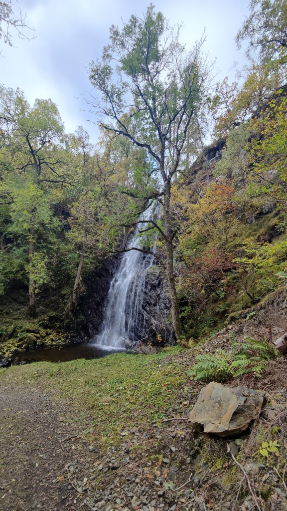
My path led down a long-abandoned un-made road by the side of the stream, down into the most magical valley, a beautiful and silent dell, peopled only by the sound of the rushing waters of the stream. This was the highlight of the trip! I had to carefully ford the stream. I continued, in a little trepidation that should have to turn back at the last. And indeed, the track to Culachy House was gated and very clearly marked “PRIVATE”. But there was another way – a hairpin to the right, down into another deep valley where I found, by chance as it were, the most beautiful waterfall: Culachy Falls.
From the falls a pleasant walk along a path through the woods, across the road and into a graveyard by the river. A little further on, the main road, and my walk was done.
Day 1: From Newtonmore to Glen Markie, 25km in 8 hrs 33 mins
Day 2: From Glen Markie to Lagan-a-bhainne, 27km in 8 hrs 7 mins
Day 3: From Lagan-a-bhainne to Fort Augustus, 12.3km in 3 hrs 28 mins.
I stayed at Morag’s Lodge in Fort Augustus, a former hotel now trading as a hostel. For a modest fee you can share an ensuite room with bunks. For slightly more money but still well below B&B prices, you can buy an entire room to yourself. Morag’s Lodge serve supper and packed lunches and a continental breakfast, and they have a drinks license. There’s a members’ kitchen as well as a proper bar, so it has the best of both worlds. The staff were super friendly and helpful.
The first time I came to Fort Augustus was in May 2012. I’d camped wild the night before further north in the Monadliath. My diary of the time records the following:
Yesterday I drove west from Aberdeen, in wonderful hot mid-20’s weather, enjoying the quiet roads and rolling wooded hills of Deeside. I pressed on over Lecht to Tomintoul through the summer afternoon to Nethy Bridge. Then over Slochd and left down minor roads towards Fort Augustus, at this point looking for somewhere to camp. I turned left again, up a minor side road, going right up over the top into the heart of a dark and wild corner of the Monadliath. The sun was behind me as I drove, and it was glorious. I found a place to camp amidst sufficient dry fallen timber for a jamboree of Scouts to make open fires. I camped in a little copse of pine above the road. It was 9.20pm and full daylight. Sunset at this latitude in late May is 9.45pm. There was sufficient wood from where I sat to make a lovely little fire, on which I prepared sirloin steak (medium) and courgettes and (alas) instant mashed potatoes. A nice S.E Australian Shiraz made it the pleasanter still. I had brought with me 2 litres of water, for there was no running water here – I could not have camped had I not brought water in myself. A couple of times, an estate factor’s landrover drove past and stopped. My fire was making a fair bit of smoke; there was no wind and the smell was unmistakable. They could not see me, and perhaps they cared less, for they did not come looking for me. I went to bed at 11p.m and woke at 5a.m, thence dreaming my way through to 7a.m. Morning was misty, yet dry. No single drop of dew fell, which was remarkable. My breakfast was bacon, mushrooms, tomato, roll and butter, served with fresh black coffee. A breakfast of champions, particularly when served outside.
What struck me most about this camp was the silence. The only noises were the calls of birds, particularly the call of cuckoos, and the sound of sheep. I set off at 8.30a.m in deep mist, back to the Great Glen, and on down to Fort Augustus, where the sun burnt the mist off, leaving a cloudless sky, a glorious summer day. I took coffee and cake at “The Scots Kitchen” in Fort Augustus, and read the paper. Could I ask for more?
An important part of this journey today was the adventure of doing it solely using public transport. I took bus Scottish CityLink bus 919 down Loch Lochy through Spean Bridge and onto Fort William. Once in Fort William I then had to wait a couple of hours for the sleeper train to London, which left on time and arrived more or less on time at Euston at 0800 the next morning. Thence along the Euston Road again and back into St Pancras station, where it was so early, there were no decent coffee shops open yet, and I had to get a coffee from Costa. Onwards home to Derby, and my trip was complete.
At 5pm, to the station at Cromford. I took train through to Derby through the sunny late afternoon. At Derby I adjusted the straps of my new rucksack to what I hoped would be a satisfactory arrangement. I bought a bottle of London Pride from a shop across the road from the station. Through to London in first class, a most pleasant experience for which I paid about £30. I could have picked up the sleeper at Crewe: I have done this before. But then it would have been necessary to wait on Crewe station for nearly two hours til almost midnight. Even on a warm summer evening, that’s not a sensible way to spend time. I walked the few hundred yards through to Euston station, walking behind the British Library, before joining the Caledonian sleeper a little after 8.30p.m. I ordered a full breakfast for £10- life is too short!
I slept fitfully, as I generally do on the sleeper train, but I know I did sleep, for I dreamed. I recommend the use of the Caledonian sleeper. If you can stand the narrow bed and cramped conditions, it is in my view, a cost-effective way to travel to Scotland. I got off at Dalwhinnie, after my full breakfast, into thick, grey morning mist. The train rumbled off towards Inverness, its red taillight disappearing into the mist. All was quiet. The time was 0655. One man got off ahead of me and walked away ahead of me.
I started off on the long walk-in, which begins with a detour along the main road as a key level crossing is closed. It is a long and tedious walk-in along a good and reasonably flat unmade road on the west bank of the reservoir, the enormous Loch Ericht, a loch so long that I could see the horizon at the other end of it. From Dalwhinnie station to Ben Alder Lodge, where the route leaves the road, about 12km. I was consciously and deliberately trying to keep my pace down, albeit with only limited success. I’ve seen and experienced in the past, the effects of walking too fast, too soon. But the slowest I could manage along the flat was about 13 minutes per kilometre. After Ben Alder Lodge the path trends to the right and uphill, through woods onto the open moor. At this point I found myself ahead of the gentleman I’d followed along the lake shore. The path arrows up into the brown hills; it was so very, very dry. Every small stream I crossed was dry; every drain and ditch, just full of dust. I wondered if there was any water at all in these hills. I was glad to arrive at a big stream, which ran clear and fresh, though somewhat depleted. The stream led up to Culra.
I arrived there at around 11a.m, as I’d predicted when planning this trip as a desktop exercise during the winter months. 17km in four hours. At Culra there is Culra Lodge (a wooden hunting lodge, locked down, with a wind turbine), a bothy (closed due to asbestos), and about half a dozen tents pitched. I added my own tent and sat outside for a leisurely lunch. The older man I’d seen earlier, who I’d burned off on the climb up to Culra, arrived and we had a brief chat. His destination, as was mine, was Corrour.
Looking up towards Culra, with The Lancet in the background
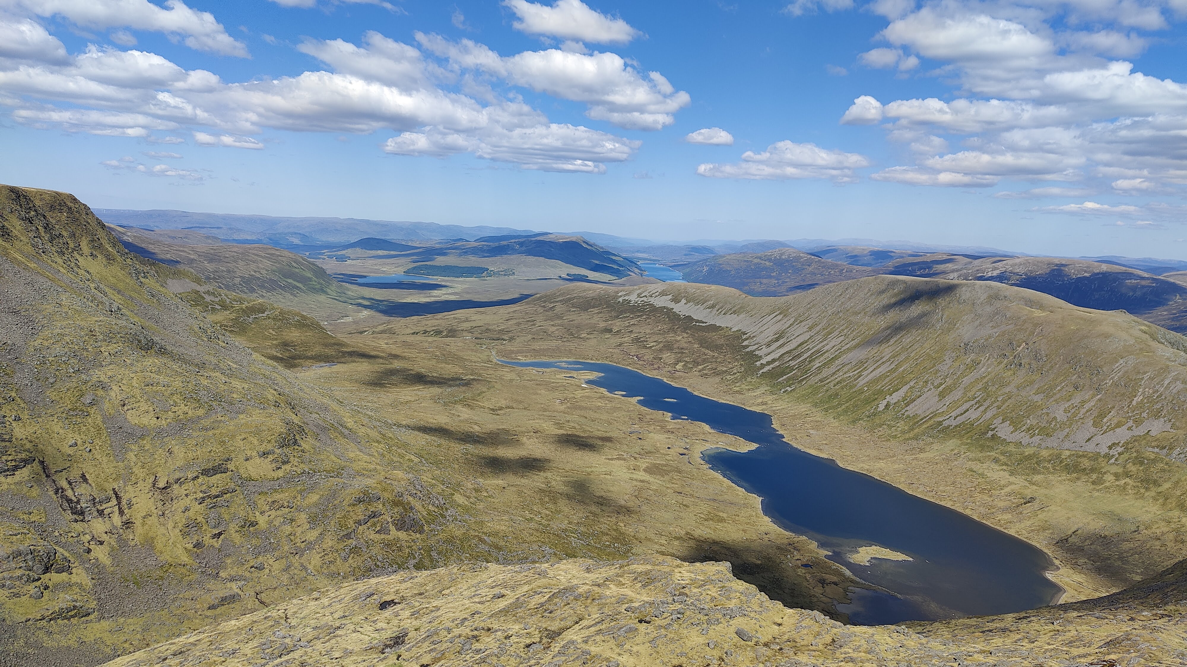
After lunch I pulled together what kit I needed for hillwalking and stuffed it into my now almost empty rucksack. What did I carry? Sunglasses, sunhat, warm jacket, spare long trousers (I was in shorts), first aid kit, food and water, map and compass, walking poles. What did I leave behind? Tent, stove, fuel, sleeping bag and mat, more food, my Kindle and notebook and power banks. After judicious use of suntan lotion, I set off over the brown moor, under a cloudless sky. Up and over the moor, as dry as any I have ever seen, rising into a small glen containing not a high mountain tarn, but a substantial ribbon lake, Loch a Blealaich Bailthe. The atmosphere was magical as the path led round the lake, with the massif of Ben Alder on the far side. I met a young man and woman, mountain cyclists who had cycled over Ben Alder. This hill is so remote that to climb it in a single day trip without the use of a mountain bike is quite tricky, even in summer. Not long after that I stopped for a while for a second lunch and bathe my feet in the loch. To wash your feet in such water as this, on such a day as this, is to wash away tiredness and pain, to sooth away discomfort and ache.
I continued up to the col – Bealach Breabag – and then on upwards to the right under hot sunshine. It was sleep but perfectly manageable. As I climbed, I encountered a party of five older men coming down, so I knew I was on the right track. Straightforward enough, in this weather, to continue upwards and onwards to the summit of Ben Alder, a most remote mountain.
Looking down to Loch a Blealaich Bailthe from Ben Alder. In the far distance, Loch Ericht.
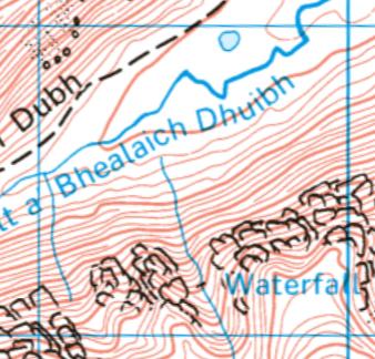
Not long after point 1081, I made a grave mistake. Treading north in the afternoon sunshine, I could see the sharp ridge of the Short Leachas ahead of me. There was no descent possible this side of it; the Harvey’s maps (1:40k and 1:25k) I had on me did not reveal a usable descent on the other side of it. Yet, descent there must be – to this day I do not know where. Possibly it goes directly down the Long Leachas ridge. I opted instead to swing to the left and downhill, aiming for the valley of a stream unnamed on the Harvey’s map, along which no cliffs were marked. There being no signal, my phone would not resolve to the 1:25k OS map, so all I had was the 1:50k which showed this. After the fact, a close reading of even this low scale map does reveal that this is a hanging valley and that therefore there are likely to be cliffs. I should have known better. The sun was bright, the phone screen was hard to see, and I didn’t see what I ought to have seen. To say nothing of the word ”waterfall” which was warning enough!
This screenshot from the 1:25k map illustrates what a hanging valley looks like on a map
This photo is looking more or less SSE from the path, at the very top of this map image
I descended on the right, keeping in the sunshine, until I could go no further as cliffs impeded further downhill progress. I put away my trail poles as doing more harm than good in a very steep and rocky place. Then I crossed over to the left-hand side, taking the opportunity to drink from the stream, and continued downhill again before my path was blocked by gently sloping slabs as the hanging valley opened onto the main valley. I was almost down and safe – but not quite. With great care and considerable difficulty, I made my way back to the stream, descending all the while, and crossed over again. Most of the time I was descending sat down, but twice on that return to the stream I had to resort to descending face-in, and down-climb. I do not think I could have gone back up: whatever I was doing, at this late stage I was committed to going all the way down. I should have turned back earlier, but I didn’t. As I scrambled out of the gorge on the right bank again, I saw a huge deer run down to the water and disappear behind a fold of the land. It emerged seconds later barely yards from me, belting down the hillside in a panic of fear. I shudder to think of my fate had it collided with me.
In all of this descent I was never actually frightened; I was well aware that I could ill-afford to allow vertigo, or fear of getting stuck, to get the upper hand. That said, my pulse was up to 156 and I don’t think that was down to exertion, as I was going downhill. I was lucky with the weather, and I was lucky with the time of year – whatever I did, I had plenty of time. I had food, water and probably 4 hours of useful daylight to play with. From where I’m stood now I got out of that situation not only by luck, fitness and mountaincraft, but by the sheer grace of God.
In due course, therefore, through great care in route selection and discerning choice of foot placement, I made that perilous descent successfully and safely and found myself on the valley floor. There followed a 3-4km tramp through the mid-afternoon sunshine, down the valley to my tent at Culra.
My supper was taken outside my tent, sat by the stream in the warm sunny evening. I started with that Englishman’s staple, a Nice Hot Cup of Tea. After a break I followed that with fresh tortellini with an admixture of fried chorizo sausage, washed down by some red wine, and followed by hot chocolate. It was a warm night, and very tired, I slept like a top, turning in not long after 2130.
I was away by 0700 the next morning. I have divided my tent up into three separate dry bags. This makes it easier to pack and easier to keep important parts of it dry. The inner tent, the flysheet, and the groundsheet and pegs are all in separate bags. That was unnecessary this morning after a completely dry strike – there was not a hint of dew. My path led back up the same route I had came down the previous afternoon, but as the Bible and the well-known hymn remind us, “morning by morning new mercies I see” – this morning, with the sun from a different direction, this was a different place, an absolute paradise. A stream wandered down the brown valley, babbling past rowan trees and chuckling to itself as it ran over boulders. Glad I was indeed, to be permitted to be in such a place as this, on such a bright morn. I passed the scene of my adventure the previous afternoon, appearing this morning as grievous shadowed slash on the hillside, and continued upwards to the Bealach Dubh – black pass. I was entirely alone, at this early hour.
Looking up towards The Lancet
Carrying only a litre of water, augmented in my pack-up by several small oranges and a bag of small tomatoes, I set off up the hillside from the Bealach, conscious that I might not see running water again til late afternoon. There was no cloud in the sky; it was barely 0900. Not far up the hillside I did in fact find the very tiniest little streamlet, a mere dribble running clear and cold. Not something one would normally touch, and certainly never in the Lake District with its ubiquitous livestock. I filled my spare water bottle – another litre – added a purifying tab and marked the bottle so I knew which of the two bottles was which. In the end, I never needed it. It was just there in case. My path led up a shoulder of green grass and grey stones, never steep enough to climb with feet and hands, but rocky enough to make trail poles a liability at times. Geal Charn (1132m) was a dun hill, a huge, rounded plateau, a rolling summit of brown grass. As with some of the landscapes on Ben Macdui, it is reminiscent of parts of the Dark Peak – but this is 1100m above sea level. It’s NOT the Dark Peak. From Geal Charn, easy and gentle hillwalking continues, up and down, over Aonach Beag (1116m) and Beinn Eibheinn (1102m). I rather suspect that the ups and downs I found easy, even carrying nearly 20kg, because I’m very fit. There were no clouds, little wind, and no shelter from the sun. In these conditions, a sun hat and sunglasses are PPE, not an optional extra. I met around ten people at various points on this hike, all going in the opposite direction to me.
View from Aonach Beag towards Beinn EibheinnBeinn EibheinnLoch Ossian
From Beinn Eibheinn, down to Meall Glas Choire, crossing a rather strange dry gap at 730436. As someone trained in geology I wondered at its formation. It resembled the Chalamain Gap in the Cairngorms, though on a much less grand scale. It is a strange thing to see, at such a high altitude, boulders rounded by some primordial torrent, in what was clearly a dry riverbed. I suspect that at some point at the end of the ice age, the retreat of a glacier has caused some temporary glacial lake to burst its banks, and a torrent like unto Niagara, has carved through this hillside. This kind of thing happens in the Himalaya even today.
Onwards down the brown grass to a rocky knoll, Creagan na Craibhe, and thence down through troublesome and difficult heather to the stream. This trackless ground was bone-dry and in a normal May would have been difficult, squelchy terrain. The stream was actually a substantial river and was called Uisge Labhair – “the waters spoke” or such. See that Gaelic word “Uisge”? After you try pronouncing it, it will become more familiar.
And there I stayed, dear reader. I washed my feet in the waters of that noble river, and made my camp nearby, near the place on the map called Lub Mholach. This was the finest camp I have made in many a long year. It was a magical garden spot. I bathed in the river, dried off and had my supper. Red Lentil Dhal, Farinata, Red wine. Though there was no mountain to the west like last night, to provide shelter from the evening sunshine, I was tired enough and retreated to my sleeping bag around 2100, before the sun had even set. I was very cold that night. I had wondered before the trip if I should invest in a lighter weight summer sleeping bag, but my experiences this night, tell me to stick with the three-season down bag and silk liner even in a warm Scottish May
Next morning I was awake bright and early and out of bed and breakfasting before 0600. A breakfast of champions: porridge (with Grouse and chocolate in it), black coffee with sugar, and fried bread and fried chorizo with melted cheese. My feet, which had been sore in the late afternoon, felt a little better after a night’s rest and some Paracetamol. I packed up and was away before 0700, to hike something like 10km through to Corrour station, arriving there just after 0900.
Loch OssianLoch Ossian, looking back up from near Corrour
A delightful hike through the woods along the shores of Loch Ossian. Arriving at Corrour station, in the brown emptiness, under the endless blue sky, I was dismayed to find the cafe shut, but that couldn’t be helped. I had enough food left to make a cup of hot chocolate, and a cheese and egg sandwich, whilst I waited, in company with others, for the train.
Corrour station house
By train two hours down the line to Arrochar and Tarbet. I had a “credit” for an unused night in the Tarbet Hotel on Loch Lomondside, and I made use of it to stay here tonight. Once checked in, I enjoyed several cups of tea and a long shower, before descending to the bar without boots on, to sit and enjoy a pint and a pub supper after another successful hiking adventure.
The next day, I took train from Arrochar and Tarbet to Glasgow Queen Street. I walked the few hundred yards to Central Station and took a Pendelino to Preston, then another one to Crewe. I had a “Standard Premium” ticket which was effectively first class without the catering. I thought it was good value at £130 for a four-hour train ride. At Crewe, a seamless change into a smaller and less salubrious train bound for Newark, which encountered technical problems – the first problems on this complex return train journey – which meant that I missed my connection at Derby. Hey-ho – I got home an hour later. Sat in the train at Blythe Bridge, waiting for the fault to be found, I remember a similar experience as a boy in the early 1970’s on our way back from Blackpool, when a Crewe-Newark train we were in broke down somewhere along there. On that occasion we had to wait a lot longer than an hour. The trains? Cromford to Derby (£8), Derby to London in first class (£32), London to Dalwhinnie in the sleeper (£255), Corrour-Glasgow (£35), Glasgow to Crewe in standard premium, (£133), and Crewe to Cromford (£20). The journey I made could not have been easily accomplished at all without public transport, and I deemed it good value for money.
Geek stuff – gram counting and costs
My rucksack, an Osprey Aether Pro 75, weighed around 14.5kg without food and water. The Aether Pro 75 is probably the lightest serious expedition rucksack on the market in the UK, weighing a truly astonishing 2.1kg empty. Here’s a table of the weight of some of my kit:
Kit item
Rucsac weight
MSR Elixir 2 tent and pegs stored in dry bags, poles
2805
Aether Pro 75 rucksack
2100
Skyehigh 700 sleeping bag with compression drybag, cotton bag and silk liner in its bag
1300
Trangia 27 with matches, striker etc
840
Lhotse raincoat
580
Spare clothes (socks, underwear, T-shirt)
550
First aid kit
460
Trangia fuel (ethanol) with bottle
412
Thermarest mat
380
Mountaineering trousers
365
Notebook with pens
260
Goretex overtrousers
238
Goretex gaiters
231
Merino wool leggings (winter only)
200
Kindle
187
2 x Powerbanks
362
Merino wool hat
175
plate, cup and spork
170
sun hat
133
Black Diamond headtorch w/batteries
120
Mittens winter only
120
Garmin Inreach Mini 2 with karabiner
114
Thick gloves
107
Aftermarket rain hood for rucsac
104
Ledlenser lantern with cable and battery (winter only)
I’m off on my adventures again, fitter, more experienced, and with a better packed rucksack and better equipment, than when I started doing this in the autumn of 2020. This is my fifth consecutive Autumn solo backpacking trip.
First, a trip from my home in the Midlands, to the Lake District, using only public transport. A flawless train journey; change at Sheffield and Manchester. At Sheffield, cloudless skies and sunshine. Barely ten miles later, emerging from Totley Tunnel into the Peak District, it’s grey cloud and drizzle all round. At Manchester, I changed into a shiny new “Transpennine Express” train going to Glasgow. I had thought that the very useful direct trains between Manchester and Glasgow were one of the many good things that had disappeared when the railways were privatised thirty years ago.
At Penrith, I stood sheltering from the drizzle waiting for the bus to Keswick. Here’s a father and his daughter travelling to the Lakes for half-term. Here’s a young English fisherman and his Eastern European female partner, with so much luggage you’d think they were actually moving to the Lake District. Here’s a bearded Italian traveller playing some kind of woodwind instrument, and here are five nervous-looking youths, Hasidic Jews wearing yarmulks, travelling to Scales near Threlkeld. A Monday on a bus in an English country town.
At Keswick, I stepped off the bus into light rain. I had planned to go by bus through to Braithwaite, but I needed to stretch my legs and warm up a bit so I thought I’d walk. I walked along a familiar route, past the Pencil Museum, across the muddy wet fields to a suspension bridge, and on to Portinscale. I first came this way in the late 1970’s. The path was flooded out completely – this Autumn the Lakes are very wet. At Portinscale I saw one of those micro-vans selling cakes and coffee. The young man running the stall had a little hand-written sign: “Mince pies £4. Free glass of mulled wine”. You can hardly ignore an offer like that…I had a chat with the fellow while I toasted my forthcoming adventure in mulled wine, and then moved on.
I followed a muddy path through the fields, cutting off a bend in the road, and still arrived at Braithwaite before 2pm, over an hour earlier than I’d planned. I’ve been coming to Braithwaite for over forty years, though I don’t think I’ve ever been here in fine summer weather. To me it’s a cold weather kind of place. I continued onwards and upwards towards Force Crag Mine, walking slowly. A temptation for the amateur athlete is to go too fast, too soon – and here, not only was there no hurry, but there was nowhere to camp except in a location barely two hours walk from here. At the mine, there is a turn-off to the left that crosses the stream and then curves around the hillside up to a distant cloud-shrouded col. There was a ford, and it was by no means passable, certainly not when walking alone with an 18kg rucksack. That was unlooked for. It was not in the risk assessment. I wasn’t expecting that. To have difficulty fording streams – in the Cairngorms, yes, one expects that. In the Lakes, even in October, not so much. It is very wet this year.
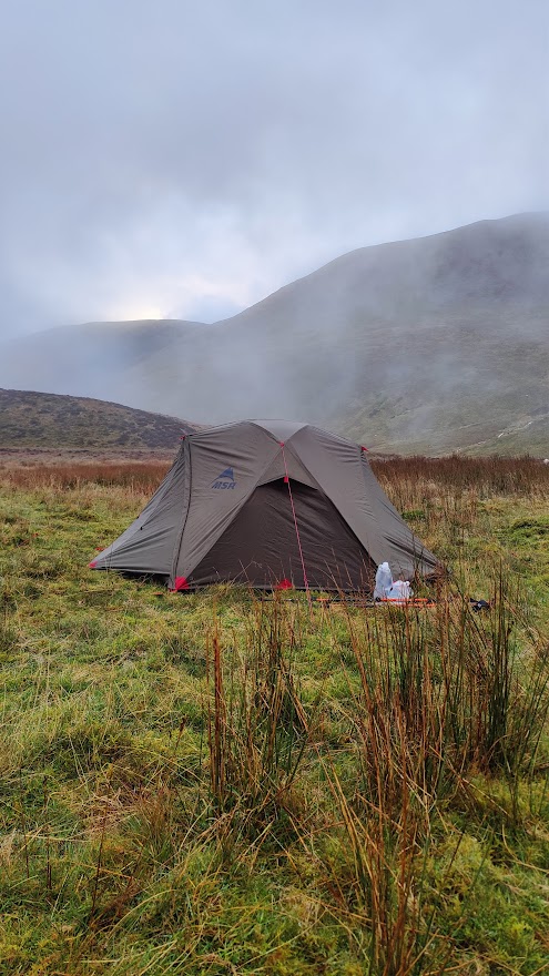
I continued up the right bank of the stream, through stones and rubble, through mud and marsh, through the outflows of strange settling tanks relating to the long-closed Force Crag Mine. I walked past the whole mine workings looking for a safe place to cross. At one point I found myself on very loose and spongy vegetation, quite possibly grown over a bog or an actual pond. Potentially lethal! I made a swift retreat. Force Crag Mine was a barytes, lead and zinc mine until less than forty years ago. It is in a beautiful location at the head of Coledale, with the dramatic Force Crag behind it. Eventually I managed to cross the stream, and had to bound uphill over steep heather to regain the path. Onwards up to the col and in no time at all I found myself a reasonably flat if not dry place to pitch my tent in the area above Force Crag. An eldritch, wild location, particularly as darkness fell. I made a good camp, had a good supper of fresh tortellini and red wine, and slept very well.
My camp above Force Crag
29/10/24
I was away from camp by 0745. It has taken me around an hour and fifty minutes from the decision to get up, to actually starting my hike timer. Unfortunately I had a wet strike – my tent was wet with dew and mist. My new Ledlenser lantern was superb, a revelation in kit. Light, small, and very bright. I walked first up through the clag to the windswept Coledale Hause – no real camping there; no water, no shelter. From Coledale Hause, to the left and south, up a broad valley to a crossroads (or crosspaths) at a gentle col. Here, turn right and uphill to Grasmoor, a tall hill (853m) whose rocky edges, such as they are, are away on the north side. Descending from Grasmoor, in thick mist, I had to resort to the compass and micro-navigation. This underlined an important principle of mountaincraft – trust the compass and not your inclination. (This does presume that you do know how to use a compass properly.) I counted paces and found where I needed to go. I would have liked to make greater use of my polythene 1:40k map from Harveys, but my path lay off the western edge of this map, and to be honest a 1:40000 map is neither use nor ornament for close navigation on foot.
The path goes south and down the ridge called Lad Hows. At the start of the descent I happened to look round; as the clouds were thinning and sunshine was trying to peep through, I saw a remarkable sight. I saw a rainbow almost full circle, surrounding the mountaintop. I struggled to get my camera out in time; by the time I had it ready, the effect had almost disappeared. Further down, I saw a red grouse in silhouette against the cloud. It flew off. I pressed on downwards, eventually coming down below the cloud deck and seeing Crummock Water far below. I could see Loweswater, and also a distant band of light indicating that the weather was not quite as bad at the coast as it was here in the mountains. At the ford by the road I met the first of many half-term holidaymakers.
Descending to Crummock Water
Along the road for a few hundred yards, then left onto a parallel track. I was passed by two running ladies. This path was not on the map. The Ordnance Survey maps, whether 1:50000 or 1:25000, are wholly inaccurate and inadequate at this location. My route took me – this was not on the map at all – along a good path down the side of a woods (High Woods) to a stile where one enters those woods. Here I was passed again by the same two running ladies, this time going in the opposite direction. Clearly there was some kind of loop path not on the OS map. Interesting to see that the open-source maps available on the Ordnance Survey phone app, did have these paths. Onwards through some magical woods, past a boathouse. I met quite a few people and various dogs. The path led to the outflow of the lake, which is a modest dam – more of a weir, really – into which fish ladders have been built. On the other side of the dam, on a silvery grey beach, I found a place to sit for an early lunch. It was a little after 11a.m. I needed to charge my Garmin watch, which suffers serious power drain when recording a hike.
Looking up Crummock Water towards Rannerdale Knotts, the prominent mountain
I had the usual lunch: hard-boiled egg, chorizo, cheese, butter, tomato, and some pitta bread. Pitta bread was not a success when cold. Also, mini oranges and trail mix – raisins and chocolate and my own chocolate covered date/nut/seed fingers. A lot of holidaymakers passed me with a succession of labradors. Most of these were leashed or reasonably polite but one of them had to be physically restrained – actually man-handled – to keep it from sticking its nose in my bag of food. The owner’s very apologetic teenage grand-daughter, in charge of the dog (which was off-leash) was not strong enough to control it, and she was horrified by its behaviour. To those who might say that I presented temptation to the dog by having a food bag out, I say the same thing as I said to the dog…
After lunch, the path led quite literally along the water’s edge, past a pretty “pump house” (why are municipal water works in the UK almost always architecturally admirable?), and then away from the lakeside up over a hillside. I passed two black horses. Up through some more delightful woods – this was your Green Wood and Flass Wood, above High Park and Low Park farms – round the shoulder of White Crag. The path curved around to the left and south and on into Mosedale. Here in Mosedale I consciously and deliberately put in the pace, faced with the conviction that I was running late. The route up Mosedale is along a good un-made road. Later, the road ends and the path curves right and to the east, over boggy wet ground, towards Floutern Tarn.
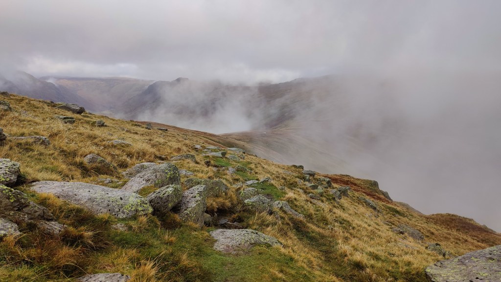
Floutern Tarn was in the clouds, shrouded in mist and clag, and I was tired. At a rough col above the tarn, there was a straight fence marching up the mountainside. Where man can put a fence, I can walk. Oddly there was no path on the OS map, yet, today’s route, made months ago using the “snap to path” functionality in the OS mapping software, goes vaulting right up this mountainside – Steel Brow. On the ground, there was in fact a rough path. It was very, very steep and very nasty. But I am very fit and I made it to the top, albeit slowly. At the top, more marshy ground. One follows the fence more or less due SE to the summit of Great Borne, and from there, across more brown moorland over Starling Dodd and Little Dodd. At this point I was growing concerned about my timekeeping. About 2pm, I met the only other mountaineer I saw all day, a South African fellow hiking back along to Great Borne, heading for Ennerdale YHA. We agreed that I should struggle to reach Black Sail by nightfall, given that I had yet to even start along the Red Pike ridge. I thought I might even struggle to reach the Scarth Gap, and find myself benighted on the ridge. This wasn’t likely, but I was tired, and it was a grey and gloomy afternoon.
As I continued, in a patch of wet, boggy ground, I lost the path. Looking at the map, I saw that by going along the contour (level) for perhaps half a kilometre, I should reach the descent path from Red Pike down into Ennerdale. I decided instantly to get off the hill: always know when to cut your losses. Solo backpacking in late October, my natural inclination to “glass half empty” becomes mere common prudence and good mountaincraft. Counting paces, I did just that – trod level along the contour for something like 600 paces, and without difficulty, encountered the downward path. It’s worth noting that this was a combination of micro-navigation (counting paces and a close understanding of the map) with full knowledge of my location from satellite positioning. It would not have been possible without a smartphone.
As I came below the cloud deck and saw Ennerdale below, I glanced at my watch and saw that the power was almost out. I stopped the hike timer on the spot: I had been on the hill for 7 hrs and 52 minutes. Down through a broad firebreak, a rather beautiful grove of autumn coloured deciduous trees. Ennerdale, though ostensibly the wildest of all the main Lakeland valleys, has good roads, contrary to popular understanding. It’s just that these roads are private, unmade, and reserved for forestry.
Descent into Ennerdale, dusk
I arrived at the road around 4pm. All I had to do now was peg it uphill along the forest road towards Black Sail, looking for a campsite. I had no chance of reaching Black Sail in daylight. Black Sail was over 5km away uphill, and in these gloomy conditions, at best an hour of daylight remaining. I had to work out afterwards at home where I actually camped. I needed two things: 1) running water within a few hundred feet 2) flat ground in which to pitch my tent. Running water was super-abundant; the road crossed streams every few hundred yards. Appropriate flat ground capable of supporting a tent peg – not so much. As I hiked, three or four people passed me hiking downhill with no packs, clearly on an afternoon stroll out of Ennerdale YHA. As time wore on and the light faded, and as I grew tireder, my criteria for a pitch grew less discerning. When I eventually chose a spot, it was getting on for 6pm and almost completely dark. I needed to use a torch to pitch my tent. I pitched it outer first. Whilst it was not actually raining, I was effectively in the clouds and the air was full of light drizzle. All parts of my tent were absolutely soaking wet – footprint, inner and outer. I got the inner up and had to use my towel to wipe the inside dry.
I was absolutely shattered, exhausted almost to the point of nausea. Tent up, everything inside, I was finally able to rest. My first priority was to go out again and fetch water, and then, drink water. I was concerned that I was dehydrated. Then, dry clothes, ibuprofen, and some Ralgex for my shoulder. After a while just sitting, I began to feel a bit better, and started to prepare my supper. This was red lentil dhal with garlic and onion and spinach, and some farinata – chick pea pancakes, washed down with red wine carried onto the hill in a plastic water bottle. It was a most excellent supper.
A most excellent supper
My new lantern performed well, though the limits of the battery were starting to show. It flickered several times and then switched itself to a dimmer setting. I had not bought the charging cable. No matter; the lantern is a game-changer for dark season camping, as it weighs barely 80g and is about half the size of a pack of cards. And so to bed – not long after 7pm.
30/10/24
I slept passably well. In fact I slept very well, on both nights. When sleeping on the ground (even using a Therma-Rest mat) I’m accustomed to reaching for the brufen as soon as I wake up. Yesterday it was not necessary. Today, whilst I did drop 400mg brufen as soon as I got up, it was not so much for aches and pains as prophylactic, to ward off shoulder discomfort later. I took it easy; there was no rush: I was out of my pit before dawn on a very mild morning. I had insufficient water in my tent and could not be bothered to get my trousers on and my boots on and laced up, which would have been necessary to get more water. This meant that I did not have any coffee or hot chocolate. Another advantage of eschewing coffee is that the subsequent need to make use of the sh1t shovel can hopefully be delayed until reaching civilised facilities. Unfortunately, this morning that was not possible.
For breakfast, porridge with melted chocolate and malt whisky, although I had eaten half of it before I realised I ought (at least on the hill) put sugar in it as well! This was followed by a mess of chorizo, spinach, tomato, pitta bread and melted cheese, fried in a little oil. Breakfast of champions! That said, I would not again use pitta bread and will resort to more usual western forms of bread next time. I struck camp in half light and was away hiking up the forest road before 0740. Up to within a kilometre of the Black Sail hut, there is a good road, easily passable in any car. For the last kilometre a 4WD vehicle would be absolutely necessary. This good road does belie the hostel’s reputation as the most remote youth hostel in England. Ennerdale is stupendous in its magnificent wild beauty, even in these heavily clouded conditions, and even though the whole valley is an industrial plantation. The clouds part occasionally to reveal the heights of Pillar and other peaks. Of all the great valleys of the Lakes I like Ennerdale the best; it reminds me of the music of Sibelius. I passed the Black Sail hut at 0800 hours.
A few navigational errors saw me on the path up Seary Knott onto Fleetwith – not what I wanted. I had to turn back, and I found myself wandering through a field of immense drumlins. Part of the problem is that that the path as marked on the OS map, and as it exists on the ground, is different. The path on the OS map is a straight line directly uphill up the tongue between Tongue Beck and the main Liza river. The path on the ground is a windy route up the crest of the “Tongue”. I laboured up this path into the mists, zigzagging through the grey clag, hat on sometimes, hat off when I overheated. In this mist l stuck to the path like it was my only friend. Everywhere, sheepsh*t. I never saw so many sheep, and so much sheepsh*t, as in the Lakes this Autumn. It made me reluctant to drink from the mountain streams without using Puritabs.
After a long plod uphill, I reached a T-junction; the path crossed Moses Trod, a named path weaving across the mountainside from Brandreth to Kirk Fell. Along Moses Trod, counting paces, until I reached the point where I must strike uphill, over red screes and deep in the enclosing mist, steeply uphill to Windy Gap. As I reached Windy Gap, I saw a man with a dog. This was exactly what I saw the last time I was here, in very different weather conditions five years ago. Today we were enclosed in the mist; five years ago I could see the Irish Sea. Windy Gap is a tight and narrow col between Green Gable and Great Gable. I have been here a half dozen times in my life, the first being as long ago as 1979. It was 0930 – slightly under two hours from the Ennerdale valley floor.
Some chocolate and trail mix and the remains of my water to refresh myself and onwards down Aaron Slack. At first, it is a rough but easily manageable scree, but further down it becomes a very good staircase. That said, the stone steps were somewhat slippery in the wet when going downhill. That might be a weakness of these boots. As I moved carefully downhill, four figures appeared behind me, moving very fast. No rucksacks. At first I thought they were runners or perhaps military personnel – but no, they were just young lads. I had a pleasant chat with one of them, who had the grace to dimple when I said (of my slower pace) “Oh to be nineteen”. The four of them were most polite and civilised members of the Praetorian Guard of youth, with all their lives ahead of them.
Down to Sty Head; find the tarn in the grey mist, yomp up to the top of the pass in thick clag. Then, briefly in company with four more youths, one female, I had some difficulty in this thick mist, with locating the Sprinkling Tarn path. Find out using GPS exactly where I am, then, some compass work, some counting paces, and the path was found easily enough. Onwards and upwards, now and for the rest of the hike, on strong Lakeland paths, motorways amongst mountain tracks. Halfway up I was pausing for breath when I was surprised and a little mortified to be overtaken. I was overtaken by a substantial (at least a dozen) party of what looked like U3A hikers to me, not one of them except their leader a day younger than I, and all (except for their guide) carrying tiny knapsacks. I was hauling probably 18kg of wet expedition bag, and had hiked 45 km since Monday lunch time. In fact, starting off again, I kept pace with them and started to overhaul them, but they turned off to the right into the mists.
At Sprinkling Tarn, though it was barely 1100, I stopped for a very early lunch, sat in what little shelter I could find by the brown moor, the steel-grey rippled lake. The clouds lowered. I pushed on, passing through an area where clearly there had once been a tarn. The geography was all corrie, though the only trace of dried up lake was the colour of the grass and a marshy area. Up to a broad col where going wrong would have taken me up to Esk Hause, which was not at all necessary today. Esk Hause is that spot in the Lake District furthest from a metalled road. It’s about 2.5 miles to Rosthwaite in Borrowdale, to the Wasdale Head Inn in Wasdale, and about the same (using Rossett Gill) to the Dungeon Ghyll in Great Langdale – my final destination today. Coming down from the col I passed two young people, a man and a woman, working on some repairs to the path. And so by degrees down to Angle Tarn, my third and final grey lake in the clouds of the day. Styhead Tarn, Sprinkling Tarn, Angle Tarn. To think we camped here when I was but 16! What were we thinking of? In warm and dry conditions, fair enough. In wind, cloud and wet, not so much.
In all this hike there has been no actual rain at all, and it has been mild to a remarkable degree. The wind has not risen so much as to rattle my tent. I could have done with some wind to cool me down, dry my sweaty clothes and dry my tent. I wore gloves for perhaps 5% of the time I spent hiking. From Angle Tarn, along the contours or perhaps slightly uphill , to the right of Lining Crag, and thence down, below the mist line, to the “Pile of Stones” at the top of the Stake Pass.
The top of Stake Pass seen in the distance as the mist clears
In effect, job done. It was just around 2pm. Downward then, along a good staircase down into Mickleden, and then along the flat of Mickleden to the Old Dungeon Ghyll Hotel, whence I arrived, tired and footsore, a little after 3pm.
Mickleden, seen from some way down the Stake Pass
I hiked a little over 55km in three stages over a little less than twenty hours. From Keswick to Pudding Beck was 9.7 km over 3 hr 23 minutes. From Pudding Beck to my camp in Ennerdale was 26.4 km in 9 hrs 16 minutes, finishing after dark. From Ennerdale to the Dungeon Ghyll via Sprinkling Tarn was 19.4km in 7 hrs.
I took train to Crewe, arriving in good time for the sleeper service to Scotland. The train slipped into the platform almost in silence, as if to not disturb the sleeping customers. I boarded, and off we went. In the morning the train stopped for a while at Tarbet on Loch Lomond-side. I could hear the rain drumming on the roof of the carriage – but that was at least forecast. I was allowed by the male provodnik (Russian for “sleeping car attendant”) into the “Club Car” for my breakfast, and told somewhat loftily to sit “over there” clearly away from the very few first class customers. Feeling less than welcome, I had my sausage bap and cup of tea, and left.
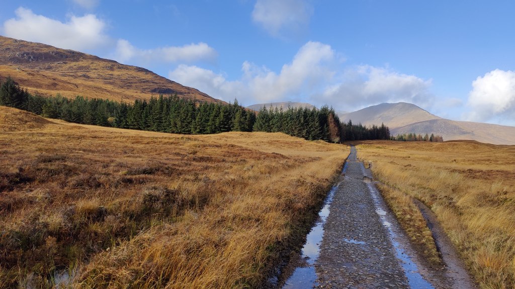
At Bridge of Orchy I got off, and under the shelter of the station canopy, prepared for hiking. It was raining. The buildings of the station have been converted into a low-cost hostel, although I saw on social media that this hostel has a poor reputation as being somewhat spartan. The West Highland Way, or proximity to it, is an opportunity to sell excellent services to travelers, or perhaps, in some cases, a magnet to less scrupulous property owners hoping to make a fast buck from accommodation. The railway station itself is uncrewed – as was the hostel, at this time of year.
I left, in the dripping rain, and almost immediately passed the only southbound hiker I saw in two full days on the hill. It was 9.a.m. The initial part of the route lies over the summit of Mam Carriagh and is marked on the OS map as an “Old military road”. It is one of General Wade’s roads from the early eighteenth century, from the years of the Jacobite rebellions. As I walked, the rain rose to a crescendo, and I made full use of my new Mountain Equipment “Lhotse” jacket, which I bought heavily discounted from Cotswold. It is has a great hood, but as a tall man I could do with a waterproof least six inches longer in the body – a coat in fact, not a jacket. Why are modern mountaineering waterproofs all jackets?
I came down to the Inveroran Hotel, all shuttered up now for the winter, in grey and spitting rain. Onwards onto what was referred to on a sign as the “Old Drovers Road” to Glencoe, which was ostensibly the main road before 1933 when the current road was opened. Of the current road, arrow-straight across Rannoch Moor and with sweeping curves down through Glencoe, the Scots mountaineer W.H Murray once said (a propos of complaints that it spoilt the landscape) that the new Glencoe road could “no more spoil the landscape than the facade of Chartres Cathedral could be damaged with a pen-knife”. Murray was quite right – and he was an early environmentalist.
The drovers road across Rannoch Moor
There is no evidence that this road was ever covered in tarmac – it is stones and cobbles now. Ninety years is a long time; the tarmac could be long gone, but I somehow doubt it ever was a tarmac road. I found the road very hard on my feet, but that may be because my current boots are approaching the end of the natural life and may in consequence be a little thin in the sole. But it is a good road, passable by car even today (were it allowed – of course it is not), albeit at not much faster than 10mph. It rises gently from Victoria Bridge at 174m to a summit of 353m over 7km, before falling again down to the access to the “Glencoe Mountain Resort”.
Is there a sport less sustainable than skiing? I am a mountaineer. I seek to cross mountains for pleasure, doing so on foot, doing so safely, and leaving no trace other than footprints. There are few things I find much more depressing than a ski resort in off-season. (Maybe a British seaside town in February…) A ski resort needs good roads, ski lifts, hotels and shops, bars and restaurants, accommodation for staff. It needs street lighting, drainage and all the other municipal services we take for granted. All these things are good things of themselves. But out here in the beautiful autumnal brown of the Blackmount in November, I find it all rather jarring. Even as I stood by the roadside thinking this, a 32 tonne truck rumbled past carrying a snow-mobile and ski-lift pods. I finish where I started: can there be a sport less sustainable than skiing?
Crossing the A82 as quickly as possible, but with great care, I continued. From here to the Kingshouse the way leads along what is clearly a former tarmac road. The Kingshouse, once merely a hotel, is now a small community. One day, it seems to me, it may be an actual village called “Kingshouse” – there are diverse lodgings and houses, and a community centre, as well as the eponymous and famous hotel with its extensive car park. It even had a roundabout. In the car park I had to detour round tourists taking photographs of a red deer which had wandered in. The weather was darkening.
A hundred yards past the hotel, once again in open country, I decided to stop for a snack. My mountaincraft is sharper and better than I know; it works at a subconscious level. I had barely finished my chocolate and so forth, when a squall of rain and hail descended. I was hard put to get my hat, gloves and scarf sorted and my coat zipped up before the onslaught. How had I known that the squall was so imminent? How did I know to take this last opportunity for a snack for an hour or more? It was surely neither luck nor coincidence.
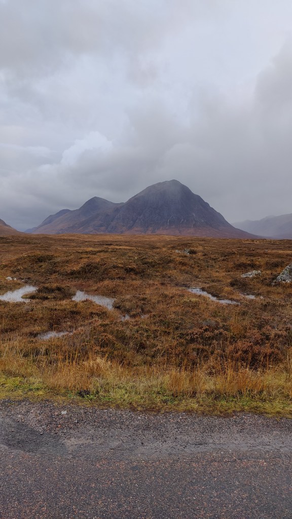
The next stretch of the road was again an “old military road” more or less parallel to the A82, finishing at Altnafeadh. The weather was dreadful; grey cloud and squall, brash wind and rain. I would have taken more pictures of the magnificent towers of Stob Dearg (“Buchaille Etive Mor”) on my left – perhaps the most recognized mountain in the UK. But others have photographed that graceful hill more effectively than I, and I was loth to take off my gloves in this rain.
Stob Dearg (“Buchaille Etive Mor”)
At Altnafeadh it was 3pm. The traffic rushed past; the clouds lowered. Time-wise I was on target. I had thought I might camp here, having at very best maybe ninety minutes of daylight remaining, and not wishing to be caught in the hills above the Devils Staircase. But there was no suitable location, and the rain came down. I had a little snack and a fat little robin came and sat near me; I fed it with some of my wife’s Rice Krispy cake. Onwards: in heavy rain and hail I started up the Devils Staircase. A struggle if you’re not fit, that ascent, but I pushed very hard and fast uphill, to the point of starting to overheat. Time was of the essence now. I had to find a flat and sheltered place in the hills to pitch my tent, and I had to do so pretty much within the hour.
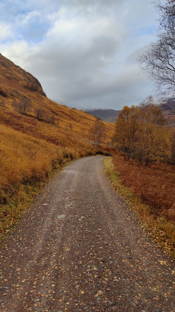
I thought, looking at the wind direction (this is mountaincraft again) that the weather would be better on the far side of the hill up which the Devils Staircase goes back and forth. I was right to think that; so it proved. On the Rannoch/Glencoe side, grey rain, clag and wind, hail and storm. On the far side, calmer, even to some blue sky. I pushed on over as late afternoon became evening and dusk, looking for a camp ground. I had limited daylight and my salutory experience in the Cairngorms two years ago was fresh in my mind. I found a flat place right next to the trail, right next to a stream. Not a place I’d choose in summer. The place was more or less where I had predicted from theory beforehand that I ought to camp, in order to make this passage from Bridge of Orchy a two-day rather than three-day hike. It was the stream of Alt a’ Choire odhair bhig.
My tent went up easily enough, pitched outer first as rain looked imminent. In fact I had not long been pitched when there was a tremendous hailstorm turning the world white. I found it hard to get warm, but once I’d eaten and gotten into bed, I warmed up in due course and slept passably well, being in bed for nearly 12 hours.
I awoke respectably late, but still before dawn. Surprisingly so given that I had been in bed for almost 12 hours. I went through the drill of having breakfast (porridge with an admixture of chocolate, sugar and sultanas and a little malt whiskey) and striking camp. The practice of solo backpacking and wild camping, particularly in autumn or winter conditions, is the practice of detail, the practice of method, the practice of doing things right, in the right order. In other words, it is the practice of mountaincraft. This is one of the reasons why I put myself through it. It is no ordeal; it is a pleasure and a privilege. It is a pleasure and a privilege to be alone in the wild. I can put myself, in an uncontrived way, in a place where doing things right, in the right order, is the difference between, on the one hand, an enjoyable and relaxing experience, and on the other, a dreadful or even life-threatening experience.
I was on the hill, full of breakfast, by 8a.m. I had a long day ahead of me of 32km, but I knew I could make Fort William, if not by nightfall (about 5pm) certainly not much later. I started out in Gore-tex over-trousers but today’s weather was much more forgiving and they soon came off on the descent to Kinlochleven. Early on, I had problems with very cold fingers, as my gloves were wet from the previous day. I had to use my big mittens, which were still dry. One action from this trip is that I need to think carefully about carrying multiple pairs of gloves (as one carries multiple pairs of socks), or, look into waterproof gloves. The light and the views this morning were lovely.
Coming down into Kinlochleven one sees six tremendous pipes marching across the landscape, bearing water from the faraway dam on the Blackwater Reservoir. At the bottom of the hill by the river, an enormous and striking mill, Edwardian architecture with some Edwardian technology inside and out, as the rushing water from the great pipes feed the hydroelectric plant inside. Kinlochleven at 9a.m was quiet and cold, only dog walkers were around. I’d been aware that I could have resupplied here to save weight, but it turned out that I needed nothing, and I walked on out of town without stopping. Kinlochleven is rather sleepy and forgotten since the opening of the Ballachulish Bridge in 1975. Today it seems little more than the start of the final stage of the West Highland Way. That said, its location is stupendously beautiful, central to a wide range of wild country and high mountains. It reminded me, however – particularly in cloud-streaked autumn at that time of day, of the town in the Pacific Northwest in Sylvester Stallone’s film “First Blood”.
I climbed up out of town through pleasant and fragrant managed pine woods, emerging into a higher, colder valley. “Footpath to Fort William via the Lairig” the sign had said. The path runs true up the right hand side of the valley, reaching a bealach at which there is a substantial ruined house. From here, one cannot see where the route goes, but it curves round to the right and to the north. I passed a young woman out from Kinlochleven; she said she was just doing this last stage. Only the second person I had seen hiking for two days.
The ruins at Lairig Mor
The path continues northward, a little open on the left, with higher mountains on the right. Such trees as there were in the area were not entirely consistent with their representation on the map – this is a working plantation. I had been saying to myself, “Ben Nevis dominates Fort William, but I cannot see it yet. When will I see it, and know that I am getting closer to my destination?” The path kinks round to the right, trending more north-westerly, and finally, in the afternoon, I found myself in a place where I knew that just beyond, lay Glen Nevis. At the head of this valley was a confusion of hillside, rather strange looking. Some odd geological effects were at work here. In the heart of the confusion, lies the ancient fort “Dun Deadail”.
Nevis seen from the trail not far from the fort “Dun Deadail”
From Dun Deadail, the way lies along forest road all the way down to tarmac in Glen Nevis. In the deepening cold of late afternoon (that is, 3pm at this latitude and time of year – it’s great to come to Fort William in May when “late afternoon”, from the perspective of the sunshine, is 8.30p.m!!) I trod the forest road down, and then tramped the final tough tarmac mile or so into Fort William.
Glen Nevis
In Fort William I was met by a friend of mine who kindly arranged for me to stay at the excellent Fassfern guest house on the shores of Loch Linnhe. We had a couple of pints and some pizza at the Black Isle pizza bar in town, but to be honest, after my trek I was shattered, and was glad to be in bed by 9.30pm.
A ten-hour train journey
This first leg of the immense train journey back to the English midlands leads through a brown, grey and relict green autumn landscape, towards Spean Bridge. In the distance, cloud-draped mountains have winter’s first coat of snow. Behind me in the tiny two-carriage train, are five mums with at least that many toddlers, dogs, bicycles and pushchairs, all off on a short winter’s day’s outing to Corrour. The toddlers are all of a gurgle; at my feet, one of the dogs has settled down to hide from the youngsters. The train wends its way along a gorge; the frothing river is the colour of Guinness being poured. You can hear the engines straining as the train climbs the grade up onto the moor. I could be on worse train journeys and I probably will be later today.
Crianlarich: nearly two hours out from Fort William. It would take an hour to drive here from Fort William, though to be fair to the train, it does take that huge detour up to Spean Bridge. As someone with a passing interest in railways it is interesting to note that some of these Highland stations still retain a substantial yard with sidings. Generally these are used, on this remote single-track railway, to store modern permanent way repair equipment. In England, many of these yards have long since been converted into car parks, particularly in the metro area where commuters dominate the market. This little train dates from the late 1980’s, and the technology in it is much older than that. Hearing the sound of the antique brakes, though I’m sure they are perfectly good brakes, makes me feel about 12, so much does the sound remind me of 1970’s trains.
At Queen Street station in Glasgow, a delightful Victorian arched train shed, I join a brand-new electric train to Edinburgh. The Scots at least, have a constructive view on railway electrification: that is, do as much as possible, as soon as possible. I have a sneaking suspicion, however, that English tax-payers will be picking up the tab for it, even if the Westminster government and the Department for Transport feels it can’t afford the same for England. Who needs joined up thinking? I read that these new and shiny 21st century trains are actually owned by a Japanese bank.(https://en.wikipedia.org/wiki/British_Rail_Class_385). Another piece of evidence of the chronic short-termism of the people who manage and finance our railways.
Arriving at Waverley station in Edinburgh, I had to make a decision quickly. I had a seat booked on the 1707 X-Country service straight through to Derby. It was cancelled. The time was 1636. I might travel at 1710 down the east coast route towards Kings X, and change at Newark, and then across to Derby. Or, I might travel at 1652 down the west coast towards Euston, and change at Crewe, and then across to Derby. Which is better? Six of one and a half dozen of the other…or is it? this is advanced travel knowledge. I opted for the latter and joined an Avanti West Coast Pendolino bound for Euston. That was a good decision. As I’d opted for a very reasonably priced first class ticket, I got a nice panini and at least two Gins and Tonic, thrown in. That enlivened my journey to my home, which took until nearly 10.30p.m. That said, I left Edinburgh at 5pm and arrived at Derby about 9.30p.m, and that involving a change of trains. You’ll nae be driving from Edinburgh to Derby at that time of day, or at any time of day in fact, in four and a half hours.
J. Parkinson and I, at this point in time busy people working for a living and raising kids, wanted to get away hillwalking, but we found that the time could not so easily be spared. After our successful overnight assault on Nevis of the previous year, we thought we might resolve this conundrum (and spend less time away) by the simple expedient of doing some classic hill-walking overnight. On this occasion we did the Snowdon Horseshoe; on another, we made a noteworthy attempt on Idwal Skyline, and bailed after rather too long spent on Tryfan – of which more later.
We left Derby at 7.35pm. We parked at Pen-y-pass and started up the PYG track at 11.30pm. The drive in along the coast road had taken 2 hrs 40 minutes. There was some moonlight on the climb up to Crib Goch. We had of course deliberately chosen a clear night as near as was practical to full moon. I walked in up the PYG track, and out along the Miner’s Track, in trainers, only using big boots for the actual route itself.
Unfortunately the moon disappeared behind clouds and our traverse of Crib Goch was accomplished in darkness without benefit of moonlight. It was windy; both of us found Crib Goch technically very demanding in the dark. Scary, in fact.
Up and over Crib-y-ddysgl, up the railway and onto the summit, which lost it’s cloud cap only while we were there, about 3a.m. We found that route-finding on the ridge was impossible by torchlight; there was no way of looking ahead. The light of dawn started to appear as we crossed from Snowdon (Yr Wyddfa) to Y Lliwedd. As we descended from Y Lliwedd, there was beautiful, transcendent morning light. We were back at Pen-y-pass at 6.40am. Seven hours on the hill.
On another occasion – I can’t find any paper notes for this but I remember doing it – we decided on an attempt on Idwal Skyline in the dark. We picked a moonlit night of course, and set off from Derby, arrived in Snowdonia, parked up at Milestone Buttress, and set off up the North Ridge of Tryfan.
The North Ridge…what we hadn’t bargained for, what we had not implicitly understood, was some basic astronomy. The moon shines from the same direction, more or less, as the sun. It is never found in the north in the Northern hemisphere. I ought have known this, having worked at or near the equator and seen the rather odd spectacle of the moon being DIRECTLY overhead – something you’ll never see the UK. Ever tried climbing the North Ridge of Tryfan in the dark? Don’t. A fit party might climb the North Ridge from the road to the summit in slightly over an hour. I’ve done it many times, summer and winter, in between 70 and 90 minutes. It took us three hours. That was a salutory lesson. Wisely we opted not to climb Bristly Ridge. We descended to Bwlch Tryfan and from there straight back down to the road.
Here are a number of accounts of climbing the Sharp Edge of Blencathra, over thirty years. The first, in the mid-1980’s, and most recently in 2015.
This wonderful modern (2022) photograph of the Sharp Edge of Blencathra is courtesy of Dave Massey Photography https://davemassey.photography (permission to reproduce, applied for)
25/7/85
From Castlerigg into Keswick. Then we tramped out, eventually hitting the disused railway. It was a hot, hazy, blue sky kind of day. Under the big A66 bridge, and some of the old river bridges had a very Canadian feel to them. Splendid scenery. We left the old railway and crossed several fields to a road, which we followed down into a ravine. We stopped in the shade by the babbling brook, a lovely spot encouraging lassitude, but eventually we had to push on.
Up the hillside as the sun beat down on us. This is your Mousthwaite Combe. We laboured up a grassy path up onto the shoulder, which offered amazing views. FM radio reception was quite remarkable – we were listening to Q102 Dublin on our walkmans – in stereo. We continued onto the summit, not taking the route via Sharp Edge on this occasion. We dropped back down to the road arriving at the Salutation Inn in Threlkeld for an excellent bar meal. From there after a pleasant drink, we walked back to Castlerigg in the gloaming.
13/10/85
A large party of ten for a mass ascent of Blencathra! From the inn we moved along a road and struck left into a short valley, across the headwall of which, could be seen our path, forming a diagonal upwards. Mousthwaite Combe. At the top, we found ourselves on a broad whale-back, with a deep valley below. In it, the gloriously Tolkienesque River Glenderamackin. [Tolkienesque to me that is, not to the younger fellow who wrote this account in 1985; he knew nothing of Tolkien when he was 20.]
Along the left side of this valley, before climbing steeply up into the corrie of Scales Tarn. This is really impressive rock scenery, particularly Sharp Edge. One member of our party, somewhat afraid of heights and exposure, went up the screes to the summit. The rest of us went up Sharp Edge, with K. and R. at the front, and myself and T. J Walmsley shepherding one or two less experienced walkers in the rear.
It was my first time here on what became and what remains probably my favourite route. I found it passably sharp, suitably impressive and very exposed, but too short. It looks a lot worse than it is from a long way off. When you think of the great ridge walks in the British Isles, the Sharp Edge of Blencathra is by no means least among them, though is one of the shorter routes, the crux of it being only a hundred yards long. Even Crib Goch is only a few hundred yards of really sharp rock ridge mixed in with a mile or so of reasonably narrow ridge walking. For sustained narrow rock edge work you have to go to the Aonach Eagach above Glen Coe, which is miles long. But that’s not passable in winter conditions for walkers.
The route lies up over some gendarmes and up onto the summit where we had lunch. To the north there are many kilometres of wild moorland, but not particularly exciting hill country. At the top, it started to mist up. Blencathra has little to recommend it but Sharp Edge, and the descent was tedious. This being a Sunday, it had to be a short day – 4 hours on the hill. But satisfying for all that.
11/2/89
On a windy day, myself and J. Parkinson walked into Blencathra through low cloud. There was a fair amount of snow visible in the corrie of Scales Tarn. Sharp Edge itself was in cloud and the rock was exceptionally greasy to the fingers and to the boots. There was little snow on the ridge itself, but a fair bit on the face at the end.
We did not reach the summit: My friend noted that he was in his element roofing, sitting on the crown of a house in the urban environment, and had no problem with heights, but the conditions here put us both out of our element. The rock cold and greasy, we withdrew safely.
Always know when to turn back. A key lesson for the mountaineer, learned here at no cost. I’ve been fortunate over many years to learn some important lessons in mountaincraft at very, very modest cost.
9/1/91
Myself and R.C.E Ball, in heavy standing snow but clearing weather, climbed up into Mousthwaite Combe. It was windy; spindrift was troublesome to us the whole day. The path round to Scales Tarn was barely visible under the snow. In places, folds in the land caused very deep snowdrifts to form, hindering our progress considerably.
We got into the Scales Tarn corrie about 1.30pm. Scales Tarn itself was frozen. The main part of Sharp Edge was great sport, if spoiled somewhat by constant spindrift storms. There was hard frozen snow from previous falls, as well as fresh snow. The crest up to the summit was technically very difficult in winter conditions, as we neither of us were carrying ice axes or crampons. An axe would have been a great help. The snow was very hard, the rocks iced over to eliminate all handholds, and footholds were hard to make.
The summit plateau was lethal verglas. We got up and off quickly but with considerable difficulty, via Scales Fell, and good glissading (or bumslides in this case) down to Mousthwaite Combe. We were the first party on the hill after heavy snow.
The previous day, 8/1/91, we’d taken a short stroll from our camp at Braithwaite, up Stile End to Overside (1863′), before retreating before a blizzard in late afternoon. A warming up stroll terminated abruptly by a heavy snowstorm.
10/3/92
We were on the hill (that is, into Mousthwaite Combe) by 12.15pm. We arrived in the Scales Tarn corrie around an hour later. There was an attack of hail as we climbed up to Sharp Edge. The conditions were excellent. Up on the top of Blencathra we could see Styhead Tarn glinting in the distance. We detoured around for extra hill-walking – Blencathra is a short route. However, the weather worsened and a snow squall forced us to shelter. So we came down and were off the hill by 4p.m.
I think this is the time we went to camp at Castlerigg, but decided to go to a B&B in Keswick instead. I recall getting wet even opening the car door, at the campsite up at Castlerigg, and we thought, “No.”
26/6/15
We drove through to Scales and set off up Blencathra at about 2pm, in good weather.
As we got into the corrie of Scales Tarn, the weather broke big time, and our scramble up Sharp Edge was lethal. Conditions were very greasy and slippery underfoot. The mist was down, and for a time it rained quite heavily. My young colleague had never been here and struggled with confidence. We got up Sharp Edge only after long meditation and careful consideration. In any case, to withdraw from Sharp Edge in those conditions would have been more hazardous than going on. An ascent of the Sharp Edge of Blencathra is no mean achievement in any conditions.
So, on and up we went, and we were soon finished. We were further encouraged by three friendly men making their way slowly up the ridge behind us with much talk and laughter. After the summit we descended through pleasant afternoon sunshine to the car and drove directly to Honister Hause YHA. We checked in and had the cup of tea we as Englishmen had been desiring for some time. I saw that Youth Hostels are now licensed. Supper was at the Fish Hotel in Buttermere, taken outside, on a very clear and pleasant evening.
A trip to Knoydart – extreme backpacking in October
My trip this October, in the planning these last three months, was to walk from the railway at Glenfinnan, through to Inverie on the Knoydart peninsula. Inverie is one of the most remote places in mainland Britain. The walk itself I understand is part of the so-called “Cape Wrath Trail” though there was nary a sign at any point to indicate that.
I took the 48km walk in three more or less equal stages of about 16km each. From Glenfinnan to Strathan, Strathan to Sourlies, and from Sourlies to Inverie. As I was hiking alone, completely out of phone range, I don’t think I’m exaggerating to call it “extreme” backpacking. Conditions underfoot were absolutely dreadful, wet and deep mud and peat throughout. Across that ground, I was walking at barely 2km per hour averaged over the whole day. I thought I’d meet few people if anyone at all, mid-week in October, but eight other people were on the hill travelling more or less the same route at the same time. We met several times, finishing with drinks in the Old Forge in Inverie.
As in the past, my journey north on the Caledonian Sleeper began with a pint in the Doric Arch at Euston station. Virtually deserted on a Monday night, this railway-themed public house has a giant scale model of “Evening Star”, British Rail’s last steam locomotive, strategically placed behind the bar.
It was really rather pleasant to sit in my berth in the morning, watching the West Highland landscape scroll past the window. Breakfast came as the train rounded the famous Horseshoe Curve near Bridge of Orchy. At Fort William there was ground mist. My eye was caught by a Stanier Black Five stood waiting in the mist for the off with the “Jacobite Express” charter train to Mallaig.
After shopping for some minor groceries in Fort William, I took train a little after noon to Glenfinnan. The mist had burnt off; the skies were clear. The train was absolutely rammed full of tourists, and the officials of the railway company, in consequence perhaps, were a little above-averagely irascible. Passengers must not leave bags here…bicycles must be stored front wheel uppermost…
In the most beautiful clear weather, I hiked up through the heather and trees towards the viaduct. It is concrete: anywhere else but in this stunning location it would be ignored as an industrial monstrosity. But here, certainly since Harry Potter, people travel hundreds of miles to visit Glenfinnan viaduct.
The way ahead lay up a tarmac road through Glenfinnan. As a 10k runner I have learnt much about pacing myself this last year – but not enough. Though I consciously tried to keep the pace down, I still went too fast along the tarmac and in only a few kilometres the hard impacts did more damage to my left heel than in the whole of the next three days, causing a small blister. I continued past the bothy at Corryhully, taking a late lunch, and continuing up to the top, the Bealach a Chaorainn. Here there was a rather surreal gate with no fence on either side of it. Onwards, trending north-east away from the setting sun, down into a wide glacial valley, the long and straight Gleann Chaorainn. As the afternoon wore on, the light grew more delicate.
The ground underfoot became boggier and more complex, and I was starting to tire. As the valley came out into the bigger Glen Pean, I fell over in deep mud and somehow managed to buckle the bottom third of one of my trail poles. Ratty, I crossed the bridge over the Pean and approached a band of forest. Here I met the first of the eight people who were crossing to Inverie at the same time as me, an Englishwoman called Suze and her partner Andy, a Scotsman. After a brief chat I left them in peace and sought somewhere to pitch my tent. But the ground was tussocks and hummocks, dreadful, pathless wet ground wholly inappropriate for camping. In the middle distance I spied some different green, and thought, that might a better campground. It did – but it was on an island in the river. I crossed to the island with only minor difficulties (the boulders in the stream bed were a bit slimy). I deemed the risk of flooding on this particular night, to be negligible, although there was clear evidence that the island could and would flood when the river rose in spate.
Next day, the tent was wet inside and out with dew and condensation. In packing, I found that I had inadvertently brought onto the hill, over half a kilo of spare cheap tent pegs which had been stored right at the bottom of my rucksack. Rather too much weight to casually carry around – I had to abandon them. I crossed the river again, noting that the river had fallen during the night, and set off into the forest. The route lay along a track that clearly predated the trees (an industrial plantation) by decades if not generations. Round onto a forestry road and onwards; beyond the woods, the sky was clear and blue. A choice presented itself: I could hike up Glen Dessarry in the woods, or in the sunshine. On such a beautiful morning, it had to be the sunshine, at the expense of a short detour.
There is a reasonable unmade road up Glen Dessarry, up which it was my task to toil. I took an early lunch – or maybe it wassecond breakfast. I am become a creature of Hobbit on the hill: bread and butter, cheese, tomato, Chorizo sausage, chocolate, date/nut/seed trail mix, perhaps an orange. At Upper Glendessarry the path leaves the unmade road and kinks to the right – “Inverie, 17miles” a sign says. Wet and very muddy, the path continues, keeping another industrial plantation on the left. I reached the top edge of these upper woods and found a convenient flat stone on which to have another snack. A mile or so away below I spied two hikers, presumably the Scotsman and Englishwoman. They saw me clearly against the sky, and waved, but I missed that. They must have taken the route through the woods. As I lunched, a single Typhoon fighter roared past in the distance.
Lower Glen Dessarry
Lower Glen Dessarry
The lodge at Upper Glendessarry and the sign for Inverie
Looking back down the glen from the upper woods
The path continues upwards, always wet, muddy and boggy, over Bealach an Lagain Duibh, which to my unschooled eye looks something like “Black Lake Pass”. One arrives in due course at two linked lochans, dark and forbidding in the lost, high hills. That said, the sun was out and though the water was black, the mood was not too bad. Lochan a’ Mhaim, it is called. On the bank of the second of these, a small boat was stashed, having clearly been laboriously carried up from Loch Nevis.
Lochan a’ Mhaim
On the way down to Sourlies from this lochan, there was at least one significant ford over the Finiskaig river. One has to take care with fords, hiking alone. The trail poles are a great help in safely crossing a river. It was a lovely walk down through variable terrain, but always muddy and wet underfoot. At times the river meandered as a “misfit stream” through the valley, then it dropped down through a gorge to the valley floor proper at the head of Loch Nevis. After the initial significant ford, the path kept to the right all the way, sometimes high on the hillside above the river, other times, lower. I passed three people, the first of whom I spoke with briefly. In a strong Slav accent, he told me he was making for the roadhead at Strathan, and that his friends were some hours behind him. An hour or more later I passed his companions. A lady with a Husky and an older, less fit looking man, labouring slowly up the hill with stertorous breath and a Cross of St Andrew on the back of his rucksack. They had started from Sourlies – and late indeed was the hour for them to be passing me not even close to half-way to Strathan.
The Finiskaig River as a meandering “misfit stream”The view down towards Sourlies. Note the “roche moutonee” in the foreground, with the scratches from the glacier pointing down the valley, but the prevailing geology at right angles to the valley.
Once on the valley floor I spotted a party of two walking ahead of me. They arrived at the Sourlies bothy a few minutes before I did. Mark and Dave; Dave, a Scotsman, Mark, an older guy from near Manchester. I decided to stay in the bothy and I put my tent up to dry in the stiff breeze, and it dried in minutes. Mark made some tea, and I contributed some milk from the sleeper train. Not long after that, the Englishwoman Suze and her partner Andy arrived, and there was some sociable chat. They opted to camp outside. Then, four Dutchman arrived – going to be crowded tonight! But they also opted to camp, although they prepared their food in the bothy and stayed for a chat. We started a fire, but if there was any wind at all, the chimney didn’t draw properly, and the bothy soon filled with smoke.
I cooked spicy lentils and a “faranata” – a chickpea flour pancake. This impressed everyone, as freeze-dried wilderness meals seem to carry all before them. Just add hot water. But I like cooking, and one-pot cooking in the wilderness is a challenge I cannot resist. It does mean that I have to carry various bits and bobs onto the hill to make such mountain cuisine possible. A small onion perhaps; a clove of garlic, a twist of spices and salt and pepper. It all adds weight but is worth the effort. As I am a big man, today weighing over 90kg, I can afford to carry 20kg on the hill.
From inside the Sourlies bothyThe wild aspect of the bothy (seen the following morning on departure)
During the night it rained for a time and the wind rose. For some reason I did not sleep well, though i was comfortable enough on a little wooden platform with a couple of mats under me. The Sourlies bothy is in a magnificent wild location at the very head of Loch Nevis, a fjord in all but name. The Fort William to Mallaig road is 15km to the south and about the same to the west, over trackless mountains. To the north, across more trackless mountains 10km to Loch Hourn, itself 15km from Loch Alsh, another fjord or sea-loch. To the east, the route I walked – 13km or so to Strathan at the roadhead on Loch Arkaig. In short, as wild a place as anywhere in Britain.
Next day I was away bright and early, on the hill by 8.15a.m. The couple camping had already set off. The first part of the route lay right along the seashore, quite literally on the beach. Would be tricky at high tide, I would think. The path curves right up onto the headland of Strone Sourlies, and round into Glen Carnoch. One is then presented with a dreadful flat salt marsh to cross. At this point, before nine in the morning, the sky was deeply threatening, lowering grey. There were various paths across the marsh, and the light was good enough, but the going underfoot was really slow and boggy, very, very wet. Without trail poles this would be a really challenging walk.
The marsh in Glen Carnoch: note the deer in the middle distanceLooking back down past the deer towards Loch Nevis. Note the mere ghost of a path I was following
I found crossing the marsh not so much the moral low point of my journey, as the moment when the sheer wildness and remoteness of this terrain, came home to me. Fall over badly here, walking alone, and even sprain your ankle, much less break your leg, and you’d be in a world of hurt. There’s no mobile connectivity. At best, at this time of year there might be twenty-odd people a week through here, and raising the alarm, without satellite telephony, would only be after 6-7 hours walk from here. Last year in the Cairngorms, I found the scale of the wilderness there similarly daunting. This West Highlands terrain is more intimate and familiar than the Cairngorms, resembling as it does the Lake District or North Wales, but this particular stretch was the exception, and that sense of intimacy deserted me. It was almost frightening.
Halfway across the marsh, I spied a stag and his harem of does, right in my path. I was concerned that the stag would get edgy and jealous if I came too close, and I tried to give them a wide berth, which wasn’t easy in a marsh. I’d been hearing rutting stags all the way from Glenfinnan. As I pondered the way forward, the deer moved out of my way. I spotted the footbrdge which I needed to cross. The scale of the landscape was so great that I had not seen it sooner. Soon after, I spotted the Englishwoman and her partner some way off course, keeping to the right up the valley. There was nothing I could do about it. I became conscious that I was not even carrying a whistle.
The bridge at Sourlies is new, having been erected in 2019 after the old one presumably collapsed or washed away. In October, one might ford this river only with the greatest possible care, and to do so alone would be foolhardy. Crossing, one then hikes up to the ruins of Carnoch, a substantial village or even township. Strange and ghostly it seemed me under that lowering sky. A substantial community once lived here.
The ruins at CarnochThe ruins at Carnoch
From Carnoch, the path lies slow and steady uphill to 575m, back and forth in neat zigzags, to the col which is marked only by a small cairn. This morning’s walking, from Sourlies to this col, has been the summit, the climax, the crux, of the whole three days from Glenfinnan. A propos of the wilderness situation, the guy Dave had shown me earlier, some form of satellite-based emergency position-indicating device, for use in such country as this. I may have to consider carefully, obtaining something of that nature.
And on down into Mam Meadail and the rough bounds of Knoydart. The path was straight and true, steadily downhill and on the right of the river, but ever wet and muddy underfoot. Quite some way down – it is not obvious on the OS map, and so is a relative innovation of recent times – the path becomes a rather obtrusive unmade road. There is evidence of digging machinery having been here; the road is graded and passable with great care in a 4-wheel drive vehicle.
Over the top and down towards InverieThe graded road lower down in Gleann Meadail
The valley narrows into what is almost a gorge as it passes Torr an Tuircc on the right. There is a footbridge and a ford for the tracked vehicles used to make the road. From here, on the left of the river through pleasant woodland, into the wider valley of the Inverie River, to another more substantial footbridge. Thence onto a pretty useful unmade road, past a monument on a hillside. Then – again the OS map has not caught up with reality – past a blasted wasteland of harvested plantation, all giant grey tree stumps and waste timber. I continued along a high forestry road until reaching the edge of the land owned by the Knoydart community, where there was good signage. Along the side of some woods, which were somehow reminiscent of the Dark Peak, and then left, in spitting rain, down a path beside a babbling brook, down to the road.
Down the Inverie River, past the monument to Inverie. The distant mountains are the Isle of Skye.A substantial road here but I had to come off it to give these horned cattle a wide berth
The West Coast atmosphere here is very strong. These houses and lanes of Inverie very strongly resemble the settlement at Kinloch on Rum, as well they might. I walked out towards the campsite, passing as I did so, a mobile home. As I passed, two little girls leaned out of the window to tell me that the campsite was cold and wet and that there was a bunkhouse. Bemused, I stopped for a moment, and their father appeared to shush them, telling me that the campsite was fine. This pleasant-mannered Englishman sold me a place in the Knoydart Foundation bunkhouse nonetheless, for £22, and with that I was well pleased. The bunkhouse was great: comfy bed, superb showers. I had a cup of tea and sat in a lovely lounge, very high-ceilinged and gloomy. A fire crackled and two visiting old Lancashiremen sat chatting. I made myself some supper in the kitchen, and then walked out through the damp autumn leaves to the Old Forge, the “most remote pub in mainland Britain”.
Today, to walk through from Glenfinnan, though objectively a tremendous achievement, is not unusual. I was the first of nine people to cross today from the Sourlies bothy. This evening, all nine of those people were in here – myself, the couple from Edinburgh, the two guys from Manchester, and the four Dutchmen. Five of us sat down for drinks, and we had as remarkable and pleasant a time of fellowship with strangers, as ever I had.
“Somebody left us whisky And the night is very young I’ve got some to say and more to tell And the words will soon be spilling from my tongue”
I would not recommend going on that route without trail poles, waterproof trousers and gaiters. The weather was unseasonably mild, so I didn’t use gloves or a hat at all. I used a waterproof copy of OS “Outdoor Leisure map” #398, Loch Morar and Mallaig, as there does not appear to be a Harvey’s Mountain map of the area.
When I look back over more than forty years of hillwalking and mountaineering, starting in 1977 and continuing to the present day, there are a small handful of summits I find I have visited time and time again. Tryfan and Snowdon are two of them; Blencathra is a third. I was very surprised to find, when I started preserving my written mountaineering logbooks, that the Old Man of Coniston (803m) was actually quite high on my list.
We visit the mountain here in February 1986, in what were superb, icy-cold snowy winter conditions: quite remarkable for the English Lake District even forty years ago. I rather suspect that we shall not in our lifetime see snow like that in the Lakes. But one may hope.
Five of us left the hut in Coniston and walked up the path, towards Low Water. A tedious slog saw us into the Low Water corrie in deep snow, where we practiced ice techniques for a while on a large, gently sloping icefall. We went on up a gully to the right of Low Water Crag. Apart from a steep grassy step, it was easy but very satisfying snow climbing. It brought us out in due course onto the unconscionably cold and icy summit of Brim Fell.
Nick Hough on Brim Fell February 1986
In mist we continued south along the ridge, which looked quite alarmingly sharp in winter conditions. Snow can sometimes have the effect of making the merely British hill look alpine, and give the appearance of difficulty to what is merely straightforward. I recall being told that one of the first French mountaineers to see the Snowdon Horseshoe in winter, in the late 19th century, wildly over-estimated the height, length and complexity of the route under winter conditions. The party got to the start of Crib Goch, and saw Snowdon in the distance, covered in snow, looking very Alpine. The french mountaineer declared that the summit of Snowdon was too far away to reach from where they stood, in daylight.
Coniston Old Man was iced over, but not completely covered; the Lakeland summits are not high enough to permit a serious build-up of snow. We left north, as the mist cleared to reveal Goat Hause and Dow Crag. We stopped for lunch at Goat Hause and continued across rather rough mixed ground, which was very hard on the crampons. This would be scree in summer and there would be a perfectly obvious path to follow. We were aiming for a snow gully at the northern end of Dow Crag. The first section was just drifted snow, but soon it became some rather trickier frozen-over grass and rock steps. Nearer the top we moved over a rocky rib into the next most southern gully, which was well in condition, packed with hard snow, especially near the top. It twisted away below us down to Goat Water. [It is entirely possible that the photograph of me that opens this article, was actually taken here. At 40 years remove I cannot be sure.]
Not sure where we are here: except it must be broadly west into the sun at that time of year and time of day. Possibly taken from Swirl How. The small lake middle left may be Devoke Water. February 1986.
This was fulfilling and satisfying work, a great end to the route as we scrambled out onto the summit of Dow, to clearing weather and the sight of the Scafell massif absolutely plastered in snow. The weather was photograph-clear. From Dow, we considered our options, and moved onto Grey Friar. When we got there, it was cold, and windy, and we were becoming rather tired. We thundered around the hause and up the gentle slope to Swirl How.
This is Seathwaite Tarn – a reservoir
From Swirl How there is a very steep ridged descent called the “Prison Band”. This was excellent sport downhill to Swirl Hause, and from there, down to Levers Water through a good foot of soft powdery snow. That was hard going. In the sky, pastel hues of pink and yellow, a beautiful evening in the making. An absolutely grand day. Down past the iced-over quarry roads through the Coppermines Valley, arriving at the hut around 5pm.
Levers Water, late afternoon, February 1986
The ongoing project of preserving paper notes of mountaineering and hillwalking going back as far as 1983, can be browsed here: https://plateroom28.blog/great-outdoors/
Whilst I was physically unhurt by what happened at Curved Ridge, I don’t doubt that it had a deep and lasting effect on my psyche. Rob and I (Rob was the lad from Kingussie who knocked me from my perch on the ice) had no business surviving such a fall.
I recall falling head down on my back, and tipping head over heels, until I was facing inwards to the snow and ice, head uppermost. I came to a halt. I truly don’t know how that happened, because I had let go of my ice-axes, and they dangled uselessly on their wrist cords. They played no part in my narrow escape from death. One might retain no composure at all during such an event. One moment I was climbing a fifteen foot wall of ice and someone shouted “Watch out”! The next moment I was off and falling. In fact my colleague, hoping to snap a racy and exciting action shot of me battling my way up the ice pitch, had slipped and plunged off downwards, unfortunately landing on me on the way past.
When my wits returned – it was probably no more than a few seconds of confusion – I found myself on the steep snow below the short ice pitch. Of my friend there was no sign. My first understanding was that we had been caught by an avalanche. A few glances about me, however, and I knew the truth, that we had fallen off. I looked around for Rob, but of him there was no sign.
Darren, the third member of our team, bravely made his way unaided down the ice pitch we had been climbing, and together we gazed into the depths. It was entirely possible that a small yellow speck on the snowfield a thousand feet below was the broken body of our friend. He could not have survived such a fall. It was a sour moment.
We could not follow him down the cliffs of Buchaille Etive Mor, the mountain we were climbing. To get down, we had to move on up to the summit. Girding our loins, we set off, hurrying up and over the top. We went swiftly on down into easier terrain, country where we might walk without risk of falling to our death. After an hour or so, we chanced upon some of our colleagues from the mountaineering club, to whom we relayed the terrible news. All of them were stunned to silence, appalled at the news of violent death. Someone immediately set off on foot to raise the alarm – this was 1986, long before the advent of mobile phones. The rest of us moved in a group around the skirts of the mountain, through the melting snow, to search for Rob. At this point I was suddenly struck with a tremendous fatigue. I felt terribly guilty about it, as if I was betraying my friend. I could go no further; I was almost staggering with exhaustion. That I had myself been involved in a serious fall, that I was bruised and in shock, and had narrowly escaped with my life, did not occur to me. I felt bad that I could not keep up with my companions.
And so it was that that paragon of the mechanical engineering department, Mr. Ray Boucher, came into view some time later, with unlooked-for good news. Rob lived yet! The best news ever delivered in a strong Ulster accent. By some miracle he had survived a fall of some fifteen hundred feet. Really this was what I needed to hear; uncaring of anything else, I felt I could retreat to the minibus without further disgrace. I recall stumbling right through the icy and swirling waters of the river, hip deep, unheeding of the cold and wet, the quicker to get back to the minibus.
Much later there was the helicopter, settling onto the car park in the grey and blustery afternoon. In the artificial gale caused by the helicopter, an old Citroen 2CV in the car park was rocking back and forth on its springs to such an extent that we thought it would blow away. From the chopper emerged Mr. Hamish McInnes, mountaineer extraordinaire and leader of the Glen Coe mountain rescue team. He was dressed in immaculate light blue Gore-Tex over-trousers. The Great Man spoke briefly with us, telling me that Rob and I were incredibly lucky to have escaped with our lives. More chance of winning the football pools than both of us surviving such a fall, he said. Odd that. It didn’t feel like I had won the pools. I’ve thought about it a bit then and since, thought about other narrow escapes. Is there destiny? Does God in Heaven direct the affairs of men, delivering one, whilst allowing another to die alone and in pain? I didn’t really consider myself important enough to be delivered from death, and still don’t, but that never stopped me wondering.
Rob dislocated his hip. He fell over a thousand feet over snow and ice and rock and dislocated his hip. And that astonishing luck meant that he made the Daily Mail, as did I myself in a small paragraph in the same article. In hindsight he reflected that the dislocation of his hip had done more damage and hurt more than if he had actually broken his leg. He was on crutches for months and limping for longer still.
That summer I put the Curved Ridge accident behind me. Three of us went to Glen Brittle on Skye in an old black Mk I Escort, and climbed and walked the Black Cuillin. It is only a coincidence, so I tell myself, that I have not climbed ice since the fall at Curved Ridge. The final word? News of the accident, published as it was in the local press and even in the “Daily Mail”, made it to the ears of a teacher from my old school. He was a very experienced alpiniste, a climber of an entirely different stamp to me. He said to me at beer one night, in jocular reference to an article in the local press,
“So did you fall off the dangerous and treacherous Curved Ridge or was it the easy and classic Curved Ridge?”