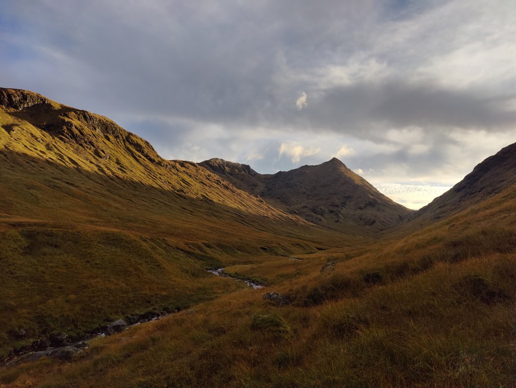
In cold grey clag we set off up Stickle Beck, intending at the least to visit Stickle Tarn, but both of us, I think – though neither of us said it out loud – intending to try for Jack’s Rake. We arrived at the tarn and had a short snack. Some young people were there; the mist was thick and cold. We walked round the side of Stickle Tarn and addressed ourselves to Jack’s Rake. This would be my fourth ascent of Jack’s Rake. I came up here alone, carrying a big bag, in May 1987. I led a party of four up in September 1989, and I brought my son up here in 2014. That took some coaxing and encouragement. I happened to mention to him the principle in scrambling and rock climbing that “hesitate and you’re lost” and he replied that he’d learned that principle from me, on this route.
I write that deliberately, for today, Jack’s Rake was cold and wet and I found it quite difficult – I was “sketched out” as my son might say; in places it was sketchy. Whilst at least the exposure was limited today because of the mist, my fingers, even in gloves, grew very cold. In several places I was stuck for some minutes, hesitating long before committing to upward moves. In wet and greasy conditions underfoot, one wants good handholds. They are generally there on an easy scramble like Jack’s Rake, but in wet gloves I was starting to loose feeling in my fingertips. Loss of handhold would have been catastrophic, whereas slipping and losing a foothold whilst retaining a good handhold, would merely have made my pulse shoot up. We got to the top in good order without really serious difficulty, me going ahead of Nat for my safe-keeping, he herding me up the route whereas on the previous occasion, our roles were reversed. This was fitting. I am not unhappy to say that I have probably gone up Jack’s Rake for the last time. It would have to be a dry summer before I venture back there.
At the top, a short snack, before continuing by compass bearing through cold wind over cloud-strewn brown moor, overblown with rotten snow, down to the top of the Stake Pass. Down the Stake Pass into Mickleden, that most favoured of places, and along the valley of Mickleden in the slowly fading light of a winter afternoon. Even in winter I can’t walk through Mickleden without hearing sheep, without feeling the heat of summer sun on my shoulders. Then, tea for two in the bar of the Old Dungeon Ghyll, before a companionable wander through the gloom across the fields to the car park at the New Dungeon Ghyll. For a short day, a towering achievement. A good scramble, easy fellowship and safe transit over the mountains in poor weather.
After work, in the afternoon, to the shop to buy various bits, and then pack a bag. The rucksack, which had been 13.9kg with equipment less about two kilos of batteries, Kindle, notebook and pens and trail poles, was 22kg on the eve of departure – all up: all clothing, all food, and some water. Heavier than I anticipated, but manageable. Where had that weight crept in from? This was to be my ninth solo backpacking and wild camping adventure. To Cromford then, and by train to London.
Arriving in London I had a bit of time – trains in the UK are just not reliable enough to cut things fine and not leave plenty of time. I was at St Pancras at 19:38 for a 21:15 train out of Euston, up to Scotland. Why was I travelling from the Midlands down to London to go back up to Scotland? Because the alternative was taking the train to Crewe and picking up the sleeper there at midnight. If you’re going to wait for a couple of hours on a draughty railway station platform at night, I don’t recommend Crewe. I did that once; it won’t be happening again. I had a pint and a sausage roll in the Betjeman Arms at St Pancras, then strolled along the Euston Road to join the sleeper to Inverness, the longest train in Britain, and my carriage right at the front of the train.
I slept well enough on the train and had to hurry through my full Scottish breakfast in a paper bag. I found myself on the platform at Newtonmore at 07:15 on a drear and misty morning, barely starting to get light. I dragged on everything I had, to keep warm, and in Goretex over-trousers, gaiters, waterproof jacket, gloves and woolly hat, set off into the pre-dawn gloom. I had in reserve only a thin Rab mid-layer and at that point in the morning wondered if I had come onto the hill ill-clad. I walked out of town up onto the heath; had there been no mist this would have been glorious and scenic. You could tell it was a temperature inversion – there’s a look about the sky when you can sense that radiant blue sky and sunshine are only inches, as it were, above the steel-grey ceiling of mist.
I ascended the Calder River up Glen Banchor, meeting no-one, listening to the fearful noise of stags rutting. This noise reminds me, with my taste in films, of the zombie apocalypse. At one point I needed to take care fording a stream. Late morning, I was approaching a tin hut somewhere round 648984, where the map marks “township” at Dail na Seilg. A stalker strode out to speak with me. We had a polite conversation about my plans, and his plans, and I saw that I needed to change my plans. It suited me to do so, to be fair – it wasn’t simply a matter of me rolling over. That said, this is pure stalker’s country, not at all walker’s country. I followed a tired old land-rover trail and became aware I was going in the wrong direction. I was soon lost and disoriented in the brown upland, stumbling over the heather looking at my compass. It took some close map and compass work to get me onto the right trail, a good and substantial unmade road, which I followed south-west down Strath-an-Eilich.
Early afternoon I came out at Castle Cluny, a nice-looking Scottish Baronial pile in the usual grey granite. Through the delightful autumn colours I trod through the grounds out onto the road. Without a detour, there followed a tiresome 2.5km tramp along the A86, a single track road at this point, but still with a fair amount of traffic. This brought me to Laggan, around about 3pm. From here, another tarmac road tramp of 4.5km brought me to the “Spey Dam”. I had not been aware I was walking up the Spey valley. I met no mountaineers or walkers. At this point, around 4pm, I’d been 7-8km on metalled roads and much of the rest of the distance on good unmade roads. I admit that had I known so much of this route lay along actual roads, I might have chosen differently.
Resting by the dam, I saw a couple of cyclists whizz past. I set off along the road under the dam and arrived at a kind of industrial yard, with piles of rubble and hardcore, and big spotlights ready to be connected to a generator – there’s no mains electricity here, even though this countryside isn’t the ostensible wilderness of the Cairngorms. All around there are very robust and well-maintained deer fences, with proper access for vehicles and pedestrians at the appropriate places. At this point, early though it was, I was looking for a place to camp. I could continue along the unadopted and private metalled road along the north side of the reservoir created by the dam, or I could hike uphill into more wild country further up Glen Markie. I opted for the former. I went through a metal gate, pulling back the bolt. The bolt made a displeasing sound that in the pristine silence of that place, sounded like a lamb being slaughtered. I walked a hundred yards before repenting of my decision and turning back. Such sudden changes of mind have served me well in the past. Being willing and able to change your mind is a virtue, not a vice – don’t let anyone tell you that stubbornness is a virtue.
I detoured uphill into Glen Markie for about an hour, past a wasteland of industrial plantations, until I came across a place where I might camp. I would have to hike back downhill to the reservoir tomorrow morning, but this was more or less where I thought I would end up when planning this trip as a desktop exercise back in June. I camped near the ford of the Allt Tarsuinn Mor, just before it joined the Markie Burn, a substantial river. I had a very cramped and limited pitch, but it had the advantage of being bone-dry heather. I was just below the tributary stream as it flowed down a ravine into the main river. I could hear running water in three different registers: the roaring or rushing of the river, the chuckling of the brook over stones, and the sound of small waterfalls. In spite of the limited pitch, it was supremely comfortable and I took one of the best nights’ sleep for some years, from around 7.30p.m right around until well after 6.30a.m next morning. I had a completely dry strike and was away from camp around 9 o’clock. There was no hurry. In any case, at this time of year in this place, daylight comes late and lingers late. There was little usable daylight much before 7.30a.m.
I hiked back down to the bottom of the glen, and turned right, resuming my route of the afternoon before. There followed 12km along metalled road – a single track road through glorious, empty country – but a metalled road all the same. The adopted part of the road (that is, the part coloured in yellow on an OS map) ended at Garva Bridge. Here there was an ancient bridge of 18th century military origin. Two cyclists whizzed past. I stopped for lunch and sat between the road, the woods and the Spey, under the cathedral of a clear blue sky. Today’s weather was better than yesterday’s. The tarmac gave out at a place called Melgarve – an empty house. At this point, in the heart of the Monadliath, you’re about 16km from the main road at Laggan, and perhaps a little further from Fort Augustus.
Beyond Melgarve, first a very conspicuous “Road Closed” sign, secondly, an actual half barrier blocking the way ahead to vehicles. The road itself continues up into Corrie Yairack, though without benefit of tarmac. This is one of “General Wade’s Military Roads”; to walk this route is why I was here. The afternoon’s walking ahead of me was the crux and heart of my trip.
Corrieyairack Pass
To the chagrin of some, a mighty high-tension power line marches up the valley, into the corrie and up and over the pass. All should have access to electricity. I remember in the 1980’s hitch-hiking in the Lake District and getting a lift from an estate agent. He told me that the Friends of the Lake District – every one of them living in a home with electricity – had opposed the building of power lines over a wild valley, which would have brought electricity to houses that did not at that time have access to power. Ever since then I’ve had little patience with the sort of environmentalist who sits in comfort opposing construction that would being the same comforts to others.
One of General Wade’s original bridges
Near the foot of the pass proper, I met a cyclist, the first outdoorsperson I had spoken to in days. I had seen no walkers, nor even so much as a footprint, along this route. The crux of the pass was six zig-zags, six legs of which were at this time of day (mid-afternoon) walking directly into bright sunshine. I was bareheaded. I had not thought to bring a sun hat, though I did have sunglasses. I blazed up the zig-zags barely out of breath. I’ve had eye trouble this year, and for that reason I chose this route because it was not so physically challenging. I also reflected that I have become successively more physically fit, particularly upper body muscle tone, on each one of these nine solo camping expeditions I have undertaken since 2021. I came off the hill on that first trip and had some unpleasant muscle problems in my shoulder, and had to visit a sports physiotherapist at the cost of several hundred pounds. Since then, on the advice of the physio, I try to do regular upper body strength exercises. Coming down to the Dungeon Ghyll last October, after two hard days on the hill, I was absolutely shattered – and part of me, misses that feeling. Being immensely tired sharpens one’s appetite for the simpler comforts in life –a hot shower, clean clothes, a Nice Hot Cup of Tea, a pint of beer and a pie, a warm bed.
At the top, a squalid guard-house stood, with an open door and bunks visible inside. In the long and golden afternoon I followed the path down towards Fort Augustus. I passed a 4WD vehicle with three fellows in it clearly observing deer. Another thing I noticed which I found unusual, was overflight by a small fixed-wing aircraft – repeated overflight, three or four times. Helicopters would be unremarkable, but a light aircraft, I found unusual: this is wild country. It was certainly not a sight-seeing flight. Far more interesting and dramatic mountains are available within a few minutes flight time for even a light aircraft. My best guess, looking at the heading and direction it was taking, was that some form of commercial survey was taking place, probably of the power lines in the valley.
It was my intent to camp at a place called Lagan-a-bhainne, a wooded area of small valleys about 12km out from Fort Augustus. Still in the wilds, but off the high moors. When planning the trip I had spotted the area and thought it looked like a likely spot for a wild camp. My eye as someone with some experience in map-reading, was drawn to it. As on the map, so the reality on the ground: it was indeed a quite magical area where a narrow wooded valley cuts through the high moors. I found a spot to camp, taking quite some care that my tent could not be seen from the dirt road: it seemed to me that the three men I’d seen earlier would be employees of the landowner, and they might be driving through later on. Unlike in England, it is still perfectly legal to camp wild in Scotland, but why draw attention to yourself?
This was my second night by a babbling brook. I find the sound thereof, very restful. For supper I had my usual Indian: a spicy red lentil dhal, chick pea flour pancakes, and fresh spinach, all washed down with about 200ml of rather nice Shiraz. I always say, wild camping does not mean roughing it. Wild camping – any camping for that matter – is not, for me, a means to an end (as in merely low cost accommodation close to the mountain), but an end in itself. It is time spent alone outdoors, time spent in the wild countryside, time to collect your thoughts and prayers, time to be still. I came away carrying probably 22kg, of which 3kg was food and drink. I was not troubled thereby.
Interestingly, though I had picked a reasonably flat place to pitch, I could not settle comfortably at all – there was incipient backache, tossing and turning whichever way I lay. I moved through 180 degrees and slept like a baby. I woke up around 0600, which is too early at this time of year and latitude – there being another ninety minutes of darkness. But I was awake. I got up and prepared for my day. I had a breakfast of champions – cubes of bread, cubes of cheese, and chorizo sausage, all fried in a little olive oil and butter. Porridge of course. Black coffee. I did not have a dry strike, but it was a lovely morning and there was no rain – it was all condensation. I am using three separate dry bags for the different components of my tent – outer, inner and “footprint” (ground sheet), and this technique is a useful convenience, making the tent easier to pack in my rucksack, and ensuring that the wettest bit (generally the outer) doesn’t get the drier bits wet during the day.
Around 0800 then, onwards through the grey morning, trending ever downhill on a good road across the moor. After an hour or so, Loch Ness and Fort Augustus came into sight, and my heart fell – was it so close? I didn’t want to arrive there mid-morning. Actually the route has not so much a sting in the tail, as the walk-out is longer than it looks on the ground. On the map it was 12km; it just didn’t look that far. On my way down I passed an estate 4WD rumbling uphill, and a cyclist labouring along. It is a long and seemingly everlasting hill from the Fort Augustus side – rather like climbing Helvellyn from the Thirlmere side.
The road came down to another area of confused drumlins and narrow valleys full of trees, all very picturesque and rather reminiscent of the western Peak District. The road splits round a height of 228m at around 371055. General Wade went left; on a whim, I went to the right, along a 4WD road clearly very overgrown and ill-used. Well, not quite on a whim – a study of the map seemed to indicate that there was a way through some rather promising wild woods. I made the right decision! On the mountain, as 1930’s Scots climber W.H Murray noted, it sometimes pays to turn aside commonsense routine.
My path led down a long-abandoned un-made road by the side of the stream, down into the most magical valley, a beautiful and silent dell, peopled only by the sound of the rushing waters of the stream. This was the highlight of the trip! I had to carefully ford the stream. I continued, in a little trepidation that should have to turn back at the last. And indeed, the track to Culachy House was gated and very clearly marked “PRIVATE”. But there was another way – a hairpin to the right, down into another deep valley where I found, by chance as it were, the most beautiful waterfall: Culachy Falls.
From the falls a pleasant walk along a path through the woods, across the road and into a graveyard by the river. A little further on, the main road, and my walk was done.
Day 1: From Newtonmore to Glen Markie, 25km in 8 hrs 33 mins
Day 2: From Glen Markie to Lagan-a-bhainne, 27km in 8 hrs 7 mins
Day 3: From Lagan-a-bhainne to Fort Augustus, 12.3km in 3 hrs 28 mins.
I stayed at Morag’s Lodge in Fort Augustus, a former hotel now trading as a hostel. For a modest fee you can share an ensuite room with bunks. For slightly more money but still well below B&B prices, you can buy an entire room to yourself. Morag’s Lodge serve supper and packed lunches and a continental breakfast, and they have a drinks license. There’s a members’ kitchen as well as a proper bar, so it has the best of both worlds. The staff were super friendly and helpful.
The first time I came to Fort Augustus was in May 2012. I’d camped wild the night before further north in the Monadliath. My diary of the time records the following:
Yesterday I drove west from Aberdeen, in wonderful hot mid-20’s weather, enjoying the quiet roads and rolling wooded hills of Deeside. I pressed on over Lecht to Tomintoul through the summer afternoon to Nethy Bridge. Then over Slochd and left down minor roads towards Fort Augustus, at this point looking for somewhere to camp. I turned left again, up a minor side road, going right up over the top into the heart of a dark and wild corner of the Monadliath. The sun was behind me as I drove, and it was glorious. I found a place to camp amidst sufficient dry fallen timber for a jamboree of Scouts to make open fires. I camped in a little copse of pine above the road. It was 9.20pm and full daylight. Sunset at this latitude in late May is 9.45pm. There was sufficient wood from where I sat to make a lovely little fire, on which I prepared sirloin steak (medium) and courgettes and (alas) instant mashed potatoes. A nice S.E Australian Shiraz made it the pleasanter still. I had brought with me 2 litres of water, for there was no running water here – I could not have camped had I not brought water in myself. A couple of times, an estate factor’s landrover drove past and stopped. My fire was making a fair bit of smoke; there was no wind and the smell was unmistakable. They could not see me, and perhaps they cared less, for they did not come looking for me. I went to bed at 11p.m and woke at 5a.m, thence dreaming my way through to 7a.m. Morning was misty, yet dry. No single drop of dew fell, which was remarkable. My breakfast was bacon, mushrooms, tomato, roll and butter, served with fresh black coffee. A breakfast of champions, particularly when served outside.
What struck me most about this camp was the silence. The only noises were the calls of birds, particularly the call of cuckoos, and the sound of sheep. I set off at 8.30a.m in deep mist, back to the Great Glen, and on down to Fort Augustus, where the sun burnt the mist off, leaving a cloudless sky, a glorious summer day. I took coffee and cake at “The Scots Kitchen” in Fort Augustus, and read the paper. Could I ask for more?
An important part of this journey today was the adventure of doing it solely using public transport. I took bus Scottish CityLink bus 919 down Loch Lochy through Spean Bridge and onto Fort William. Once in Fort William I then had to wait a couple of hours for the sleeper train to London, which left on time and arrived more or less on time at Euston at 0800 the next morning. Thence along the Euston Road again and back into St Pancras station, where it was so early, there were no decent coffee shops open yet, and I had to get a coffee from Costa. Onwards home to Derby, and my trip was complete.
Let us start from Queen Anne’s Gate in the heart of Westminster. Go through one of two entrances onto Birdcage Walk, cross the road into St Jame’s Park, and then take a route diagonally through the park. Keep the lake on your left, and skirt round the tourists of every tribe and nation – it is nearly always very busy here. As you come round the head of the lake, cross over the road and take a diagonal path across the miniature gravel plain that is Horse Guards Parade. Whenever I cross here, I am reminded of an old picture of Winston Churchill as a young politician crossing Horse Guards in company with Sir Edward Grey, on the eve of the Great War. The building on the left as you cross, the one with the aerials and wires on top, is the Old Admiralty Building. It resembles – as well it might – Britannia Royal Naval College at Dartmouth.
Go through the arches onto Whitehall, turning left towards Trafalgar Square. This the place where the two mounted sentries are often photographed by tourists. As you come onto Whitehall, you can see Nelson’s Column in the distance. Going up Whitehall away from Westminster, on the right there is a pub called “The Clarence” which I highly recommend. My wife and a friend of hers went in here some years back, on a trip to see the Queen, and they had no food left except for some Scotch Eggs, but this they served most graciously and cheerfully. She was impressed with the service. I’ve quite literally gone out of my way to eat there ever since – eaten there with my wife at least twice, with colleagues from work, and on my own. They have some great upstairs rooms which aren’t always as busy as the main room downstairs.
Cross Trafalgar Square – generally best done by going to the right, from Whitehall, crossing the entrance to the Strand. Science-fiction author Stephen Baxter wrote a novel about the flooding of London, and his tip, if central London is flooding, is get above the Strand. The clue, as he notes in his book “Flood”, is in the name…
Keeping St Martins-in-the-Fields on your right, the National Gallery will be on your left. At this point, Charing Cross Road dog-legs to the left; if you wish you can follow it to Cambridge Circus, and then turn right along Shaftesbury Street. But the more direct route is to turn slightly to the right and then straight on, along St Martins Lane though Covent Garden. It’s a very relaxing walk along a reasonably quiet road traffic-wise, passing different pubs and restaurants. What you will see, is two unusual and complex road junctions. Inner city five-road junctions are fairly common in the UK. But six-way junctions in the inner city – three crossing roads – not so much. And seven roads, as at “Seven Dials” – very much rarer still. One comes out on Shaftesbury Avenue just near the Forbidden Planet store. Along here is a little café called “Franx” which I like to stop at sometimes.
Continue along a pedestrianised section of Shaftesbury Avenue a hundred yards or so and you find yourself on New Oxford Street – the A40 in fact. Take a right along here, and then a slight left onto Bloomsbury Way, with the main flow of traffic, leaving New Oxford Street behind. At this point the streets are broadly NW/SE and NE/SW. The British Museum is about two blocks away on the left. Continuing along Bloomsbury Way, you will see on the right the Swedenborg Institute”, a modest building devoted to the writings of the philosopher Emmanuel Swedenborg. Further along, on the left, a park – Bloomsbury Gardens. On the right, at the junction with Southampton Row, you’ll see Sicilian Avenue, a delightful pedestrianised interlude of Italianate cafes and shops, under repair in these times, but well worth a visit if you’re in the area.
One thing you will notice on a long walk across London, is the changing architectural styles and the changing atmosphere. Once in Southampton Row, you’re no longer in West London. Really, even though we’ve still to cross the Euston Road, we’re in North London. Here there are shops and restaurants, little dentists and minor medical institutes, and as we approach the station district, a number of slab-sided hotels of differing age and architectural merit. Passing Russell Square on your left (and the tube station on a minor side-street on the right), Southampton Row becomes Woburn Place and then, Tavistock Square. In this quarter, we start to see various hospitals and big, important institutes. You will pass, for example, the headquarters of the British Medical Association. The road continues, and intersects with Euston Road adjacent to the St Pancras New Church, a Regency-style church which I still have not visited. At this point, the depressing 1960’s heap that is Euston station, is on your left across the very busy Euston Road. It’s not widely understood that Euston, St Pancras and Kings Cross are all within half a mile of each other.
But we will take a step backward here. If you turn right off Southampton Row near Russell Square, you can find Coram Fields, a rather lovely inner-city park. This is a university quarter too – the streets are full of students from all over the world. Some of them go for lunch, at a branch of King of Falafel on Tavistock Place, where it crosses Hunter Street and Judd Street. I found this quite by chance one day when wandering through this great city. Here is another great place to just sit at a café at a road junction and watch the world go by, some on foot, some, on their bikes. I was sat here once when the bin men arrived, and I watched the proprietor put together a bag of samosas for the bin men, and give it to them with a smile. Heart-warming: another place I will literally go out of my way to visit.
Let’s go back to Euston Road. Euston Road is part of a great E-W arteries across the centre of London, stretching from Shoreditch in the east, curving north-west to the Angel, Islington (which we will cover later in another London Walk), west to Kings Cross, then south-west to Regents Park, Marylebone and Paddington before it becomes the Westway. It is always a busy road, an artery pulsing with the blood of the city, the hustle and bustle of people hurrying from one place to another. Crossing the road with care, you can then see the British Library – that building that King Charles once called a “monstrous carbuncle”. Personally I don’t agree. The Barbican, or perhaps Euston station – now they are “monstrous carbuncles”.
Next door is the still-magnificent St Pancras Hotel, now beautifully restored and consequently too expensive for most of us to stay at. Outside, on the station forecourt, you will see a purple sports car easily worth hundreds of thousands of pounds. I wonder that the hotel keep it here purely as a tourist attraction. I’ve no idea what sort it is. People take photographs of it, but I take Shania Twain’s view – “OK – so you’ve got a car.”
Carry on up the slope to the far entrance to the station. Going in this entrance rather than coming into the undercroft where all the shops are, you can catch the full glory of St Pancras, to my mind one of the most dramatic and startling railway stations in Europe. When it was built, it was the biggest single arch iron-spanned roof in the world. It is still eye-catching, painted today in a pleasant sky blue. As someone who remembers St Pancras in the dark days of the 1990’s, the Eurostar terminal it is a vast improvement on what it was. In front of you, there will be three or four Eurostar trains. On the right, the Betjeman Arms: maybe time for a refreshing pint after our walk.
At 5pm, to the station at Cromford. I took train through to Derby through the sunny late afternoon. At Derby I adjusted the straps of my new rucksack to what I hoped would be a satisfactory arrangement. I bought a bottle of London Pride from a shop across the road from the station. Through to London in first class, a most pleasant experience for which I paid about £30. I could have picked up the sleeper at Crewe: I have done this before. But then it would have been necessary to wait on Crewe station for nearly two hours til almost midnight. Even on a warm summer evening, that’s not a sensible way to spend time. I walked the few hundred yards through to Euston station, walking behind the British Library, before joining the Caledonian sleeper a little after 8.30p.m. I ordered a full breakfast for £10- life is too short!
I slept fitfully, as I generally do on the sleeper train, but I know I did sleep, for I dreamed. I recommend the use of the Caledonian sleeper. If you can stand the narrow bed and cramped conditions, it is in my view, a cost-effective way to travel to Scotland. I got off at Dalwhinnie, after my full breakfast, into thick, grey morning mist. The train rumbled off towards Inverness, its red taillight disappearing into the mist. All was quiet. The time was 0655. One man got off ahead of me and walked away ahead of me.
I started off on the long walk-in, which begins with a detour along the main road as a key level crossing is closed. It is a long and tedious walk-in along a good and reasonably flat unmade road on the west bank of the reservoir, the enormous Loch Ericht, a loch so long that I could see the horizon at the other end of it. From Dalwhinnie station to Ben Alder Lodge, where the route leaves the road, about 12km. I was consciously and deliberately trying to keep my pace down, albeit with only limited success. I’ve seen and experienced in the past, the effects of walking too fast, too soon. But the slowest I could manage along the flat was about 13 minutes per kilometre. After Ben Alder Lodge the path trends to the right and uphill, through woods onto the open moor. At this point I found myself ahead of the gentleman I’d followed along the lake shore. The path arrows up into the brown hills; it was so very, very dry. Every small stream I crossed was dry; every drain and ditch, just full of dust. I wondered if there was any water at all in these hills. I was glad to arrive at a big stream, which ran clear and fresh, though somewhat depleted. The stream led up to Culra.
I arrived there at around 11a.m, as I’d predicted when planning this trip as a desktop exercise during the winter months. 17km in four hours. At Culra there is Culra Lodge (a wooden hunting lodge, locked down, with a wind turbine), a bothy (closed due to asbestos), and about half a dozen tents pitched. I added my own tent and sat outside for a leisurely lunch. The older man I’d seen earlier, who I’d burned off on the climb up to Culra, arrived and we had a brief chat. His destination, as was mine, was Corrour.
Looking up towards Culra, with The Lancet in the background
After lunch I pulled together what kit I needed for hillwalking and stuffed it into my now almost empty rucksack. What did I carry? Sunglasses, sunhat, warm jacket, spare long trousers (I was in shorts), first aid kit, food and water, map and compass, walking poles. What did I leave behind? Tent, stove, fuel, sleeping bag and mat, more food, my Kindle and notebook and power banks. After judicious use of suntan lotion, I set off over the brown moor, under a cloudless sky. Up and over the moor, as dry as any I have ever seen, rising into a small glen containing not a high mountain tarn, but a substantial ribbon lake, Loch a Blealaich Bailthe. The atmosphere was magical as the path led round the lake, with the massif of Ben Alder on the far side. I met a young man and woman, mountain cyclists who had cycled over Ben Alder. This hill is so remote that to climb it in a single day trip without the use of a mountain bike is quite tricky, even in summer. Not long after that I stopped for a while for a second lunch and bathe my feet in the loch. To wash your feet in such water as this, on such a day as this, is to wash away tiredness and pain, to sooth away discomfort and ache.
I continued up to the col – Bealach Breabag – and then on upwards to the right under hot sunshine. It was sleep but perfectly manageable. As I climbed, I encountered a party of five older men coming down, so I knew I was on the right track. Straightforward enough, in this weather, to continue upwards and onwards to the summit of Ben Alder, a most remote mountain.
Looking down to Loch a Blealaich Bailthe from Ben Alder. In the far distance, Loch Ericht.
Not long after point 1081, I made a grave mistake. Treading north in the afternoon sunshine, I could see the sharp ridge of the Short Leachas ahead of me. There was no descent possible this side of it; the Harvey’s maps (1:40k and 1:25k) I had on me did not reveal a usable descent on the other side of it. Yet, descent there must be – to this day I do not know where. Possibly it goes directly down the Long Leachas ridge. I opted instead to swing to the left and downhill, aiming for the valley of a stream unnamed on the Harvey’s map, along which no cliffs were marked. There being no signal, my phone would not resolve to the 1:25k OS map, so all I had was the 1:50k which showed this. After the fact, a close reading of even this low scale map does reveal that this is a hanging valley and that therefore there are likely to be cliffs. I should have known better. The sun was bright, the phone screen was hard to see, and I didn’t see what I ought to have seen. To say nothing of the word ”waterfall” which was warning enough!
This screenshot from the 1:25k map illustrates what a hanging valley looks like on a map
This photo is looking more or less SSE from the path, at the very top of this map image
I descended on the right, keeping in the sunshine, until I could go no further as cliffs impeded further downhill progress. I put away my trail poles as doing more harm than good in a very steep and rocky place. Then I crossed over to the left-hand side, taking the opportunity to drink from the stream, and continued downhill again before my path was blocked by gently sloping slabs as the hanging valley opened onto the main valley. I was almost down and safe – but not quite. With great care and considerable difficulty, I made my way back to the stream, descending all the while, and crossed over again. Most of the time I was descending sat down, but twice on that return to the stream I had to resort to descending face-in, and down-climb. I do not think I could have gone back up: whatever I was doing, at this late stage I was committed to going all the way down. I should have turned back earlier, but I didn’t. As I scrambled out of the gorge on the right bank again, I saw a huge deer run down to the water and disappear behind a fold of the land. It emerged seconds later barely yards from me, belting down the hillside in a panic of fear. I shudder to think of my fate had it collided with me.
In all of this descent I was never actually frightened; I was well aware that I could ill-afford to allow vertigo, or fear of getting stuck, to get the upper hand. That said, my pulse was up to 156 and I don’t think that was down to exertion, as I was going downhill. I was lucky with the weather, and I was lucky with the time of year – whatever I did, I had plenty of time. I had food, water and probably 4 hours of useful daylight to play with. From where I’m stood now I got out of that situation not only by luck, fitness and mountaincraft, but by the sheer grace of God.
In due course, therefore, through great care in route selection and discerning choice of foot placement, I made that perilous descent successfully and safely and found myself on the valley floor. There followed a 3-4km tramp through the mid-afternoon sunshine, down the valley to my tent at Culra.
My supper was taken outside my tent, sat by the stream in the warm sunny evening. I started with that Englishman’s staple, a Nice Hot Cup of Tea. After a break I followed that with fresh tortellini with an admixture of fried chorizo sausage, washed down by some red wine, and followed by hot chocolate. It was a warm night, and very tired, I slept like a top, turning in not long after 2130.
I was away by 0700 the next morning. I have divided my tent up into three separate dry bags. This makes it easier to pack and easier to keep important parts of it dry. The inner tent, the flysheet, and the groundsheet and pegs are all in separate bags. That was unnecessary this morning after a completely dry strike – there was not a hint of dew. My path led back up the same route I had came down the previous afternoon, but as the Bible and the well-known hymn remind us, “morning by morning new mercies I see” – this morning, with the sun from a different direction, this was a different place, an absolute paradise. A stream wandered down the brown valley, babbling past rowan trees and chuckling to itself as it ran over boulders. Glad I was indeed, to be permitted to be in such a place as this, on such a bright morn. I passed the scene of my adventure the previous afternoon, appearing this morning as grievous shadowed slash on the hillside, and continued upwards to the Bealach Dubh – black pass. I was entirely alone, at this early hour.
Looking up towards The Lancet
Carrying only a litre of water, augmented in my pack-up by several small oranges and a bag of small tomatoes, I set off up the hillside from the Bealach, conscious that I might not see running water again til late afternoon. There was no cloud in the sky; it was barely 0900. Not far up the hillside I did in fact find the very tiniest little streamlet, a mere dribble running clear and cold. Not something one would normally touch, and certainly never in the Lake District with its ubiquitous livestock. I filled my spare water bottle – another litre – added a purifying tab and marked the bottle so I knew which of the two bottles was which. In the end, I never needed it. It was just there in case. My path led up a shoulder of green grass and grey stones, never steep enough to climb with feet and hands, but rocky enough to make trail poles a liability at times. Geal Charn (1132m) was a dun hill, a huge, rounded plateau, a rolling summit of brown grass. As with some of the landscapes on Ben Macdui, it is reminiscent of parts of the Dark Peak – but this is 1100m above sea level. It’s NOT the Dark Peak. From Geal Charn, easy and gentle hillwalking continues, up and down, over Aonach Beag (1116m) and Beinn Eibheinn (1102m). I rather suspect that the ups and downs I found easy, even carrying nearly 20kg, because I’m very fit. There were no clouds, little wind, and no shelter from the sun. In these conditions, a sun hat and sunglasses are PPE, not an optional extra. I met around ten people at various points on this hike, all going in the opposite direction to me.
View from Aonach Beag towards Beinn EibheinnBeinn EibheinnLoch Ossian
From Beinn Eibheinn, down to Meall Glas Choire, crossing a rather strange dry gap at 730436. As someone trained in geology I wondered at its formation. It resembled the Chalamain Gap in the Cairngorms, though on a much less grand scale. It is a strange thing to see, at such a high altitude, boulders rounded by some primordial torrent, in what was clearly a dry riverbed. I suspect that at some point at the end of the ice age, the retreat of a glacier has caused some temporary glacial lake to burst its banks, and a torrent like unto Niagara, has carved through this hillside. This kind of thing happens in the Himalaya even today.
Onwards down the brown grass to a rocky knoll, Creagan na Craibhe, and thence down through troublesome and difficult heather to the stream. This trackless ground was bone-dry and in a normal May would have been difficult, squelchy terrain. The stream was actually a substantial river and was called Uisge Labhair – “the waters spoke” or such. See that Gaelic word “Uisge”? After you try pronouncing it, it will become more familiar.
And there I stayed, dear reader. I washed my feet in the waters of that noble river, and made my camp nearby, near the place on the map called Lub Mholach. This was the finest camp I have made in many a long year. It was a magical garden spot. I bathed in the river, dried off and had my supper. Red Lentil Dhal, Farinata, Red wine. Though there was no mountain to the west like last night, to provide shelter from the evening sunshine, I was tired enough and retreated to my sleeping bag around 2100, before the sun had even set. I was very cold that night. I had wondered before the trip if I should invest in a lighter weight summer sleeping bag, but my experiences this night, tell me to stick with the three-season down bag and silk liner even in a warm Scottish May
Next morning I was awake bright and early and out of bed and breakfasting before 0600. A breakfast of champions: porridge (with Grouse and chocolate in it), black coffee with sugar, and fried bread and fried chorizo with melted cheese. My feet, which had been sore in the late afternoon, felt a little better after a night’s rest and some Paracetamol. I packed up and was away before 0700, to hike something like 10km through to Corrour station, arriving there just after 0900.
Loch OssianLoch Ossian, looking back up from near Corrour
A delightful hike through the woods along the shores of Loch Ossian. Arriving at Corrour station, in the brown emptiness, under the endless blue sky, I was dismayed to find the cafe shut, but that couldn’t be helped. I had enough food left to make a cup of hot chocolate, and a cheese and egg sandwich, whilst I waited, in company with others, for the train.
Corrour station house
By train two hours down the line to Arrochar and Tarbet. I had a “credit” for an unused night in the Tarbet Hotel on Loch Lomondside, and I made use of it to stay here tonight. Once checked in, I enjoyed several cups of tea and a long shower, before descending to the bar without boots on, to sit and enjoy a pint and a pub supper after another successful hiking adventure.
The next day, I took train from Arrochar and Tarbet to Glasgow Queen Street. I walked the few hundred yards to Central Station and took a Pendelino to Preston, then another one to Crewe. I had a “Standard Premium” ticket which was effectively first class without the catering. I thought it was good value at £130 for a four-hour train ride. At Crewe, a seamless change into a smaller and less salubrious train bound for Newark, which encountered technical problems – the first problems on this complex return train journey – which meant that I missed my connection at Derby. Hey-ho – I got home an hour later. Sat in the train at Blythe Bridge, waiting for the fault to be found, I remember a similar experience as a boy in the early 1970’s on our way back from Blackpool, when a Crewe-Newark train we were in broke down somewhere along there. On that occasion we had to wait a lot longer than an hour. The trains? Cromford to Derby (£8), Derby to London in first class (£32), London to Dalwhinnie in the sleeper (£255), Corrour-Glasgow (£35), Glasgow to Crewe in standard premium, (£133), and Crewe to Cromford (£20). The journey I made could not have been easily accomplished at all without public transport, and I deemed it good value for money.
Geek stuff – gram counting and costs
My rucksack, an Osprey Aether Pro 75, weighed around 14.5kg without food and water. The Aether Pro 75 is probably the lightest serious expedition rucksack on the market in the UK, weighing a truly astonishing 2.1kg empty. Here’s a table of the weight of some of my kit:
Kit item
Rucsac weight
MSR Elixir 2 tent and pegs stored in dry bags, poles
2805
Aether Pro 75 rucksack
2100
Skyehigh 700 sleeping bag with compression drybag, cotton bag and silk liner in its bag
1300
Trangia 27 with matches, striker etc
840
Lhotse raincoat
580
Spare clothes (socks, underwear, T-shirt)
550
First aid kit
460
Trangia fuel (ethanol) with bottle
412
Thermarest mat
380
Mountaineering trousers
365
Notebook with pens
260
Goretex overtrousers
238
Goretex gaiters
231
Merino wool leggings (winter only)
200
Kindle
187
2 x Powerbanks
362
Merino wool hat
175
plate, cup and spork
170
sun hat
133
Black Diamond headtorch w/batteries
120
Mittens winter only
120
Garmin Inreach Mini 2 with karabiner
114
Thick gloves
107
Aftermarket rain hood for rucsac
104
Ledlenser lantern with cable and battery (winter only)
I’m off on my adventures again, fitter, more experienced, and with a better packed rucksack and better equipment, than when I started doing this in the autumn of 2020. This is my fifth consecutive Autumn solo backpacking trip.
First, a trip from my home in the Midlands, to the Lake District, using only public transport. A flawless train journey; change at Sheffield and Manchester. At Sheffield, cloudless skies and sunshine. Barely ten miles later, emerging from Totley Tunnel into the Peak District, it’s grey cloud and drizzle all round. At Manchester, I changed into a shiny new “Transpennine Express” train going to Glasgow. I had thought that the very useful direct trains between Manchester and Glasgow were one of the many good things that had disappeared when the railways were privatised thirty years ago.
At Penrith, I stood sheltering from the drizzle waiting for the bus to Keswick. Here’s a father and his daughter travelling to the Lakes for half-term. Here’s a young English fisherman and his Eastern European female partner, with so much luggage you’d think they were actually moving to the Lake District. Here’s a bearded Italian traveller playing some kind of woodwind instrument, and here are five nervous-looking youths, Hasidic Jews wearing yarmulks, travelling to Scales near Threlkeld. A Monday on a bus in an English country town.
At Keswick, I stepped off the bus into light rain. I had planned to go by bus through to Braithwaite, but I needed to stretch my legs and warm up a bit so I thought I’d walk. I walked along a familiar route, past the Pencil Museum, across the muddy wet fields to a suspension bridge, and on to Portinscale. I first came this way in the late 1970’s. The path was flooded out completely – this Autumn the Lakes are very wet. At Portinscale I saw one of those micro-vans selling cakes and coffee. The young man running the stall had a little hand-written sign: “Mince pies £4. Free glass of mulled wine”. You can hardly ignore an offer like that…I had a chat with the fellow while I toasted my forthcoming adventure in mulled wine, and then moved on.
I followed a muddy path through the fields, cutting off a bend in the road, and still arrived at Braithwaite before 2pm, over an hour earlier than I’d planned. I’ve been coming to Braithwaite for over forty years, though I don’t think I’ve ever been here in fine summer weather. To me it’s a cold weather kind of place. I continued onwards and upwards towards Force Crag Mine, walking slowly. A temptation for the amateur athlete is to go too fast, too soon – and here, not only was there no hurry, but there was nowhere to camp except in a location barely two hours walk from here. At the mine, there is a turn-off to the left that crosses the stream and then curves around the hillside up to a distant cloud-shrouded col. There was a ford, and it was by no means passable, certainly not when walking alone with an 18kg rucksack. That was unlooked for. It was not in the risk assessment. I wasn’t expecting that. To have difficulty fording streams – in the Cairngorms, yes, one expects that. In the Lakes, even in October, not so much. It is very wet this year.
I continued up the right bank of the stream, through stones and rubble, through mud and marsh, through the outflows of strange settling tanks relating to the long-closed Force Crag Mine. I walked past the whole mine workings looking for a safe place to cross. At one point I found myself on very loose and spongy vegetation, quite possibly grown over a bog or an actual pond. Potentially lethal! I made a swift retreat. Force Crag Mine was a barytes, lead and zinc mine until less than forty years ago. It is in a beautiful location at the head of Coledale, with the dramatic Force Crag behind it. Eventually I managed to cross the stream, and had to bound uphill over steep heather to regain the path. Onwards up to the col and in no time at all I found myself a reasonably flat if not dry place to pitch my tent in the area above Force Crag. An eldritch, wild location, particularly as darkness fell. I made a good camp, had a good supper of fresh tortellini and red wine, and slept very well.
My camp above Force Crag
29/10/24
I was away from camp by 0745. It has taken me around an hour and fifty minutes from the decision to get up, to actually starting my hike timer. Unfortunately I had a wet strike – my tent was wet with dew and mist. My new Ledlenser lantern was superb, a revelation in kit. Light, small, and very bright. I walked first up through the clag to the windswept Coledale Hause – no real camping there; no water, no shelter. From Coledale Hause, to the left and south, up a broad valley to a crossroads (or crosspaths) at a gentle col. Here, turn right and uphill to Grasmoor, a tall hill (853m) whose rocky edges, such as they are, are away on the north side. Descending from Grasmoor, in thick mist, I had to resort to the compass and micro-navigation. This underlined an important principle of mountaincraft – trust the compass and not your inclination. (This does presume that you do know how to use a compass properly.) I counted paces and found where I needed to go. I would have liked to make greater use of my polythene 1:40k map from Harveys, but my path lay off the western edge of this map, and to be honest a 1:40000 map is neither use nor ornament for close navigation on foot.
The path goes south and down the ridge called Lad Hows. At the start of the descent I happened to look round; as the clouds were thinning and sunshine was trying to peep through, I saw a remarkable sight. I saw a rainbow almost full circle, surrounding the mountaintop. I struggled to get my camera out in time; by the time I had it ready, the effect had almost disappeared. Further down, I saw a red grouse in silhouette against the cloud. It flew off. I pressed on downwards, eventually coming down below the cloud deck and seeing Crummock Water far below. I could see Loweswater, and also a distant band of light indicating that the weather was not quite as bad at the coast as it was here in the mountains. At the ford by the road I met the first of many half-term holidaymakers.
Descending to Crummock Water
Along the road for a few hundred yards, then left onto a parallel track. I was passed by two running ladies. This path was not on the map. The Ordnance Survey maps, whether 1:50000 or 1:25000, are wholly inaccurate and inadequate at this location. My route took me – this was not on the map at all – along a good path down the side of a woods (High Woods) to a stile where one enters those woods. Here I was passed again by the same two running ladies, this time going in the opposite direction. Clearly there was some kind of loop path not on the OS map. Interesting to see that the open-source maps available on the Ordnance Survey phone app, did have these paths. Onwards through some magical woods, past a boathouse. I met quite a few people and various dogs. The path led to the outflow of the lake, which is a modest dam – more of a weir, really – into which fish ladders have been built. On the other side of the dam, on a silvery grey beach, I found a place to sit for an early lunch. It was a little after 11a.m. I needed to charge my Garmin watch, which suffers serious power drain when recording a hike.
Looking up Crummock Water towards Rannerdale Knotts, the prominent mountain
I had the usual lunch: hard-boiled egg, chorizo, cheese, butter, tomato, and some pitta bread. Pitta bread was not a success when cold. Also, mini oranges and trail mix – raisins and chocolate and my own chocolate covered date/nut/seed fingers. A lot of holidaymakers passed me with a succession of labradors. Most of these were leashed or reasonably polite but one of them had to be physically restrained – actually man-handled – to keep it from sticking its nose in my bag of food. The owner’s very apologetic teenage grand-daughter, in charge of the dog (which was off-leash) was not strong enough to control it, and she was horrified by its behaviour. To those who might say that I presented temptation to the dog by having a food bag out, I say the same thing as I said to the dog…
After lunch, the path led quite literally along the water’s edge, past a pretty “pump house” (why are municipal water works in the UK almost always architecturally admirable?), and then away from the lakeside up over a hillside. I passed two black horses. Up through some more delightful woods – this was your Green Wood and Flass Wood, above High Park and Low Park farms – round the shoulder of White Crag. The path curved around to the left and south and on into Mosedale. Here in Mosedale I consciously and deliberately put in the pace, faced with the conviction that I was running late. The route up Mosedale is along a good un-made road. Later, the road ends and the path curves right and to the east, over boggy wet ground, towards Floutern Tarn.
Floutern Tarn was in the clouds, shrouded in mist and clag, and I was tired. At a rough col above the tarn, there was a straight fence marching up the mountainside. Where man can put a fence, I can walk. Oddly there was no path on the OS map, yet, today’s route, made months ago using the “snap to path” functionality in the OS mapping software, goes vaulting right up this mountainside – Steel Brow. On the ground, there was in fact a rough path. It was very, very steep and very nasty. But I am very fit and I made it to the top, albeit slowly. At the top, more marshy ground. One follows the fence more or less due SE to the summit of Great Borne, and from there, across more brown moorland over Starling Dodd and Little Dodd. At this point I was growing concerned about my timekeeping. About 2pm, I met the only other mountaineer I saw all day, a South African fellow hiking back along to Great Borne, heading for Ennerdale YHA. We agreed that I should struggle to reach Black Sail by nightfall, given that I had yet to even start along the Red Pike ridge. I thought I might even struggle to reach the Scarth Gap, and find myself benighted on the ridge. This wasn’t likely, but I was tired, and it was a grey and gloomy afternoon.
As I continued, in a patch of wet, boggy ground, I lost the path. Looking at the map, I saw that by going along the contour (level) for perhaps half a kilometre, I should reach the descent path from Red Pike down into Ennerdale. I decided instantly to get off the hill: always know when to cut your losses. Solo backpacking in late October, my natural inclination to “glass half empty” becomes mere common prudence and good mountaincraft. Counting paces, I did just that – trod level along the contour for something like 600 paces, and without difficulty, encountered the downward path. It’s worth noting that this was a combination of micro-navigation (counting paces and a close understanding of the map) with full knowledge of my location from satellite positioning. It would not have been possible without a smartphone.
As I came below the cloud deck and saw Ennerdale below, I glanced at my watch and saw that the power was almost out. I stopped the hike timer on the spot: I had been on the hill for 7 hrs and 52 minutes. Down through a broad firebreak, a rather beautiful grove of autumn coloured deciduous trees. Ennerdale, though ostensibly the wildest of all the main Lakeland valleys, has good roads, contrary to popular understanding. It’s just that these roads are private, unmade, and reserved for forestry.
Descent into Ennerdale, dusk
I arrived at the road around 4pm. All I had to do now was peg it uphill along the forest road towards Black Sail, looking for a campsite. I had no chance of reaching Black Sail in daylight. Black Sail was over 5km away uphill, and in these gloomy conditions, at best an hour of daylight remaining. I had to work out afterwards at home where I actually camped. I needed two things: 1) running water within a few hundred feet 2) flat ground in which to pitch my tent. Running water was super-abundant; the road crossed streams every few hundred yards. Appropriate flat ground capable of supporting a tent peg – not so much. As I hiked, three or four people passed me hiking downhill with no packs, clearly on an afternoon stroll out of Ennerdale YHA. As time wore on and the light faded, and as I grew tireder, my criteria for a pitch grew less discerning. When I eventually chose a spot, it was getting on for 6pm and almost completely dark. I needed to use a torch to pitch my tent. I pitched it outer first. Whilst it was not actually raining, I was effectively in the clouds and the air was full of light drizzle. All parts of my tent were absolutely soaking wet – footprint, inner and outer. I got the inner up and had to use my towel to wipe the inside dry.
I was absolutely shattered, exhausted almost to the point of nausea. Tent up, everything inside, I was finally able to rest. My first priority was to go out again and fetch water, and then, drink water. I was concerned that I was dehydrated. Then, dry clothes, ibuprofen, and some Ralgex for my shoulder. After a while just sitting, I began to feel a bit better, and started to prepare my supper. This was red lentil dhal with garlic and onion and spinach, and some farinata – chick pea pancakes, washed down with red wine carried onto the hill in a plastic water bottle. It was a most excellent supper.
A most excellent supper
My new lantern performed well, though the limits of the battery were starting to show. It flickered several times and then switched itself to a dimmer setting. I had not bought the charging cable. No matter; the lantern is a game-changer for dark season camping, as it weighs barely 80g and is about half the size of a pack of cards. And so to bed – not long after 7pm.
30/10/24
I slept passably well. In fact I slept very well, on both nights. When sleeping on the ground (even using a Therma-Rest mat) I’m accustomed to reaching for the brufen as soon as I wake up. Yesterday it was not necessary. Today, whilst I did drop 400mg brufen as soon as I got up, it was not so much for aches and pains as prophylactic, to ward off shoulder discomfort later. I took it easy; there was no rush: I was out of my pit before dawn on a very mild morning. I had insufficient water in my tent and could not be bothered to get my trousers on and my boots on and laced up, which would have been necessary to get more water. This meant that I did not have any coffee or hot chocolate. Another advantage of eschewing coffee is that the subsequent need to make use of the sh1t shovel can hopefully be delayed until reaching civilised facilities. Unfortunately, this morning that was not possible.
For breakfast, porridge with melted chocolate and malt whisky, although I had eaten half of it before I realised I ought (at least on the hill) put sugar in it as well! This was followed by a mess of chorizo, spinach, tomato, pitta bread and melted cheese, fried in a little oil. Breakfast of champions! That said, I would not again use pitta bread and will resort to more usual western forms of bread next time. I struck camp in half light and was away hiking up the forest road before 0740. Up to within a kilometre of the Black Sail hut, there is a good road, easily passable in any car. For the last kilometre a 4WD vehicle would be absolutely necessary. This good road does belie the hostel’s reputation as the most remote youth hostel in England. Ennerdale is stupendous in its magnificent wild beauty, even in these heavily clouded conditions, and even though the whole valley is an industrial plantation. The clouds part occasionally to reveal the heights of Pillar and other peaks. Of all the great valleys of the Lakes I like Ennerdale the best; it reminds me of the music of Sibelius. I passed the Black Sail hut at 0800 hours.
A few navigational errors saw me on the path up Seary Knott onto Fleetwith – not what I wanted. I had to turn back, and I found myself wandering through a field of immense drumlins. Part of the problem is that that the path as marked on the OS map, and as it exists on the ground, is different. The path on the OS map is a straight line directly uphill up the tongue between Tongue Beck and the main Liza river. The path on the ground is a windy route up the crest of the “Tongue”. I laboured up this path into the mists, zigzagging through the grey clag, hat on sometimes, hat off when I overheated. In this mist l stuck to the path like it was my only friend. Everywhere, sheepsh*t. I never saw so many sheep, and so much sheepsh*t, as in the Lakes this Autumn. It made me reluctant to drink from the mountain streams without using Puritabs.
After a long plod uphill, I reached a T-junction; the path crossed Moses Trod, a named path weaving across the mountainside from Brandreth to Kirk Fell. Along Moses Trod, counting paces, until I reached the point where I must strike uphill, over red screes and deep in the enclosing mist, steeply uphill to Windy Gap. As I reached Windy Gap, I saw a man with a dog. This was exactly what I saw the last time I was here, in very different weather conditions five years ago. Today we were enclosed in the mist; five years ago I could see the Irish Sea. Windy Gap is a tight and narrow col between Green Gable and Great Gable. I have been here a half dozen times in my life, the first being as long ago as 1979. It was 0930 – slightly under two hours from the Ennerdale valley floor.
Some chocolate and trail mix and the remains of my water to refresh myself and onwards down Aaron Slack. At first, it is a rough but easily manageable scree, but further down it becomes a very good staircase. That said, the stone steps were somewhat slippery in the wet when going downhill. That might be a weakness of these boots. As I moved carefully downhill, four figures appeared behind me, moving very fast. No rucksacks. At first I thought they were runners or perhaps military personnel – but no, they were just young lads. I had a pleasant chat with one of them, who had the grace to dimple when I said (of my slower pace) “Oh to be nineteen”. The four of them were most polite and civilised members of the Praetorian Guard of youth, with all their lives ahead of them.
Down to Sty Head; find the tarn in the grey mist, yomp up to the top of the pass in thick clag. Then, briefly in company with four more youths, one female, I had some difficulty in this thick mist, with locating the Sprinkling Tarn path. Find out using GPS exactly where I am, then, some compass work, some counting paces, and the path was found easily enough. Onwards and upwards, now and for the rest of the hike, on strong Lakeland paths, motorways amongst mountain tracks. Halfway up I was pausing for breath when I was surprised and a little mortified to be overtaken. I was overtaken by a substantial (at least a dozen) party of what looked like U3A hikers to me, not one of them except their leader a day younger than I, and all (except for their guide) carrying tiny knapsacks. I was hauling probably 18kg of wet expedition bag, and had hiked 45 km since Monday lunch time. In fact, starting off again, I kept pace with them and started to overhaul them, but they turned off to the right into the mists.
At Sprinkling Tarn, though it was barely 1100, I stopped for a very early lunch, sat in what little shelter I could find by the brown moor, the steel-grey rippled lake. The clouds lowered. I pushed on, passing through an area where clearly there had once been a tarn. The geography was all corrie, though the only trace of dried up lake was the colour of the grass and a marshy area. Up to a broad col where going wrong would have taken me up to Esk Hause, which was not at all necessary today. Esk Hause is that spot in the Lake District furthest from a metalled road. It’s about 2.5 miles to Rosthwaite in Borrowdale, to the Wasdale Head Inn in Wasdale, and about the same (using Rossett Gill) to the Dungeon Ghyll in Great Langdale – my final destination today. Coming down from the col I passed two young people, a man and a woman, working on some repairs to the path. And so by degrees down to Angle Tarn, my third and final grey lake in the clouds of the day. Styhead Tarn, Sprinkling Tarn, Angle Tarn. To think we camped here when I was but 16! What were we thinking of? In warm and dry conditions, fair enough. In wind, cloud and wet, not so much.
In all this hike there has been no actual rain at all, and it has been mild to a remarkable degree. The wind has not risen so much as to rattle my tent. I could have done with some wind to cool me down, dry my sweaty clothes and dry my tent. I wore gloves for perhaps 5% of the time I spent hiking. From Angle Tarn, along the contours or perhaps slightly uphill , to the right of Lining Crag, and thence down, below the mist line, to the “Pile of Stones” at the top of the Stake Pass.
The top of Stake Pass seen in the distance as the mist clears
In effect, job done. It was just around 2pm. Downward then, along a good staircase down into Mickleden, and then along the flat of Mickleden to the Old Dungeon Ghyll Hotel, whence I arrived, tired and footsore, a little after 3pm.
Mickleden, seen from some way down the Stake Pass
I hiked a little over 55km in three stages over a little less than twenty hours. From Keswick to Pudding Beck was 9.7 km over 3 hr 23 minutes. From Pudding Beck to my camp in Ennerdale was 26.4 km in 9 hrs 16 minutes, finishing after dark. From Ennerdale to the Dungeon Ghyll via Sprinkling Tarn was 19.4km in 7 hrs.
What was I thinking of when I (a man 194cm in height) rented a Fiat 500 to make an eight hundred mile round trip drive to the Cairngorms? It is what it is, as they say: the rental cost was modest enough, at least compared to an equivalent train fare to Aviemore. I set off from my home in the English Midlands at 0458, and parked in the scrubland off the road near Whitewell, at about 1350. I stopped three times – at a service area on the M6, at Lesmahagow on the M74 (where there is a very convenient Tesco store literally at the top of the exit ramp) and at briefly at Blair Atholl in the Highlands. Very briefly – there is nothing there!
I was onto the hill before 1430 on a warm and hazy afternoon. I had a heavy carry – almost certainly 20kg; 3 kg of food (for three nights), water, and about 15kg of equipment. I was wearing new boots – Lowa Renegade GTX – and these performed superbly; not so much as a blister over 60km of walking. My route led up into Glen Einich, a route much patronised by cyclists. Several of them came whizzing past including one gentleman on one of those reclining contraptions.
View up Glen Einich
Gradually one leaves Speyside behind and enters a Cairngorm atmosphere. In preparation for this trip I had re-read a favourite of mine, W.H Murray’s excellent “Cairngorm Blizzard“. This is the story of encountering a Cairngorm snowstorm – in May. He writes of Cairn Eilrig as being the “last outpost” of the Cairngorms standing against the pines of the Forest of Rothiemurchus. I passed Cairn Eilrig and eventually could see Loch Einich itself in the distance. The first tactical navigation decision of the trip was upon me. Will I camp down here in Glen Einich, or will I climb into Coire Dhondail, seeking flat ground up there? At this point Coire Dhondail is just a promise on the map, a notch on the distant skyline. At the junction in the path lay two sturdy mountain bikes, completely unlocked.
I opted to climb, and up I went. After a time of climbing in the hot afternoon I was into the flatter ground of the corrie, which was sere and dry grass. There is no tarn – or “lochan” as they say in these parts. The cliffs of the headwall contained a pretty waterfall, as well two or three snowfields. It was not at all clear to me that there was a way up the headwall and onto the plateau. A trip report on https://www.walkhighlands.co.uk/ noted that the path “meanders up the headwall”, but was it passable to a man in his late fifties with less than good balance, carrying 20kg?
The headwall of Choire Dondail
I camped by the babbling brook; there was some light rain and there were occasional violent squalls and gusts of wind, followed by periods of complete silence which weather-wise, worried me more than the wind. I slept well enough – there was a sleep deficit to work off after a busy weekend – and was packed and away before 0700 the next morning.
After my breakfast coffee I set off, not finding the path that had seemed so obvious yesterday, and just went up the hillside trusting to luck. I was not hopeful, but fortunately, I soon found the path. Where one can go, another can follow – with care and a measured tread, and judicious use of trail poles. Soon enough I was up on the plateau. The clouds were down and the wind was howling, ripping along, a strong South-easterly. In these conditions up here on the western side of the Cairngorms one finds oneself climbing through an almost featureless landscape, like the surface of Mars or Venus. The only feature is the fact that the land rises. One must avoid cliffs to the left, and there are cliffs far ahead. It was time for the compass. I bore about 65 degrees – that level of accuracy would suffice. I was concerned that the wind would push me constantly to the left, but my subsequent course reveals that this did not happen. To trust the compass at any time is an act of faith in technology rather than human instinct and inclination, but in these conditions, to do so pays dividends and will save your life. In due course the easterly precipice of Braeriach became apparent in front of me, and I then turned left towards the summit. I admit that I did find the actual summit – a cairn in a featureless wasteland – by resort to the GPS on my mobile phone. The wind was harsh and sometimes bore nasty rain showers: at this point I was in full winter gear including woolen hat, snood and winter gloves, and wondering if it was going to get any colder.
This was the first serious compass work I’ve done in decades. I used a tiny (folding up to fitting in the palm of the hand) Harvey’s 1:25000 map, made of polythene. This was a life-saver. From Braeriach, another bearing, about 30 degrees, through the mist and landscape resembling alien planets, to Cairn Einich, thence broadly south to Carn na Criche and then round the ridge to Angel’s Peak and onto Cairn Toul. As I descended from Angel’s Peak, the weather started to improve, allowing me glimpses of immense cliffs and huge relict snowfields, wild ridges and the distant grey side of the Lairig Ghru.
Angel’s Peak (1258m) and Lochan Uaine
In improving weather I continued down to the col above Coire Odhar. I toyed with the idea of leaving my rucsac there and going light to the summit of the Devil’s Point, but it was so windy that there was a high likelihood that even weighing 18kg and with a fixed hip belt, the rucsac would have rolled away. It was no significant challenge to go from the col up to the summit and back down again.
The view south down the Lairig Ghru from The Devil’s Point
From there, I descended carefully into Coire Odhar – at first the path is steep and nasty, but the slope eases further down. By 4pm I was at Corrour. There were four people at Corrour; two in the bothy, two camping. I had met two people on the hill all day and seen a third person in the distance, so this was a veritable crowd. It was far too early to call it a day – though the people at Corrour clearly did not think so. I had a snack and pushed on, through light rain.
I hiked the broadly level path 5km round to Luibeg bridge, in the grey afternoon, sometimes through rain. Here my mental health failed me for some reason, and I became quite anomalously and deeply depressed. I got to Luibeg bridge grumpy in heavy rain, and with some difficulty managed to fill up my water container before pushing on again up Luibeg burn, looking for somewhere to camp. I just kept putting one step in front of the other. Eventually I found a place to stop not too far from the fords at 012952. I was so close to the burn that I could not hear rain on my tent, and the noise of the rushing water enabled deep and refreshing sleep, something I needed after a long and complex day of over 20km of walking over 11 hours.
I had breakfasted on porridge and coffee, struck camp, was packed and away hiking by seven in the morning. The route went up the ridge of Sron Riach, a geography very similar to The Band in the Lakes. The weather improved, and pretty soon, actual sunshine appeared. The primary difficulty this morning was not going uphill – that was easy enough – it were boulder fields. On a boulder field one might easily fall and bend a trail pole, or even break a leg, or worse.
Sron Riach
Above Sron Riach, one does not follow the edge – as one might automatically – but trends left and slightly uphill, and gently by degrees up to the summit of Ben Macdui. On the way, I was impressed to find a significant burn – the Allt Clach nan Taillear – quite high up, well over 3000′ above sea level, which enabled me to top up my water. I was on the summit before 0930, and considered myself early on the hill.
View from Ben Macdui across the Lairig Ghru to the western summits. Note improving weather
As I arrived, I saw another person arrive – a young Englishman with a full beard, followed shortly afterwards by a European gent carrying a full sized umbrella strapped to his rucsac. I say European deliberately – I’d suspect he was from somewhere like Alsace-Lorraine, for he sounded both German AND French. Up here on the summit there is excellent phone coverage, even to a 4G data signal, from the mast at the ski station on Cairn Gorm.
Braeriach – the classic view – seen from on Ben Macdui
From Ben Macdui to the March Burn is about 1.6km. I must have passed at least thirty people in that distance – every one of them day-trippers carrying little napsacks and some wearing trainers. It’s maybe 10km km, four hours hike, from the car park to the summit. I had not realised that the Glenmore road up to the big car parks below the ski station had made this part of the Cairngorms so accessible. In my experience over 40 years as a hillwalker and mountaineer in England, Wales and Scotland, everyone politely says hello when passing one another on the hill. That memo must not have been read by these rancid tourists. Mind I’ll give them their due – it was a lovely blue sky day and if as a tourist you’re going to do such a route as this, it would need to be on such a day. But it does irk me to see people wearing training shoes and light jackets wandering round a mountain top 1300m above sea level. It has been noted that the summit of Ben Macdui is one of the hardest in the Cairngorms to get down from safely in heavy weather.
At the March Burn at around 1115, a second decision. Will I go down off the hill now, or will I make a side trip to the summit of Cairn Gorm? From Macdui it did not look so far away – an example of how the scale of the landscape can trick the eye. The map did tell a different story – a good 6.5 km from one top to the other by path. I decided to go down, and set off thus, but then moments later, repented of the decision and turned back. I would never again be here in such great conditions as this. There might never be another opportunity. The only place to be in weather like this is on the tops. So I went up – best decision made today.
My round trip to the summit of Cairn Gorm took around two hours from the March Burn, including time for my lunch break on the summit. I deliberately pushed it along the wide, clear path, through brown, dry and sere moorland, oddly reminiscent of parts of the Dark Peak. But this countryside is 1200m above sea level – it is not the Dark Peak.
The path led across two big snowfields, and the scenery was magnificent. The secret and hidden valley containing Loch Avon over on the right – the wild heart of the Cairngorms. The high jewel of Loch Etchachan. The cliffs, the sky, the rolling fields of Scotland away to the north. I’d been here twice before – in 1990 and in 2005 – but both times, in thick fog.
The trip was all brown grassland, stupendous cliffs, white snowfields and blue skies…and tourists. There were several parties of soldiers, all conspicuously tough looking young men all with tattoos and identical rucsacs, not all of whom looked particularly in their element, particularly crossing a large snowfield. T-shirts at 1200m – and here’s me in four layers. There was a harsh wind blowing, and only in direct sunshine was there any real warmth. Along the path I rather belatedly found my sun hat and sunglasses and put them on.
Summit of Cairn Gorm
Back at the March Burn by 1400 hours, I started over the shoulder of the descent track, dropping down through the pleasant afternoon to flat ground before Lurcher’s Crag, and then, very steeply downhill into the Lairig Ghru. One might have difficulty spotting that path and keeping to it in heavy cloud – but right now, barely a cloud in the sky. Downwards over grit and rock and boulder field, to the path that leads through the Chalamain Gap. Tired now, left and back up the Lairig Ghru to where the Chalamain Gap path joins the path down the valley itself. The last bit of that was a stone staircase: I was through here in 2005 and I don’t recall that, but that was 19 years ago.
In the Lairig Ghru, off came my boots and I bathed my feet in the stream. I refilled my water container (upstream of my feet, I would add) and pushed on for the last leg back to the car. It was 1700. It had taken me three hours so far to come downhill from the March Burn. Murray wrote of the “nine mile descent to the Spey” as seeming endless. I figured it was 7km from here to the car – all downhill. On the other side of the valley are structures that look like spoil heaps – but there can be no spoil heaps in this wilderness; they are pure glacial moraines. Down and down – eventually one reaches the edge of the woods, and enters once again the Forest of Rothiemurchus, that bastion of ancient and noble Scots Firs and other aboriginal trees.
Forest of Rothiemurchus
I got to the car just before 1900, increasingly footsore, in the delicate light of evening – or late afternoon really, at this latitude and time of year.
At a crossroads in the forest, I’d stopped for a drink of water – and found that I’d left my water container back where I’d stopped up in the Lairig Ghru! Ah well! It could have been worse. Someone will benefit from it. A quick shift of clothes, swig of warm Coca-Cola deliberately left in the car for that purpose, and I was ready for the off. I drove round to the excellent campsite at Glenmore, where I had a long shower, and then, walking quite slowly, returned to my tent to cook my supper, and so to bed.
Geek details
I walked a little over sixty kilometres in a shade over 21 hours, spending from Monday afternoon to Wednesday evening on the hill. The five 4000′ peaks (Braeriach, Angels Peak, Carn Toul, Devil’s Point and Ben Macdui) took me about 24 hours peak to peak but about 48 hours car to car.
I used an Osprey Aether Pro 70 rucsac, one of the lightest expedition bags on the market at about 1.8kg empty. The fabric is unfortunately not robust enough not to get punctured. Everthing is packed in dry bags anyway; it is otherwise an outstanding bag. I have a Rab Skyehigh 700 three-season down sleeping bag, and an Therma-Rest mat. A counsel of perfection is a silk sleeping bag liner. For a few grams, packing down very small, these offer extra warmth and are useful in summer when a three-season sleeping bag has to remain unzipped. I cooked on a Trangia 27 with non-stick pans – heavy and bulky perhaps but so much easier to use on rough ground than any top-heavy miniature gas stove with separate pans. On the hill I wore a merino wool hat, a merino wool base layer and a mid layer, a fleece, walking trousers, and Goretex raincoat, overtrousers and gloves as necessary. Proving unnecessary but had to be carried nonetheless, were spare walking trousers, Goretex gaiters, a torch, and heavy winter mittens. I used Harvey’s excellent polythene Cairngorms 1:40000 and 1:25000 maps. I took two Li-Ion power packs weighing in total about 800g – unavoidable. My mobile remained in flight mode except when needed, and was actually switched off at night. I tracked my hike with a Garmin Vivoactive 4, which will not even last a full day tracking activities without a battery top-up.
I rented a Fiat 500 from Europcar, for a week, at a cost of around £286 including additional (as in beyond the statutory minimum) insurance. I would not have rented such a small car had I thought more deeply when I booked it. The kindest thing I can say about it, is that it was adequate. I burnt fuel worth £101 to drive around 800 miles. Excluding the cost of the various brown food bought to sustain me on the journey, the journey cost around £390 – approximately 50p/mile. As I’ve argued elsewhere, ground-based travel that costs substantially less than 50p/mile, is almost certainly being subsidised, either by the tax-payer, by other passengers, or by the company providing the transport. As an alternative option, the return train fare from Derby to Aviemore (in standard class) is about £220. One has then to add the cost of buses and taxis to get on and off the hill, and take into account the fact that one cannot take additional shoes or clothing without lugging them around on the hill. I also took the opportunity of visiting friends at Ballater whilst I was in Scotland, something that would have been very much more complex, if not impossible within my allowed time frame, had I took the train.
Travelling to London for work, I find that my train ticket with East Midlands Railway is “cancelled”. The female guard was quite polite about it; she caused me to fill in and sign some kind of penalty notice, and then encouraged me to appeal against it. It was only when I started to look into filling in this appeal form whilst sat in the train, that I started to encounter grave difficulties. And I got to thinking about infrastructure. Here I was, in the third decade of the 21st century, working on a modern laptop, with a modern smartphone, whilst sat on a twentieth century train trundling along at barely 100mph on twentieth century tracks.
South of Kettering, the catenary poles flash by, reminding us of the half-forgotten electrification of the Midland Mainline from London to Sheffield. That particular project has been cancelled. It has been started, and cancelled, and started again, and then cancelled again, according to some arcane and unknowable Department for Transport agenda. I’ve written about the D(a)fT elsewhere on here and noted that the Scots have a much more sensible attitude to railway electrification – that is, do as much as possible, as fast as possible. But that calculus doesn’t seem to apply to England.
The list of half-cocked railway infrastructure projects is not short. There’s the Borders Railway (part of the closed Waverley route from Edinburgh to Carlisle) which was rebuilt on the cheap with a single track; there’s the half-finished electrification of the Midland Mainline, and there is the absolute shambles of HS2, which has become a national embarrassment. Infrastructure does not seem to be a strength of the English. We seem to have forgotten how. And yet, it can be done, it has been done, it could be done. It certainly needs to be done. It is my understanding that Heathrow’s Terminal 5 was built by the contractors of the former British Airports Authority, on time, and on budget. (That it wasn’t actually opened on time is rather a different story, I think, and maybe more to do with British Airways.) So, it is possible.
But it’s not just railway infrastructure that is creaking. I’m trying to work on-line using EE’s mobile phone network. One might expect a usable (more than 5 MB/second) data signal pretty much everywhere in central England. You’ll not be getting that with EE on a Midland Main line train to London. Other providers may do better; this railway may pass through remote “black spots”. After about five or six attempts to do some basic work, I had to give up for lack of internet access. It was quite literally a waste of time. I understand very well the need for competition and a free market, but the way cellular mobile phone infrastructure is organised in the UK, does not provide best value to the customer. In some places and at some times there are overlapping competing services; at other times and in other places, there is no service at all. One buys a new mobile phone, and the sales team will tell you what colour it is, how shiny it is, how good the camera is – when all I want to know is, does it work in my front room? Does it work on the train in the heart of England?
In a few weeks I will take train with LNER, from Kings Cross to Newcastle. I will sit in a Japanese electric train which will take about 2 hrs and 45 minutes for the journey up the East Coast Mainline. Sounds great! What’s not to like? I’ll tell you what: the journey took three hours forty years ago in 1984, using the Intercity 125 – 1960’s technology diesel trains. There’s not much laudable in a modern western country about a train that takes 165 minutes to travel 245 miles, not when the French can journey from Paris to Lyon – a train trip of equivalent length – in 120-130 minutes. Although I suppose we should be thankful for small mercies: to drive from London to Newcastle will be five hours if you’re lucky. And on that note…
I used to know a fellow in East Surrey who as a boy in the 1960’s went on holiday with his family to Devon. Each year they would set out, driving along the A25, and so on through the A-roads to the A303 and on down into the West Country, taking a very long and full day in doing so. This was before the M4 was built, and long before the M25 was built.
There was a time, forty, perhaps fifty years gone by, when you might have driven from London to Derby along the M1, in not much over an hour and a half. You’d be speeding of course, but that’s neither here nor there. I have heard of someone driving from Edgware Road to Derby marketplace in 97 minutes. I myself (albeit very late at night and back in 1995) once drove from Heathrow to Derby in 105 minutes. Journey times like that would be impossible today even late at night, what with roadworks, heavy traffic, and the practical certainty of an automated speeding fine.
The road across Rannoch Moor, a road that thirty years ago you might safely drive at 90-100mph, is today literally – not metaphorically – a white-knuckle ride at 70mph. The reason is, the road is barely maintained any more and is deteriorating rapidly. In a few months time I will be driving from the Midlands to the Scottish Highlands: I expect the journey to take longer than a similar journey would have taken thirty years ago, primarily because of much heavier traffic and more roadworks. I will say nothing of “average speed cameras”.
I wonder that we in the UK have reached not “peak oil” or anything of that sort, but “peak infrastructure”. For all of my life, we have more or less assumed that there has been, and there will continue to be, improvement in transportation infrastructure. We took it for granted that roads are better, faster, and wider than they once were; that railways are more modern, with shiner, speedier trains than in the past. That has pretty much been the case for the whole of the twentieth century. Overland journeys in the UK, whether by road or by rail, became quicker, easier and more comfortable. But now, I think that has changed. In my view we can now look back at “peak travel”. I suggest that there was a moment sometime about 20-25 years ago, when transport in the UK stopped getting better, faster, and more efficient. Now it only gets worse.
28/5/23: Once again I come aboard this vessel as she prepares to cross to Rum. Today is a Sunday, the first time I ever made this crossing on a Sunday. I just bought a sausage bap and a Flat White from a most friendly pair of people behind the counter. I was struck by the friendliness of people here on the West coast of Scotland. The lady at the campsite “Tigh na mara” likewise was quite naturally open and friendly – even more so once I told her I was going to see my sister Fliss Fraser. After nearly twenty years living near London and commuting into the heart of London every day, it is remarkable to be amongst people who are naturally friendly. A similar paradigm prevails in our new home on the sourthern edge of the Peak District – even the teenage boys on their way home from school, nod at you politely and say hello!
I set off on Saturday morning from Chesterfield, in a rented car. I used the “eastern” route up the country, that is, going north up the A1 and west across the A66. I shan’t do that again. The M6 will be almost invariably quicker. At one point on the A66 I had to come off and detour across country to get past a queue following a tractor. One great thing about that road though, is the western descent to Penrith, where one might gaze on the distant but distinctive shape of Blencathra on the northern edge of the Lake District. My second leg, after a brief lunch at some farm shop in the Pennines, was very swiftly up the A74(M) to Lesmahagow, where there is an exit with a Tesco, including a petrol station, right at the top of the ramp.
From Lesmahagow, north over the Erskine bridge and onward through Dumbarton, where I have stopped so many times back in the days when there was such a thing as Little Chef. Once north of Dumbarton motoring actually becomes a pleasure, particularly at this time of day, though there were still plenty of motorhomes and pootlers to get past. I stopped for a brief rest at the Glen Etive crossroads under another distinctively shaped mountain, Buchaille Etive Mor, before plunging down through Glencoe and onwards to Fort William. I camped near Arisaig, at a little place called Tigh na Mara, right at the end of the road, beyond Back of Keppoch. And right good it was too – a lovely family campsite with excellent, even superb facilities.
In the morning early, into Mallaig to park up, and thence across to Rum. I was minded to look back and see when I have visited my sister at Ivy Cottage on Rum. It is instructive.
In 2002 I came here before the jetty was built – I remember trans-shipping from Loch Nevis into a small boat in order to get ashore. A different world then!
In 2004 I came here with our three kids by car from the midlands (that was the year it poured with rain at Camusdarach, and they all sat in the car, as they ought, whilst I struck our tent in the heavy downpour. I can still feel the rain on my back.) That was also the year we played Lord of the Rings Top Trumps, sat in a car park at Crianlarich, resting between driving legs on the way up. Family memories!
In 2005 we came back: I bought the kids by train from London. We travelled in first class for a reasonable fee. My first experience of a Pendolino: I remember an American lady saying “I wonder what Coach is like, if this is First Class?” Indeed.
In 2008 all of us visited for the wedding of my sister. Some of us came by sleeper train, some of us, by car. That was the only time I ever got stopped for speeding…it’s a fair cop, guv. Everyone was nice about it. It’s not as it it was actual dangerous driving – not on that road, at that time of day, in those dry, well-lit conditions – as the policeman himself noted at the time.
Then I didn’t visit Rum again until the modern era: I was here in 2016, 2018, 2019 and now this visit, my first visit post-lockdown. It is an extraordinarily difficult place to reach. In the interim period, between 2008 and 2016, I was very busy every summer with Scout camps.
Here on Rum the May weather is glorious. If the wind drops, the midges bite a little but not quite enough to drive a person indoors. At least two different types of cuckoos are calling, as they do in late Spring. Beyond that, the silence here is palpable, so much so that one can hear the engine noise of the ferry across the bay.
Much discussion of art and craft, of gardening and cooking, of writing and fitness – running and wild swimming. One of the books recommended by my sister is “The Artists Way” by Julia Cameron. She speaks of “morning pages”, writing three pages every morning, just to get the creative juices flowing. I wonder about the security and privacy of my notes – there is none. Anyone might pick them up and read them. I have written stuff that whilst it might not actually get me arrested, would possibly increase the likelihood of a period spent indoors at His Majesty’s pleasure, under the Mental Health Act. Bob Dylan sings “if my thought-dreams/could be seen/they’d probably put my head/in a guillotine” – that’s me.
The Rum Cuillin
In glorious sunshine I ran up into Coire Dubh, passing two parties on the way up. I was able to make use of water from streams right up onto the shoulder of Hallival, which was good news on such a hot and dry day. Thence, up onto Hallival. This wasn’t so easy, though the route was pleasant and dry. From Hallival, down over rocks and boulders and steep, dry dirt, to the col.
Eigg seen from Hallival
Askeval looks very serious and technical, starting as it does with a very steep and narrow grassy ridge. There is a reasonable path winding it’s way up the grassy eastern face, so one is never in danger of losing one’s way. As an older man I find vertigo creeps up on me: I would have raced along this ridge thirty years ago. Today I can see the ground far below in the corner of my eye. My balance and head for heights are not what they were when I was younger. Also, my perception of risk, particularly alone on the mountain, is changed somewhat.
Askeval
From Askeval, down into the Atlantic Corrie, through some tremendous, lonely rock scenery. Few people come here. There is an immense walk out to the Harris road, across trackless moor and knee-deep grass, which in claggy or wet conditions would be a real struggle. Physical fitness rendered the walk out merely tiresome, and I made it the Harris road by 4pm or so. I was even able to run out down the road back to the village.
Last night we saw a Basking Shark in the loch, and at least a dozen deer stood on the foreshore at low tide. The deer, alas, are ubiquitous and everywhere – even in my sister’s back garden. You can’t grow anything in a garden here, except you put up a tall and expensive deer fence.
As so often in the past, I left on a glorious sunny afternoon to return to the mainland. I drove down to the Claichaig and camped nearby, and then set off the next morning very early for the 380 mile drive back to Chesterfield. And this is what I saw on the way:
I was out touring in Scotland on my own, having a short break to myself, recharging the moral and emotional batteries. After leaving the Atholl Arms Hotel at Blair Atholl (see More Scottish travels) I made two short detours along single track roads through grey and rainswept countryside deep in fall colours, and after some indecision about which route to take, found myself at the Sugar Bowl Café in Kingussie, a pleasant room painted grey and orange, the steamed-up windows indicative of a warm welcome within, shelter from the driving cold rain of November.
grey and rainswept countryside deep in fall colours
I sat over coffee and cake, looking through some purchases from a nearby second-hand bookshop. I had “The sending” by Geoffrey Household, “Raw Spirit”, the de facto autobiography of Iain Banks (but on the surface, a book about malt whiskey), and “The January Man”, an account of a year of walking Britain, by a guy called Christopher Sommerville.
I made an entry in my diary, and put my pen away. I happened to check my phone and I saw that the nearby Strathspey Railway were having a Diesel Gala Day! I left the café on the instant, in a heavy downpour, and returned to the car. I drove to Aviemore and parked up at the heritage railway car park, again in heavy winter rain. It was 12.50.
In the cold and wet station I learned that the next train was at 13.15. On the platform I got talking to Duncan, a professional photographer who took a few pictures of me enjoying myself. https://www.duncansphotography.co.uk/
From here on in the reader has to put up with nerdish trainspotter details about locomotives and carriages (for which – while I explain it – I make no apology.)
Mark I first class compartment
In due course an old English Electric “08” shunter brought in the train, and a Brush type 2 locomotive was attached to the front. I sat resplendent and alone in a very well-appointed Mk 1 FK (First Class Compartment coach). It had an absolutely lovely atmosphere. For me it is the ambience of the old Mk I’s; the woodwork, the lamps, the curved sheet metal ceilings. The sound of the doors slamming that make me feel about 10 years old, going on holiday to Skegness or Blackpool. Notwithstanding the atmosphere, I “bailed”, as the train-spotters are fond of saying, at Boat of Garten, hurriedly crossed the footbridge, and joined the up train back to Aviemore, which was hauled by a Birmingham Railway Carriage and Wagon (BRCW) Type 3. A “Class 27” since the 1970s. This was mostly the newer (but still vintage) Mk II stock, still atmospheric, still nostalgic, but not quite the same as the old Mk I compartments.
BRCW Type 3 locomotive
When the railways were nationalised, British Railways found itself in charge of an absolute plethora of styles and designs of coaches, inherited from the four large companies that existed before. Some form of standardisation was required: from this, in the late 1950’s, came the British Railways Mk I coach.
This was the experience most people would have on a railway journey in the UK from the early 1960’s until the late 1970’s and indeed later, although newer designs were brought out subsequently. The Mark II arrived in the late 1960’s; the first air conditoned Mark II not long after that, and then the Mark III in the early 1970’s.
These are still around – they are the carriages seen in the old “HSTs” which can still be seen in Scotland and down in Cornwall. The privatised railway of today is up to Mk V which are the coaches used for the most modern trains like the Caledonian Sleeper. The final Mk I coaches were the old “slam doors” used in the south of England, and these were withdrawn as late as 2005.
Mark II first class compartment
I ordered some tea, crisps and a sandwich. The sandwich was freshly made! What a remarkable thing. I chatted sociably with the guy selling the food. At Aviemore, off the train and back on, and then all the way down to Broomhill at the other end of the line.
The sound made by these Sulzer engines in the Brush type 2 and the BRCW type 3, particularly when they are working hard, is really quite something; it is a magical music to my ears. There are, for me, few sounds that have quite the same effect as does the sound of a vintage diesel locomotive – or perhaps in particular, these slow-beating Sulzer engines.
One might have a hopefully pleasant Pavlovian reaction to many sounds – for example, the sound of a drinks can being opened, or that sound described by Alistair Cooke as the “most civilised sound in existence”, that is, the sound of ice cracking as spirits are poured over it. But for me, it is the sound of diesel locomotives, reminding me as they do, of going on holiday when I was a small boy.
From Broomhill back to Boat of Garten, where I changed again from one train into the other. As the afternoon went on, the weather and the light improved, though heavy showers persisted. I took loads of pictures.
From Boat of Garten back to Broomhill, then all the way back to Aviemore, arriving in the dusk after as remarkably moving and relaxing afternoon as I’ve had in recent years. And this on top of everything else this weekend bas brought. I paid £23 for a “Rover ticket” which enabled me to make something like six separate journeys up and down. I think I got my moneys’ worth.
Here’s a few words on flying after more than thirty years being paid to go on aircraft at someone else’s expense, both at the front and at the back of the bus. I worked for 17 years all over the world as field crew in marine seismic survey, and have worked for the last 18 years for a maritime trade association – again, all over the world. I’m on the way to Singapore and have just boarded the aircraft for the first leg – a Gulf Air 787 Dreamliner bound for Bahrain. On this occasion I am at the front of the bus, in seat 2A, a window seat. There is effectively infinite legroom. Interesting to see that the aisle seat has much less leg room, in order to leave space for the window seat customer to squeeze into their seat.
A row of Airbus A380’s at DXB (Dubai)
The first aircraft I ever went in was a British Airways Hawker Siddeley 748 “Vanguard” from Aberdeen to Birmingham in May 1988. My first long-haul flight was in February 1989. We flew in a UTA 747 combi, from Brazzaville in the Congo, to Paris, stopping along the way in Doula and Marseille. We boarded the aircraft up steps from the apron – no jetway. Because De Gaulle was fog-bound, we were four hours on the tarmac at Marseille, with no refreshments or anything. From Brazzaville to Paris took 12 hours. You can read more about that trip here: https://plateroom28.blog/2020/05/31/marine-seismic-in-the-tropics-1989/.
Hawker Siddeley 748 (image: Wikipedia commons)
The route I’ve flown most often is probably London to Houston, generally Gatwick, generally Continental Airlines. In the five years between 2000 and finishing offshore in Autumn 2004, I crossed the Atlantic something like fifty times, in Economy. I say that – it was actually 49 times. When my dad died the company flew me back home in business class, at less than 24 hours notice, from where we were working offshore Trinidad, with British West Indian Airways.
There have been some standouts over the years, though I’ve never been involved in any airline mishaps or near-misses. I know people who have. I know a guy who missed a flight that ran off the end of the runway at JFK and ended up in the water. I know someone who told me he was in a KLM DC-10 when all three engines spooled down mid-flight. I know someone whose dad was stuck in traffic and missed Air India flight 182 from Canada to London, that crashed with total loss of life in 1985.
British Airways flight 74 from Lagos to Gatwick was always a favourite in the mid-1990’s. I’m no fan of BA today and avoid flying long-haul with them, but back then, getting safely onboard that flight could make you start singing the national anthem. As the Lonely Planet guide of the time said, “every flight out of Lagos is like the last flight out of Saigon”…
I once flew in an Alitalia A310 Airbus from Dakar to Rome and the inflight meal was still half-frozen. The steward just looked blankly at me when I complained, and moved to the next customer. A remarkable and almost Soviet disinterest in the customer which sticks in my mind over thirty years later. I’d still avoid Alitalia to this day if I could. I once flew from Rio to Europe with VARIG – the national carrier of that proud nation Brazil…and was served instant coffee. You couldn’t make it up!
I flew from Addis Ababa to Heathrow with Ethiopian Airways. Sat in departures, a fellow turned to me and said, “Is this your first time?” I replied that I’d been on many aeroplanes in my time. He said, “No – I mean with Ethiopian Airways”.
“Are you scared?” he asked. “No”, I replied.
“Well you should be”, he replied, “I’m an aircraft engineer and I’ve seen their maintenance”.
Charming! For political reasons the aircraft could not overfly the Sudan and detoured up the Red Sea, and had to refuel in Athens. Ten hours from East Africa to Heathrow.
I once flew first class from KL to Amsterdam with Malaysian Airlines. More champagne, Mr Nick? Well seeing as you’re asking…That came about because my employer’s travel agency, organising an already heavily delayed crew change out of Songkhla in Thailand, messed up the flights for two of us. The local agent told us that there were no flights from Thailand to London. I said, you’re not thinking deeply enough: think Southeast Asia to Europe, not Bangkok to Heathrow. They came back with two tickets from KL to Amsterdam. One of them was first class at a cost of $5000. I said to the travel agent – just do it!! I didn’t actually lose my job over it, but the vessel manager arranged for me to be immediately “posted” elsewhere to a less salubrious role. Life-changing, but I neither apologised nor ever regretted it. The other guy messed up was a German fellow called Christof. He said, “you can’t treat field crew like slaves” and he was quite right. The principle still applies. That trip was fun: we had to take taxi from Songkhla in Thailand, across the border to Alor Setar in Malaysia. I was sat in the little provincial aerodrome at Alor Setar, waiting for the domestic flight up to KL in an hour and fifteen minutes. In the departure lounge it became very quiet all of a sudden…where was everyone? I realised at the last moment that there was a one-hour time difference between the two countries. Whoops!! I made that flight with minutes to spare.
On a BA leg from ABD to LHR I was upgraded from business class to first class. That was OK although the first class experience with BA is probably about on a level with the business class experience with a front-rank airline like Emirates or Cathay Pacific.
We once took a leg from Buenos Aires in Argentina to some provincial airfield in Tierra del Fuego, in what was effectively the Argentine equivalent of Airforce One. A remarkable and never to be forgotten luxury experience. Others have had to fly for four hours from Puntas Arenas to Port Stanley in a twin Otter with no lavatories – we get “Air Force One”.
The aircraft have changed. The ground-breaking Boeing Triple-7 came out in 1995, with its twin engines rather than four, and extensive use of composite materials in the body. We’ve seen the 400-series jumbo jet with the extended bubble. Upstairs in a 747 was always a special, rather intimate experience for a wide-bodied aircraft. And then of course the mighty double-decker A380. There’s nothing on earth like those lumbering monsters. I’ve often flown into Gatwick on A380’s. On one occasion, I made the mistake of selecting the forward-looking camera to my display screen. Let me tell you, an Airbus A380 needs EVERY SINGLE INCH of that runway to land safely. When the aircraft turned to taxi after landing, all I could see on the screen was green Sussex grass…
An airbus A380
In all those years I never missed a flight because of my own error. But other people’s errors? Well! In the early nineties some of us made a flight from Arlanda (Stockholm) to Heathrow only because there was an “air conditioning fault” on the aircraft. In 1993 I was flown by my employer from Manchester to Gatwick, taking the 10.30a.m flight. It was heavily delayed. Once aboard, I checked my car park ticket stub, and saw that I’d parked the car at 9.48a.m…that would be completely impossible in the post-911 world. That one WAS my mistake, misjudging the traffic driving into Manchester airport. In 1997 an idiot member of the opposite crew overslept in a hotel and quite deliberately left his phone off the hook, delaying a crew change flight from Hurgarda to Cairo. We caught the onward flight from Cairo to Heathrow ONLY because our agent had an uncle who was a Colonel. It’s not what you know, it’s who you know. Several of us once made a flight from Mexico City to Paris, after it had closed, because the check-in lady was in a good mood and was attracted to one of my colleagues. In 2015 two of us flew from Luanda to Johannesburg, on a plane delayed by four hours. We raced through O.R Tambo International to the gate for the ongoing leg to Heathrow, to see the BA 747 just being pushed back from the gate. So close!! Only after considerable difficulties with my employer’s travel agent did I secure an economy class passage from Johannesburg to Schiphol with KLM.
Air travel: it’s been a fun journey…or has it? More of a love/hate relationship. I’m 194cm tall. Whilst I enjoy meeting people and visiting faraway places as much as the next person, I have to say that if you told me that I’d just been on the last long-haul flight of my life, I don’t think I’d be crying into my beer for more than about thirty seconds.
I’ve just been looking through my old hand-written route books. I have hand-written reports of days on the mountain going back forty years to 1983. I’m in the process of typing them all up and posting them online, here at the plateroom28 blog, in the page Forty Years of Mountains. There’s quite a lot there to read. I am influenced by the writing of the great Scots mountaineer and early environmentalist W.H Murray (1913-1996). As a youth, I obtained a very old copy of his first book “Mountaineering in Scotland”, and deliberately copied his style – though perhaps not his grace – in writing trip reports.
We travel here to the Peak District on a Royal Wedding day. But which one – the reader can be the judge. Two of us left Edale about 10.30a.m and ran off up Grindsbrook. As we neared the top, a rain shower turned heavy, and we waited as it drove down-valley, a grey stain along the skyline.
The peat hags were steaming gently in bright sunshine as we moved over the flat and desolate sea of heather. Up here on Kinder, the flatness envelopes you. We arrived at the “summit”, more of a gentle watershed marked by a cairn, and from there, navigated by reference to the Holme Moss TV transmitter tower, a tall thin mast, its warning lights a-flashing periodically, some 16km to the north. Crowden Head was replaced by the dry bed of the Kinder River, which led us to the Downfall. As we lunched at the Downfall, large and sturdy sheep appeared, until around fifteen of them stood around us patiently waiting for titbits. Black clouds swooped by, darkening the fresh blue skies, soaking the good citizens of Hayfield far below.
From Kinder Downfall, north, followed closely by another line squall. Swiftly, as the skies grew dimmer, we sought shelter under a block of gritstone and waited for the squall to pass. It blew itself out after a dozen minutes or so, and we continued, now again in warm sunshine, advancing along a gentle scarp, past the white front of the Snake Inn far below, past the steep Seal Stones path downwards. We arrived at trig point 1937′ and rested for a while in warm summer sunshine. In the distance, Win Hill was a square grey top. We followed paths downhill through heather past crumbling outcrops, onto the lower moor, Crookstone Hill. In the distance, Ladybower reservoir was visibly empty. As we walked, there were a few mutters of suitably distant thunder. Along the moor, great clouds of blue and grey heaped up behind us, motivating us to hurry. Shelter was far ahead, in the woods at the edge of the reservoir.
A dense squall rushed past on our left, thunder began to crackle, and lightning fork cloud-to-cloud and onto the surrounding tops. Heavy rain began to fall. Lightning flashed again and the rain turned to hail. We flung ourselves into a ditch, hiding our heads from the hail, and then dashed for cover behind the shelter of a stone wall. Hail fell…and when it was over, the world was white like winter. It was amazing to behold. We walked in deep cold past a group of terrified pony-trekkers, their mounts as scared as any of them, down to Hope Cross and along. Fresh clouds gathered, and we tarried a while, hiding from the real risk of being struck by lightning.
Clouds back of us, we continued down the track to Hope. Hail came again, almost painful as it battered our legs, heads and backs. Water ripped at the track, a veritable flash flood, and we were grateful to leap into a Land Rover when a lift was offered. Being driven through the hail-covered lanes to Hope, we reflected that this was the most startling thunderstorm we’d seen for some time.
A trip to Knoydart – extreme backpacking in October
My trip this October, in the planning these last three months, was to walk from the railway at Glenfinnan, through to Inverie on the Knoydart peninsula. Inverie is one of the most remote places in mainland Britain. The walk itself I understand is part of the so-called “Cape Wrath Trail” though there was nary a sign at any point to indicate that.
I took the 48km walk in three more or less equal stages of about 16km each. From Glenfinnan to Strathan, Strathan to Sourlies, and from Sourlies to Inverie. As I was hiking alone, completely out of phone range, I don’t think I’m exaggerating to call it “extreme” backpacking. Conditions underfoot were absolutely dreadful, wet and deep mud and peat throughout. Across that ground, I was walking at barely 2km per hour averaged over the whole day. I thought I’d meet few people if anyone at all, mid-week in October, but eight other people were on the hill travelling more or less the same route at the same time. We met several times, finishing with drinks in the Old Forge in Inverie.
As in the past, my journey north on the Caledonian Sleeper began with a pint in the Doric Arch at Euston station. Virtually deserted on a Monday night, this railway-themed public house has a giant scale model of “Evening Star”, British Rail’s last steam locomotive, strategically placed behind the bar.
It was really rather pleasant to sit in my berth in the morning, watching the West Highland landscape scroll past the window. Breakfast came as the train rounded the famous Horseshoe Curve near Bridge of Orchy. At Fort William there was ground mist. My eye was caught by a Stanier Black Five stood waiting in the mist for the off with the “Jacobite Express” charter train to Mallaig.
After shopping for some minor groceries in Fort William, I took train a little after noon to Glenfinnan. The mist had burnt off; the skies were clear. The train was absolutely rammed full of tourists, and the officials of the railway company, in consequence perhaps, were a little above-averagely irascible. Passengers must not leave bags here…bicycles must be stored front wheel uppermost…
In the most beautiful clear weather, I hiked up through the heather and trees towards the viaduct. It is concrete: anywhere else but in this stunning location it would be ignored as an industrial monstrosity. But here, certainly since Harry Potter, people travel hundreds of miles to visit Glenfinnan viaduct.
The way ahead lay up a tarmac road through Glenfinnan. As a 10k runner I have learnt much about pacing myself this last year – but not enough. Though I consciously tried to keep the pace down, I still went too fast along the tarmac and in only a few kilometres the hard impacts did more damage to my left heel than in the whole of the next three days, causing a small blister. I continued past the bothy at Corryhully, taking a late lunch, and continuing up to the top, the Bealach a Chaorainn. Here there was a rather surreal gate with no fence on either side of it. Onwards, trending north-east away from the setting sun, down into a wide glacial valley, the long and straight Gleann Chaorainn. As the afternoon wore on, the light grew more delicate.
The ground underfoot became boggier and more complex, and I was starting to tire. As the valley came out into the bigger Glen Pean, I fell over in deep mud and somehow managed to buckle the bottom third of one of my trail poles. Ratty, I crossed the bridge over the Pean and approached a band of forest. Here I met the first of the eight people who were crossing to Inverie at the same time as me, an Englishwoman called Suze and her partner Andy, a Scotsman. After a brief chat I left them in peace and sought somewhere to pitch my tent. But the ground was tussocks and hummocks, dreadful, pathless wet ground wholly inappropriate for camping. In the middle distance I spied some different green, and thought, that might a better campground. It did – but it was on an island in the river. I crossed to the island with only minor difficulties (the boulders in the stream bed were a bit slimy). I deemed the risk of flooding on this particular night, to be negligible, although there was clear evidence that the island could and would flood when the river rose in spate.
Next day, the tent was wet inside and out with dew and condensation. In packing, I found that I had inadvertently brought onto the hill, over half a kilo of spare cheap tent pegs which had been stored right at the bottom of my rucksack. Rather too much weight to casually carry around – I had to abandon them. I crossed the river again, noting that the river had fallen during the night, and set off into the forest. The route lay along a track that clearly predated the trees (an industrial plantation) by decades if not generations. Round onto a forestry road and onwards; beyond the woods, the sky was clear and blue. A choice presented itself: I could hike up Glen Dessarry in the woods, or in the sunshine. On such a beautiful morning, it had to be the sunshine, at the expense of a short detour.
There is a reasonable unmade road up Glen Dessarry, up which it was my task to toil. I took an early lunch – or maybe it wassecond breakfast. I am become a creature of Hobbit on the hill: bread and butter, cheese, tomato, Chorizo sausage, chocolate, date/nut/seed trail mix, perhaps an orange. At Upper Glendessarry the path leaves the unmade road and kinks to the right – “Inverie, 17miles” a sign says. Wet and very muddy, the path continues, keeping another industrial plantation on the left. I reached the top edge of these upper woods and found a convenient flat stone on which to have another snack. A mile or so away below I spied two hikers, presumably the Scotsman and Englishwoman. They saw me clearly against the sky, and waved, but I missed that. They must have taken the route through the woods. As I lunched, a single Typhoon fighter roared past in the distance.
Lower Glen Dessarry
Lower Glen Dessarry
The lodge at Upper Glendessarry and the sign for Inverie
Looking back down the glen from the upper woods
The path continues upwards, always wet, muddy and boggy, over Bealach an Lagain Duibh, which to my unschooled eye looks something like “Black Lake Pass”. One arrives in due course at two linked lochans, dark and forbidding in the lost, high hills. That said, the sun was out and though the water was black, the mood was not too bad. Lochan a’ Mhaim, it is called. On the bank of the second of these, a small boat was stashed, having clearly been laboriously carried up from Loch Nevis.
Lochan a’ Mhaim
On the way down to Sourlies from this lochan, there was at least one significant ford over the Finiskaig river. One has to take care with fords, hiking alone. The trail poles are a great help in safely crossing a river. It was a lovely walk down through variable terrain, but always muddy and wet underfoot. At times the river meandered as a “misfit stream” through the valley, then it dropped down through a gorge to the valley floor proper at the head of Loch Nevis. After the initial significant ford, the path kept to the right all the way, sometimes high on the hillside above the river, other times, lower. I passed three people, the first of whom I spoke with briefly. In a strong Slav accent, he told me he was making for the roadhead at Strathan, and that his friends were some hours behind him. An hour or more later I passed his companions. A lady with a Husky and an older, less fit looking man, labouring slowly up the hill with stertorous breath and a Cross of St Andrew on the back of his rucksack. They had started from Sourlies – and late indeed was the hour for them to be passing me not even close to half-way to Strathan.
The Finiskaig River as a meandering “misfit stream”The view down towards Sourlies. Note the “roche moutonee” in the foreground, with the scratches from the glacier pointing down the valley, but the prevailing geology at right angles to the valley.
Once on the valley floor I spotted a party of two walking ahead of me. They arrived at the Sourlies bothy a few minutes before I did. Mark and Dave; Dave, a Scotsman, Mark, an older guy from near Manchester. I decided to stay in the bothy and I put my tent up to dry in the stiff breeze, and it dried in minutes. Mark made some tea, and I contributed some milk from the sleeper train. Not long after that, the Englishwoman Suze and her partner Andy arrived, and there was some sociable chat. They opted to camp outside. Then, four Dutchman arrived – going to be crowded tonight! But they also opted to camp, although they prepared their food in the bothy and stayed for a chat. We started a fire, but if there was any wind at all, the chimney didn’t draw properly, and the bothy soon filled with smoke.
I cooked spicy lentils and a “faranata” – a chickpea flour pancake. This impressed everyone, as freeze-dried wilderness meals seem to carry all before them. Just add hot water. But I like cooking, and one-pot cooking in the wilderness is a challenge I cannot resist. It does mean that I have to carry various bits and bobs onto the hill to make such mountain cuisine possible. A small onion perhaps; a clove of garlic, a twist of spices and salt and pepper. It all adds weight but is worth the effort. As I am a big man, today weighing over 90kg, I can afford to carry 20kg on the hill.
From inside the Sourlies bothyThe wild aspect of the bothy (seen the following morning on departure)
During the night it rained for a time and the wind rose. For some reason I did not sleep well, though i was comfortable enough on a little wooden platform with a couple of mats under me. The Sourlies bothy is in a magnificent wild location at the very head of Loch Nevis, a fjord in all but name. The Fort William to Mallaig road is 15km to the south and about the same to the west, over trackless mountains. To the north, across more trackless mountains 10km to Loch Hourn, itself 15km from Loch Alsh, another fjord or sea-loch. To the east, the route I walked – 13km or so to Strathan at the roadhead on Loch Arkaig. In short, as wild a place as anywhere in Britain.
Next day I was away bright and early, on the hill by 8.15a.m. The couple camping had already set off. The first part of the route lay right along the seashore, quite literally on the beach. Would be tricky at high tide, I would think. The path curves right up onto the headland of Strone Sourlies, and round into Glen Carnoch. One is then presented with a dreadful flat salt marsh to cross. At this point, before nine in the morning, the sky was deeply threatening, lowering grey. There were various paths across the marsh, and the light was good enough, but the going underfoot was really slow and boggy, very, very wet. Without trail poles this would be a really challenging walk.
The marsh in Glen Carnoch: note the deer in the middle distanceLooking back down past the deer towards Loch Nevis. Note the mere ghost of a path I was following
I found crossing the marsh not so much the moral low point of my journey, as the moment when the sheer wildness and remoteness of this terrain, came home to me. Fall over badly here, walking alone, and even sprain your ankle, much less break your leg, and you’d be in a world of hurt. There’s no mobile connectivity. At best, at this time of year there might be twenty-odd people a week through here, and raising the alarm, without satellite telephony, would only be after 6-7 hours walk from here. Last year in the Cairngorms, I found the scale of the wilderness there similarly daunting. This West Highlands terrain is more intimate and familiar than the Cairngorms, resembling as it does the Lake District or North Wales, but this particular stretch was the exception, and that sense of intimacy deserted me. It was almost frightening.
Halfway across the marsh, I spied a stag and his harem of does, right in my path. I was concerned that the stag would get edgy and jealous if I came too close, and I tried to give them a wide berth, which wasn’t easy in a marsh. I’d been hearing rutting stags all the way from Glenfinnan. As I pondered the way forward, the deer moved out of my way. I spotted the footbrdge which I needed to cross. The scale of the landscape was so great that I had not seen it sooner. Soon after, I spotted the Englishwoman and her partner some way off course, keeping to the right up the valley. There was nothing I could do about it. I became conscious that I was not even carrying a whistle.
The bridge at Sourlies is new, having been erected in 2019 after the old one presumably collapsed or washed away. In October, one might ford this river only with the greatest possible care, and to do so alone would be foolhardy. Crossing, one then hikes up to the ruins of Carnoch, a substantial village or even township. Strange and ghostly it seemed me under that lowering sky. A substantial community once lived here.
The ruins at CarnochThe ruins at Carnoch
From Carnoch, the path lies slow and steady uphill to 575m, back and forth in neat zigzags, to the col which is marked only by a small cairn. This morning’s walking, from Sourlies to this col, has been the summit, the climax, the crux, of the whole three days from Glenfinnan. A propos of the wilderness situation, the guy Dave had shown me earlier, some form of satellite-based emergency position-indicating device, for use in such country as this. I may have to consider carefully, obtaining something of that nature.
And on down into Mam Meadail and the rough bounds of Knoydart. The path was straight and true, steadily downhill and on the right of the river, but ever wet and muddy underfoot. Quite some way down – it is not obvious on the OS map, and so is a relative innovation of recent times – the path becomes a rather obtrusive unmade road. There is evidence of digging machinery having been here; the road is graded and passable with great care in a 4-wheel drive vehicle.
Over the top and down towards InverieThe graded road lower down in Gleann Meadail
The valley narrows into what is almost a gorge as it passes Torr an Tuircc on the right. There is a footbridge and a ford for the tracked vehicles used to make the road. From here, on the left of the river through pleasant woodland, into the wider valley of the Inverie River, to another more substantial footbridge. Thence onto a pretty useful unmade road, past a monument on a hillside. Then – again the OS map has not caught up with reality – past a blasted wasteland of harvested plantation, all giant grey tree stumps and waste timber. I continued along a high forestry road until reaching the edge of the land owned by the Knoydart community, where there was good signage. Along the side of some woods, which were somehow reminiscent of the Dark Peak, and then left, in spitting rain, down a path beside a babbling brook, down to the road.
Down the Inverie River, past the monument to Inverie. The distant mountains are the Isle of Skye.A substantial road here but I had to come off it to give these horned cattle a wide berth
The West Coast atmosphere here is very strong. These houses and lanes of Inverie very strongly resemble the settlement at Kinloch on Rum, as well they might. I walked out towards the campsite, passing as I did so, a mobile home. As I passed, two little girls leaned out of the window to tell me that the campsite was cold and wet and that there was a bunkhouse. Bemused, I stopped for a moment, and their father appeared to shush them, telling me that the campsite was fine. This pleasant-mannered Englishman sold me a place in the Knoydart Foundation bunkhouse nonetheless, for £22, and with that I was well pleased. The bunkhouse was great: comfy bed, superb showers. I had a cup of tea and sat in a lovely lounge, very high-ceilinged and gloomy. A fire crackled and two visiting old Lancashiremen sat chatting. I made myself some supper in the kitchen, and then walked out through the damp autumn leaves to the Old Forge, the “most remote pub in mainland Britain”.
Today, to walk through from Glenfinnan, though objectively a tremendous achievement, is not unusual. I was the first of nine people to cross today from the Sourlies bothy. This evening, all nine of those people were in here – myself, the couple from Edinburgh, the two guys from Manchester, and the four Dutchmen. Five of us sat down for drinks, and we had as remarkable and pleasant a time of fellowship with strangers, as ever I had.
“Somebody left us whisky And the night is very young I’ve got some to say and more to tell And the words will soon be spilling from my tongue”
I would not recommend going on that route without trail poles, waterproof trousers and gaiters. The weather was unseasonably mild, so I didn’t use gloves or a hat at all. I used a waterproof copy of OS “Outdoor Leisure map” #398, Loch Morar and Mallaig, as there does not appear to be a Harvey’s Mountain map of the area.
The Bar Amundsen at the Grand Terminus Hotel, Bergen
I’m sat by the fire, and slightly too warm in consequence, in this quintessentially civilised bar, all dark wood and deep seats, high ceilings and a crackling fire. It is slightly too busy and this is the only table free. This room could be in England or Scotland. It is a renowned whisky bar although God only knows what the merest shot of whisky would cost here in Bergen. I’ve had a rather excellent burger served with new potatoes, which, oddly, worked well, and pleasant conversation with a work colleague: I’m still here on business for the moment.
After supper I went for a walk in light rain. The rain rose to a crescendo towards the end of my walk, wetting my woollen coat, my umbrella, the legs of my trousers and my shoes. All was dry by morning, although for some reason I slept ill.
Next day, an excellent breakfast in a well-appointed but hard to find dining room. I could wish it were snowing – it was raining too hard for me to carry my bag round to my next hotel, the Hanseatisk Hotel. I’m staying here on business, drawing a clear line under the business part of my trip, and staying henceforth at the Hanseatisk Hotel with my wife.
The Festnings (Fortress) Museum
“We never thought about it, it was completely natural. We had to set our country free” – Johannes Hellend (in Bergens Tidende, a newspaper.) Interesting to note the use of the word “tidende” in Norwegian, rendered in English as “newspaper”. Think of the archaic English word “tidings” and reflect on where it came from…)
A remarkable and moving visit to this Fortress Museum, which I found, if that were possible, more moving even, than the War Museum in Ho Chi Minh City. A chance to reflect on war and crisis, and our response to them both – both our personal response and our collective response. What would WE do? What would I do? What would any of us do? Not so easy to consider when you read a graphical description of what a person looks like after five weeks in the hands of the Gestapo.
“I will live”
The Norwegians are a remarkable bunch of people and generally supportive of the English. They are very forward-looking on democracy and human rights. My wife and I spent a considerable and wonderful time allowing the museum concierge, a friendly fellow in his sixties, to talk to us. I need now, after this museum, to read some form of summary of WWII in Norway. The concierge recommended a book, but I cannot now recall what it was! We experienced a moment’s peace in a modern, anodyne canteen, with a picture of Kongenes Norge on the wall, before moving on to the Mariakirche – St. Mary’s church.
Floybanen
A trip to Bergen should include a trip on the Floiban funicular railway. We went up the railway and had a good walk round on the mountaintop before riding down again in the dusk to take supper at a fine restaurant in the wooden Brygge section. I had reindeer; she had seafood. The English have to brace for impact when the bill – rekningen – arrives in Norway, but that’s just Norwegian prices. Embrace it – you can’t do nothing about it. Though it does take some getting used to…
On a catamaran on a “Fjord tour”
As I sit on board this vessel, my mind is drawn to other similar vessels. The ones on that rainy day on the Lei River in the karst country of China. Ten identical giant tourist vessels, where the lunch was served as if on an airliner. The hydrofoil and the more traditional transports on Lake Garda in Italy. Numerous pleasure craft on Derwentwater, Windermere, and Ullswater in the Lake District. Similar boats on the Trent, the Seine and the Thames, and on the Rhine at Duisburg in Germany, way back in 1980. After 17 years at sea, and after endless travelling, as I know hotels, so I know boats and ships. And if I know any nationality well other than the English, it is the Norse, particularly the Bergen Norse. I was seven years at sea before I met a deck officer that wasn’t a Norwegian from Bergen. If I had to identify a centre, a place of rest, a place to make a pilgrimage, perhaps as well as Brandlehow in the Lake District and Cromford in the Peak District, I should choose Bergen.
As I sit on board this vessel, my mind is drawn to other similar vessels. The ones on that rainy day on the Lei River in the karst country of China. Ten identical giant tourist vessels, where the lunch was served as if on an airliner. The hydrofoil and the more traditional transports on Lake Garda in Italy. Numerous pleasure craft on Derwentwater, Windermere, and Ullswater in the Lake District. Similar boats on the Trent, the Seine and the Thames, and on the Rhine at Duisburg in Germany, way back in 1980. After 17 years at sea, and after endless travelling, as I know hotels, so I know boats and ships. And if I know any nationality well other than the English, it is the Norse, particularly the Bergen Norse. I was seven years at sea before I met a deck officer that wasn’t a Norwegian from Bergen. If I had to identify a centre, a place of rest, a place to make a pilgrimage, perhaps as well as Brandlehow in the Lake District and Cromford in the Peak District, I should choose Bergen.
Munch
A visit to the museum of Munch. Munch proves to be a very innovative artist, a full century ahead of his time, creating selfies and video shorts in the 1930’s!! How will WE innovate, in art and craft, in life and in love? How do we break out of the box and abandon the rule book? Another area of innovation in this land, is that of bridge-building. Literally of course – these people build very advanced, very experimental bridges. But how will we build bridges to other people?
The Hanseatisk Hotel
I’ve written about this delightful wooden hotel before. Read my story Rekningen – it is not about the Hanseatic, but I wrote that story after staying here some years back. Staying here is productive to my creative life. Our daughter Josie discovered the place for us when researching a holiday for us back in 2015: We came and stayed, and it was great. Then, I came again and stayed here when I came to Bergen on business. To think of the times I have stayed at the very ordinary Scandic on the other side of the harbour, when I could have stayed here! https://www.dethanseatiskehotel.no
The Mariakirche
We visited the Mariakirche again. It was interesting to see white-haired old ladies in predominance. Where is REAL power? We are as a culture – as has been prophesied – kept afloat perhaps, by the prayers of white-haired old ladies. We owe our lives, perhaps, to our praying women. We went this morning to an Anglican Parish Communion which was literally (and refreshingly) “by the book”. It was a lovely service. The preacher spoke on John 1:35ff wherein the disciples, seeing Jesus passing, ask him “where are you staying?”. And Jesus tells them his address….NO!! He doesn’t tell them his address. He says, “COME AND SEE” – come and see for yourself where I live. Oddly, both the epistle and the gospel reading (though given in English) were both Scriptures I’d happened to read in Norwegian the previous evening.
After church a pleasant hour over coffee in a room nearby, talking with various people from the church. There were two distinct groups of people. Firstly, young foreigners mostly of oriental background, and secondly, white-haired English emigrants (my notes say “ex-pats” but the culturally more correct term is “emigrant”). Not all female, but mostly so. We spoke with a most delightful lady of 87, hailing from Sunderland, who had lived here with her Norwegian husband since the 1960’s. She was well-preserved and elegant; she was very open and most friendly. She told us her remarkable story of how she met her future husband whilst she was working as a cook on a yacht in Alicante. This elderly lady swam in the sea every day and accounted her continuing good health thereto. She told us that she was about to go into a time of three months when there would be no lifts in her apartment building. She had a dodgy knee, a dodgy heart and she was 87. What an example to us all!!
Afterwards, we took a walk in the upper, wooden streets, above the main town, taking a stop in a little park for cocoa and “vaffels”. Then, later, a sausage dog apiece from “the sausage shop”. This jam-garnished fast food marked the end of our holiday, and soon after, in the thickening dark of late afternoon, we took bus to the airport.
Getting up for work at 11.30p.m, I’m happy, because I know this is the last shift of the trip. At midnight I join my colleagues on the gun deck and help the mechanics with recovery of the starboard side seismic guns. For me this is mainly a business of pulling in towing strops, and fixing the hook of a “concertina winch” in certain places on the gun array to bunch the array up or “concertina” it. The gun deck of this old vessel is too short to fit the seven gun array when spread out to its full length.
By 12.30a.m the booms are raised, the big Norwegian buoys are stowed out of the way, and the towing strops have been tightened to pull the slack loops out of the sea to avoid them being caught in our propellor. Shortly, we will recover the seismic cable, and for that, the vessel must be driven backwards.
In a flat calm the single short cable is recovered swiftly. Mostly just a matter of pushing and shoving to keep it neat on the winch drum, which is driven hydraulically. Newer seismic vessels have fairleads and winches which can be used as ways to mechanise this pushing and shoving, but not the Seismariner. What can take hours of potentially hazardous and unpleasant grafting in cold and wind of the North Sea, is forty minutes of tedious work in a flat calm in the overbearing heat of equatorial Africa.
Cable recovered, the ship starts to steam towards Mayumba in the Congo, where we will off sub-contract navigation radio receivers by ship’s boat. (This was a couple of years before differential GPS navigation equipment became commercially available). We all adjourn to the crew mess for a well-earned pot of tea. An hour later, work restarts, and I join the mechanic Eric down in his domain in the guts of the ship. Starting at 3.a.m, I help him strip down and replace the big end bearings in four huge water pumps – 12 bearings in all. It takes three and a half hours and two pots of tea to finish the job.
By now it’s 6.30a.m and it is pouring with rain. This is quite usual at this time of year in this part of the world. Our FRB (Fast Rescue Boat) is made ready to transfer the navigation equipment. The sub-contractors gear – receivers, cables, antennas etc – is made ready on the foredeck. The rain stops, but oppressive clouds remain. The jungle close by is steaming and looks threatening. A short break for what we call “breakfast” (though working nights, it is the main meal of the day), and then the crew is ready. It is an assistant observer (myself), the mechanic (the late Eric Gray), and the Assistant Party Chief (Mick).
We lower the boat, and Eric takes her round to the boarding ladder. I climb in along with our client’s representative, the Texan Dave, and we’re off. The ship grows smaller in the distance as we move inshore. We can discern – with eyes, ears and nose – more detail of the jungle and the beach ahead. As the seabed slopes up to the shore, a huge swell develops, white rollers crashing onto a sandbar. We search without success for a way into the lagoon beyond, passing as we do so, the wreck of a coaster bigger than Seismariner. Her rusted bridge is all that remains above the sand and water. We know that getting into the lagoon will be easy – but getting the boat out again through the immense surf will be impossible.
It’s exciting stuff for a young man: the small boat, the sea, the strangeness of the African jungle close by. We can see people waiting for us ashore, but defeated for the present, we head back to the mother ship. On the way the outboard engine stops, and Eric toils to fix it in heavy, pregnant silence, except for the slopping of wavelets against the gunwhale. The four of us in the boat breath a sigh of relief when the engine whizzes into life; we make it safely back home, and are lifted out of the water.
A while later, a second attempt is made at a slightly different location, and all the equipment and the client rep. are safely dropped ashore. It takes three separate trips to move everything, but all is complete by 10.30a.m. The FRB is recovered once again, and we leave the bay at once, steaming for Pont Noire in the Congo, some ten hours journey away at 12 knots.
After another brief tea break, I spend the final 45 minutes of my shift conducting electrical tests on cabling removed from the gun arrays. My results recorded on a scrap of paper, it’s time once again for “Swarfega” at the close of my 63rd consecutive twelve hour shift – and the last one.
My journey home was instructive. I had no ticket for the last part of the journey (from Paris to my home) and more cash to cover this was offered. I was counselled by my colleagues to refuse this offer as the actual ticket would cost more than the cash being offered by the company administrator. Several of us were taken to the airport and flew in an antique 737 with Lina Congo, to Brazzaville. They did not even pressurize the 737 and it flew at 6000′ the whole way. As it was only the 4th or 5th time in my life I had been in an aircraft at all, this passed me by. Those who knew better were petrified. At Brazzaville we changed onto a 747-combi (half passenger, half freight) of UTA. This was in fact the first long-haul flight I ever took. The flight was to Paris via Doula in Cameroon, and Marseille. All was well until we landed at Marseille at 6a.m the next day, and that’s where we stayed. Owing to fog in Paris, we remained on the tarmac at Marseille for four hours, with neither refreshments nor breakfast served. We eventually arrived at De Gaulle early afternoon. It was February in Paris – foggy.
I spent the rest of the day trying without success to get a flight to England – anywhere – Heathrow, Birmingham, East Midlands. Late in the evening I gave up and took train into central Paris, and secured myself a train ticket to London via the Bologne-Dover ferry. This was 1989 – LONG before the Channel Tunnel. I remember several things about that journey. One of them, is buying a Croque Monsieur from a vendor near Gare St Lazaire, and the second, is sitting in a compartment on the train (that dates this story – compartments??) with a number of men – clearly pilots and aircrew – who claimed to be from Mauritius but who were clearly Scythe Ifrican. This was in the days of apartheid when everything and anyone remotely white South African was considered rather bad form in liberal society. These gentlemen, it must be said, were perfectly upright and pleasant fellows.
We took train from Gare St Lazaire (the first and only time I’ve ever been to that particular station in Paris), crossed the channel, and then on a cold winter’s morning, more trains, from Dover to Victoria and on home. I arrived home on 3rd February 1989, having left on 27th November the previous year. A good trip.
The train hisses through anonymous railway stations and anonymous towns. The stations fly past to quickly for me to catch their names. The towns? Houses and streets, industrial units, perhaps the odd ancient church standing out through the early morning mist.
Across the heartland the train goes, through the very essence of middle England. You don’t need to know what the names of the towns are, to know what they are like. The rails shine with use; the electrical wires and their supporting posts flash by. In the distance, green fields and hills under an early morning sky of pale blue. The molten sunshine of not long after dawn washes everything clean. It all looks idyllic. Frost-covered green fields, patches of ground mist.
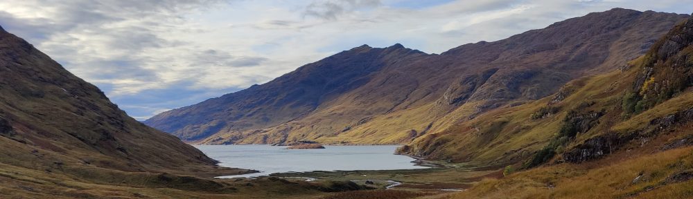
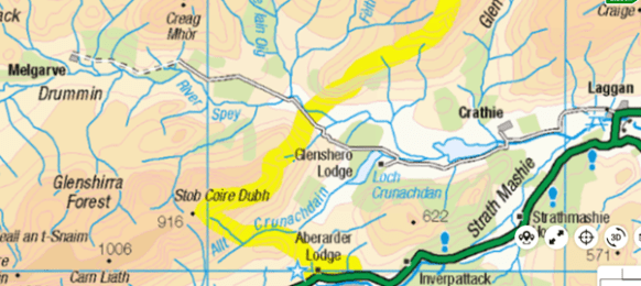

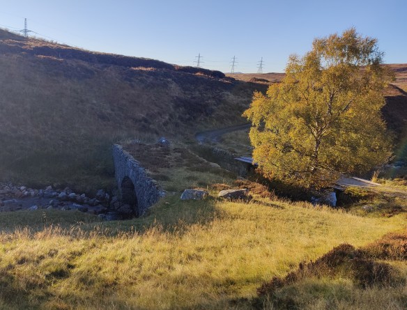
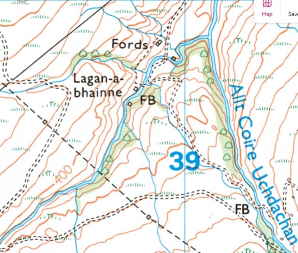
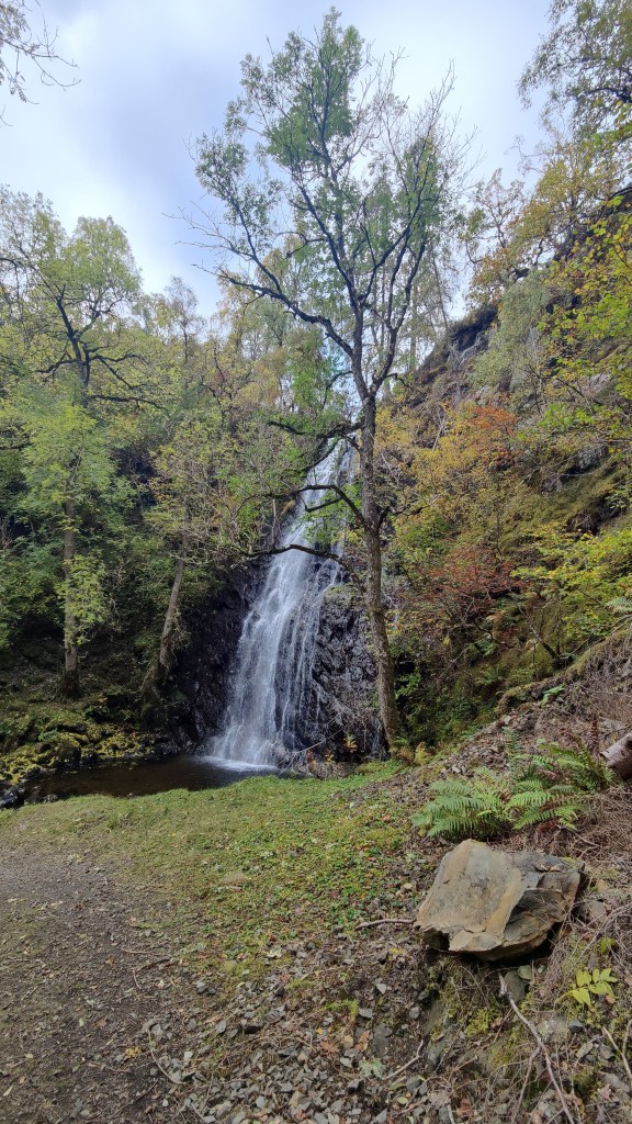
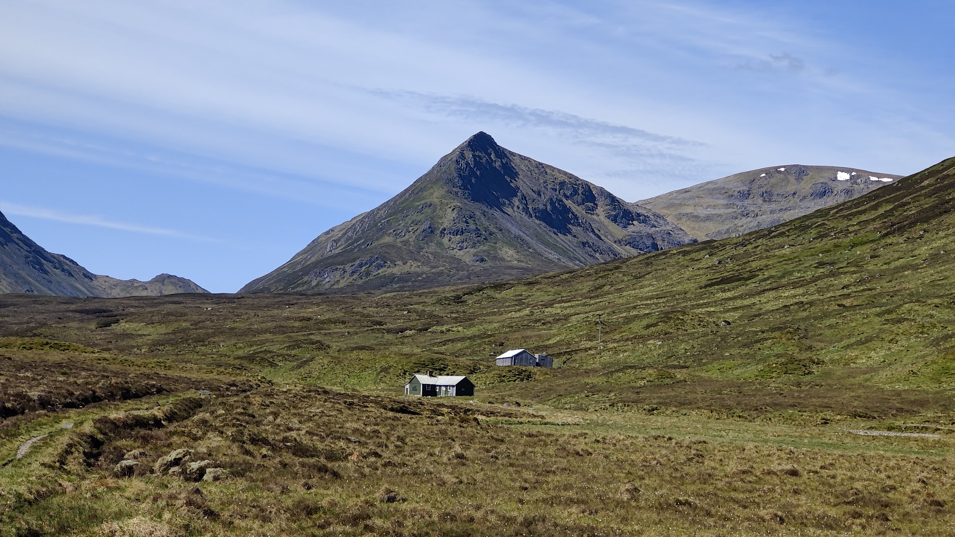
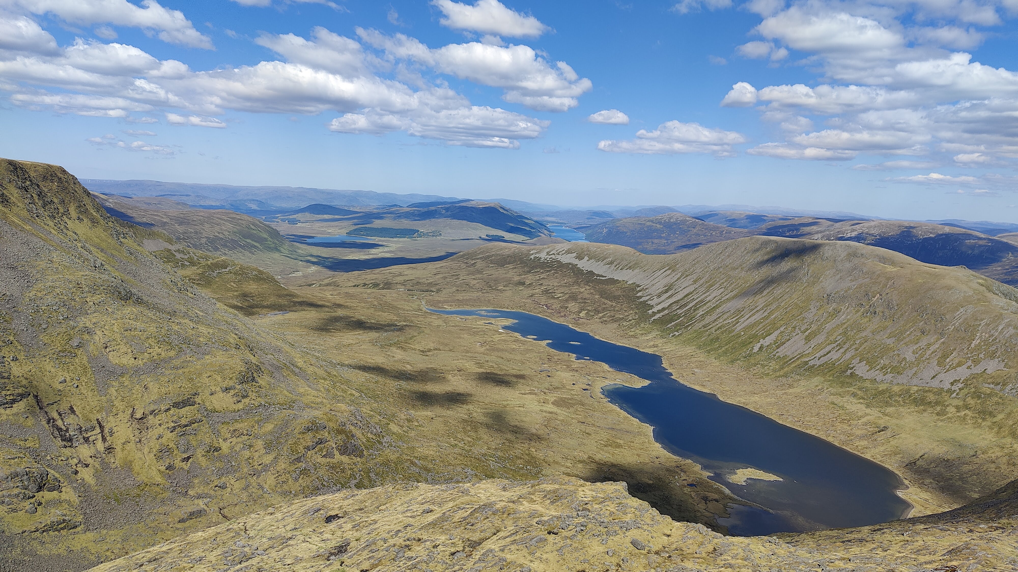
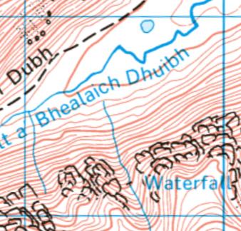

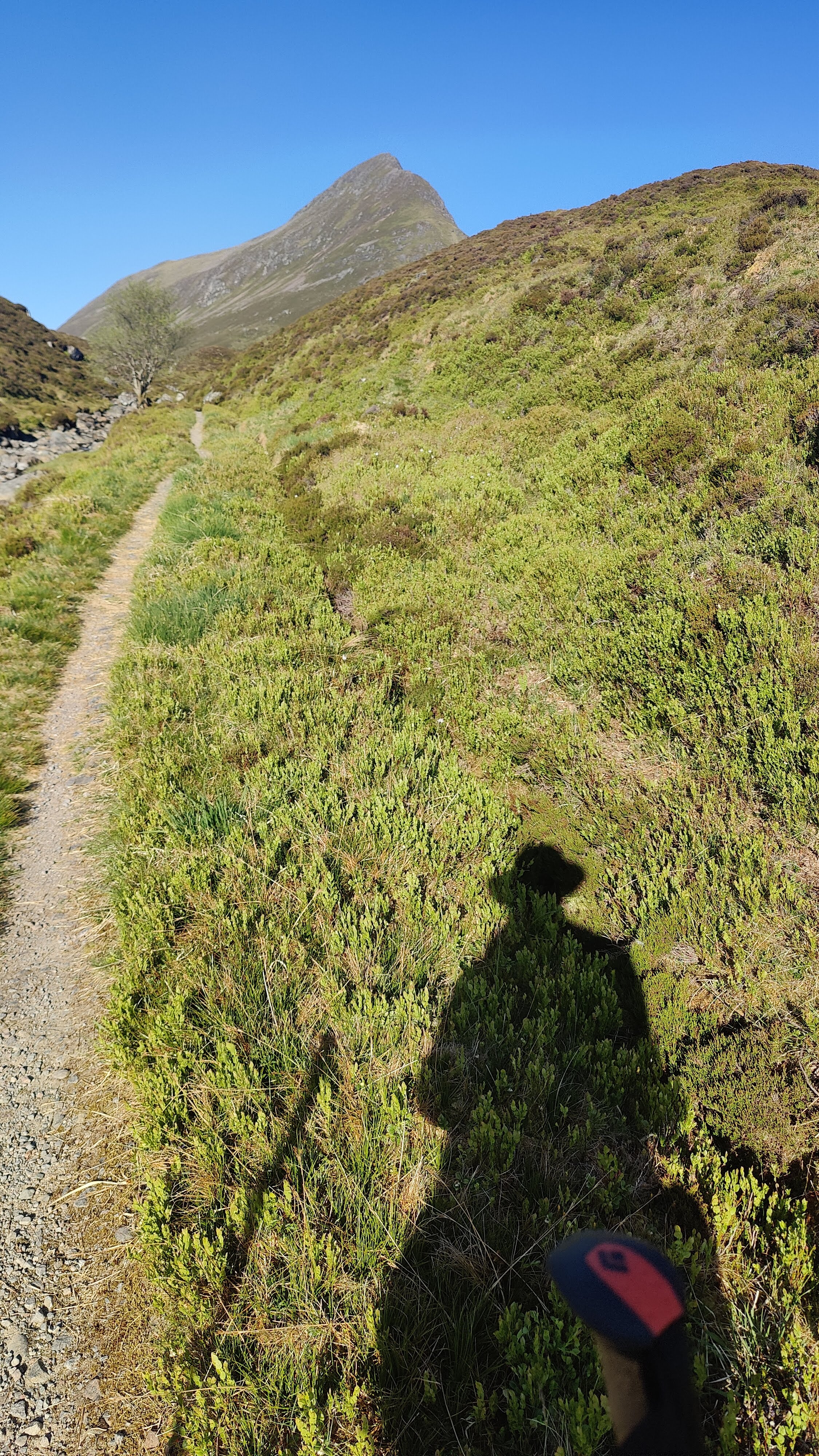
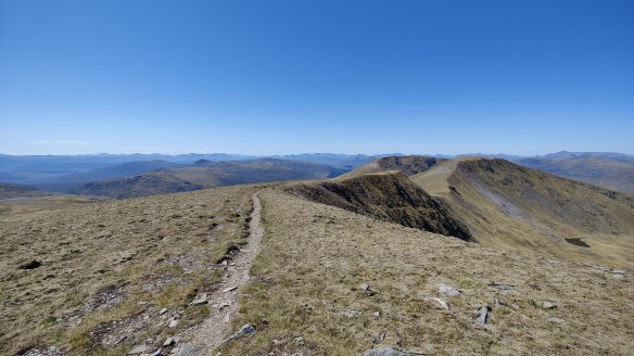
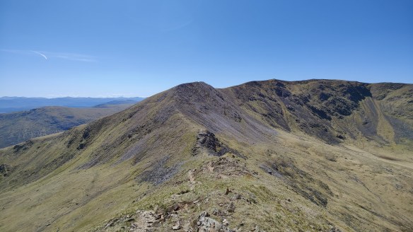
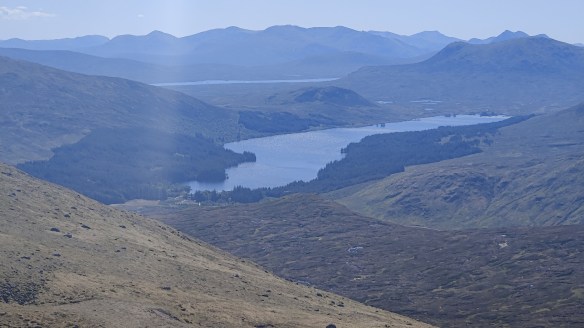
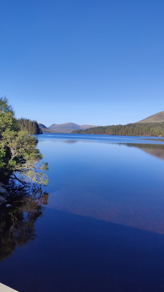
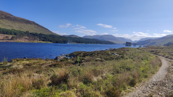
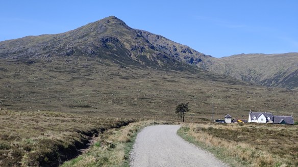
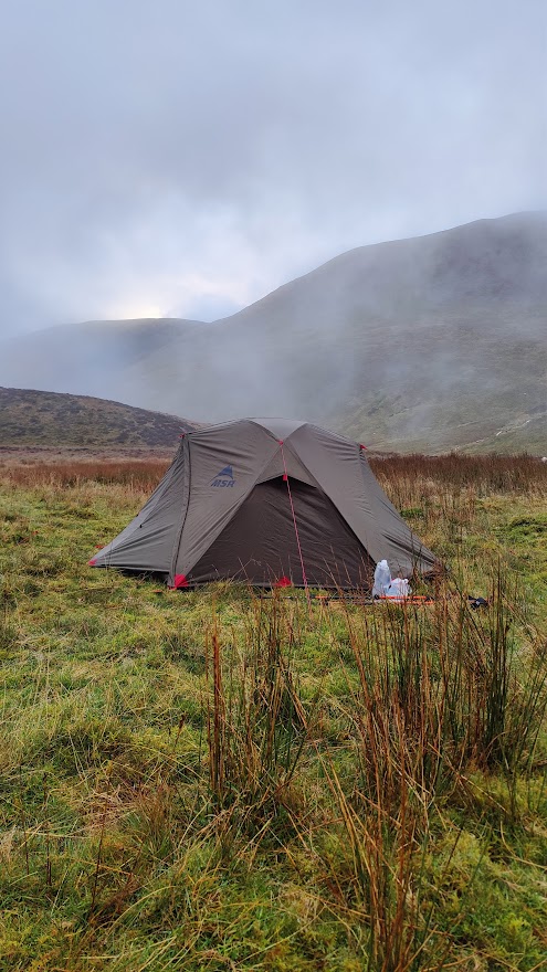
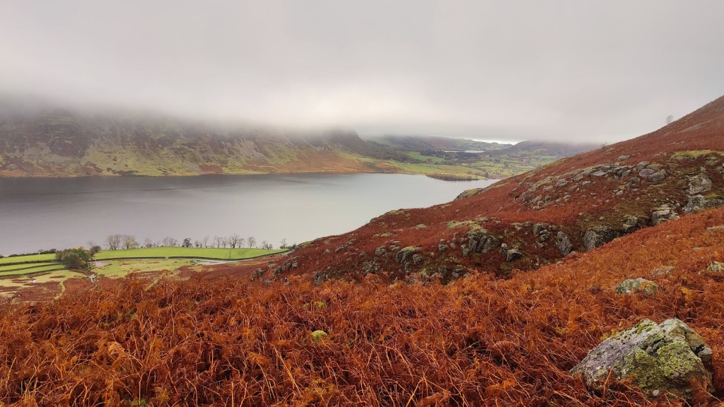

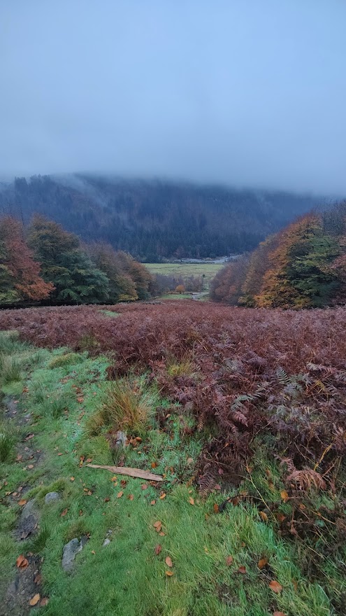
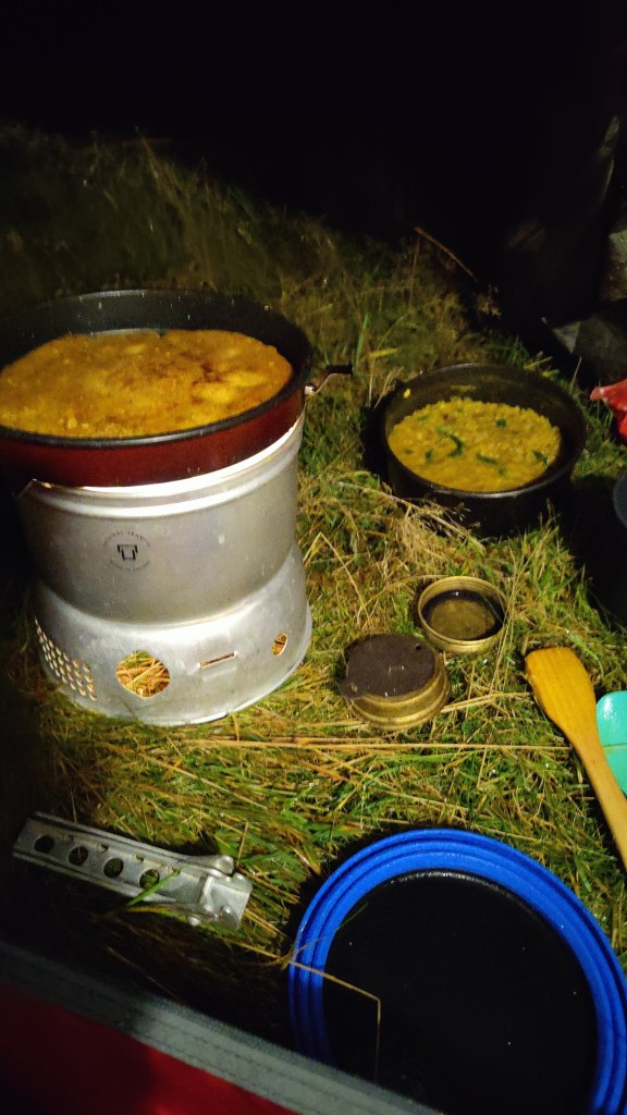
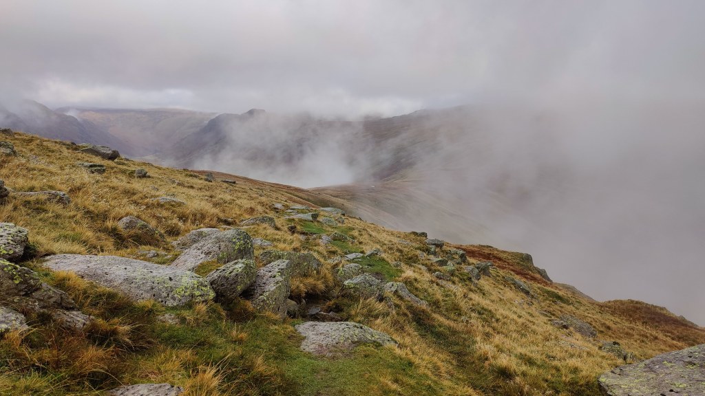
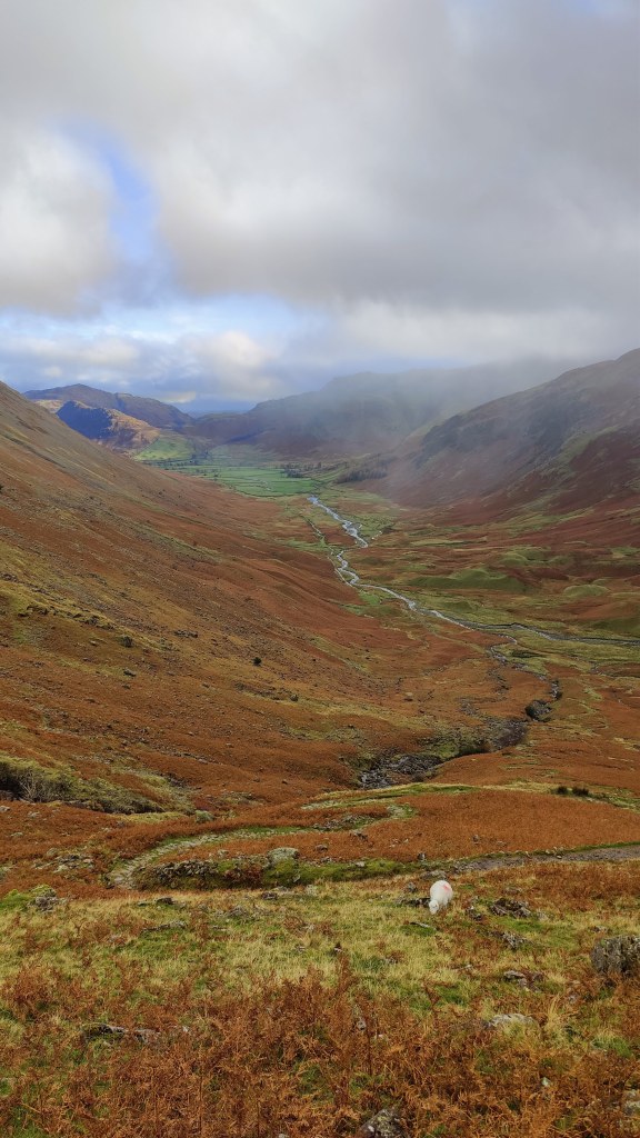
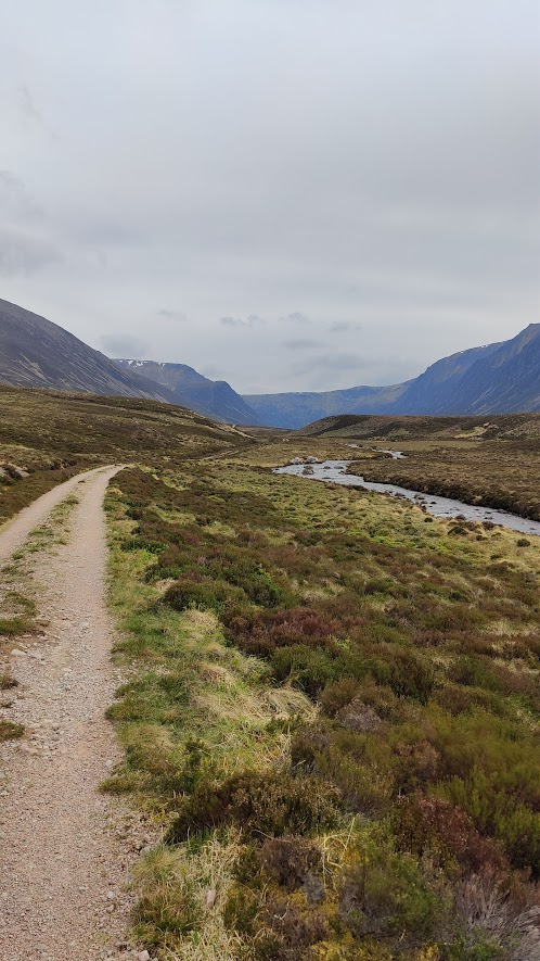
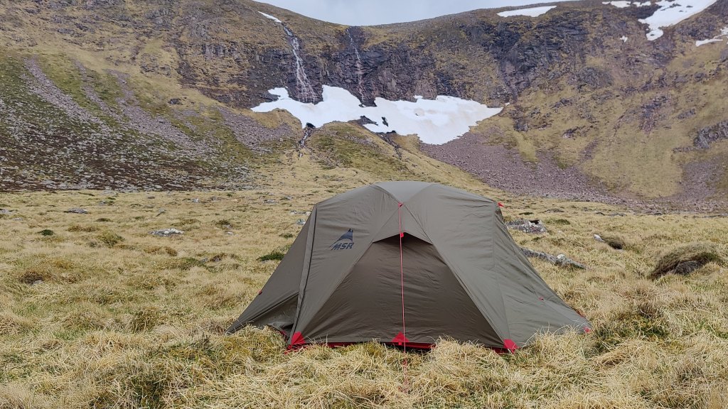
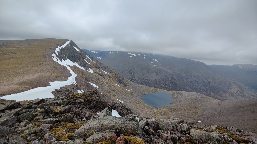
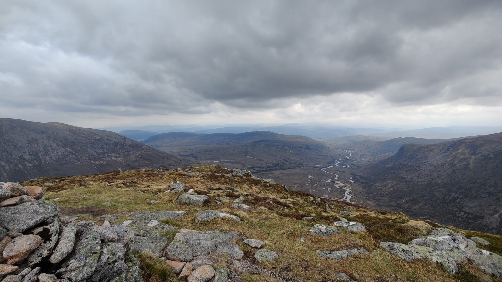
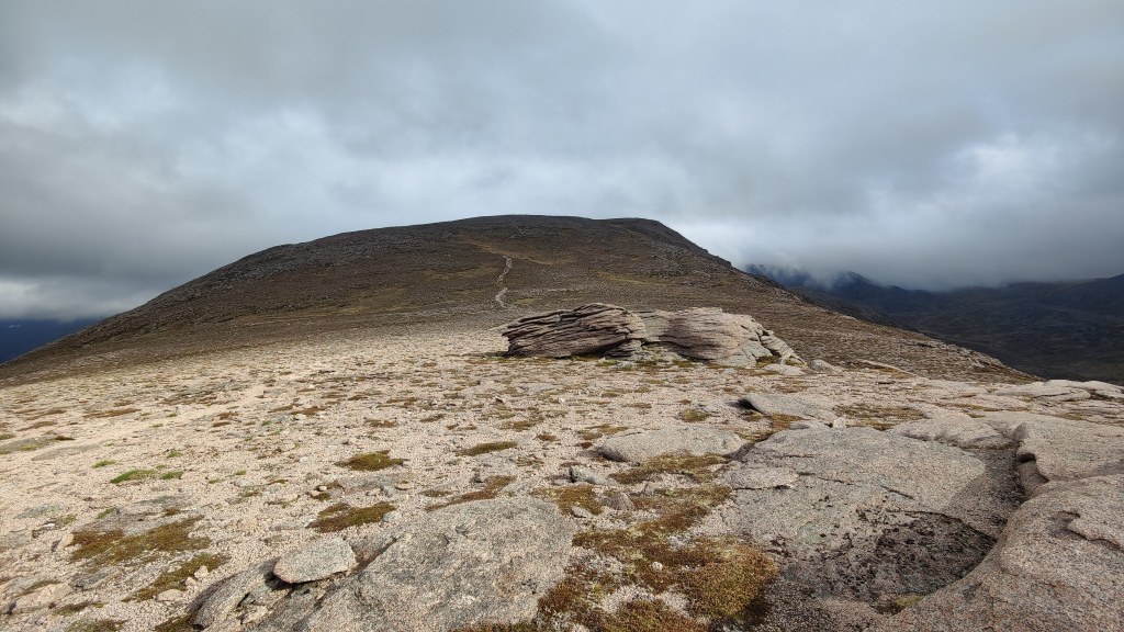

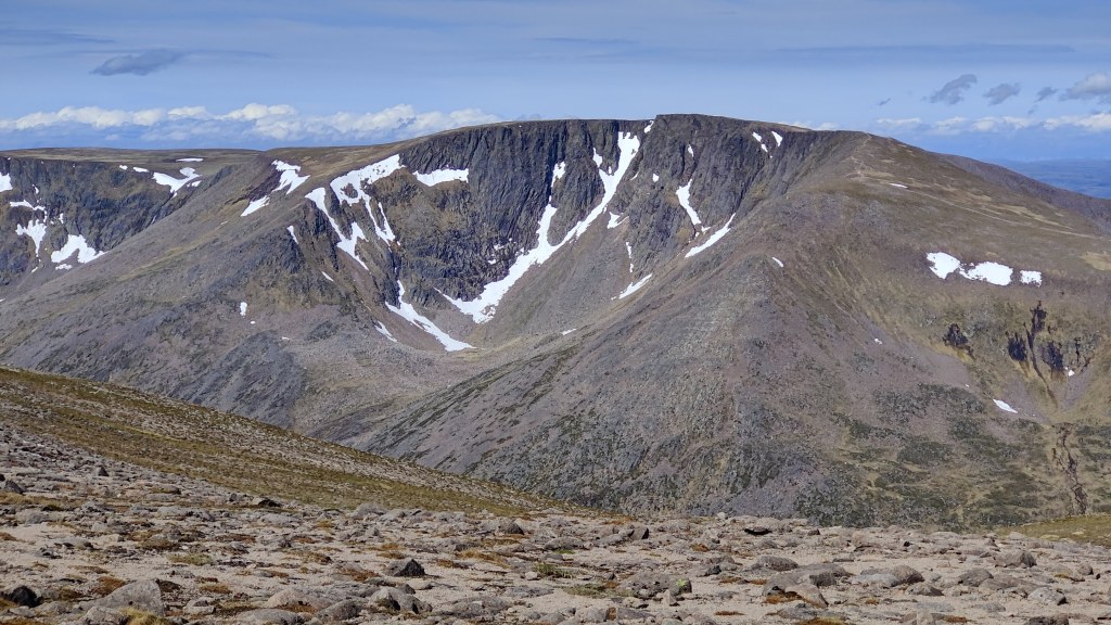
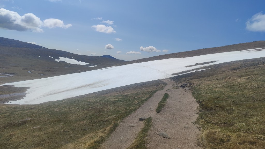

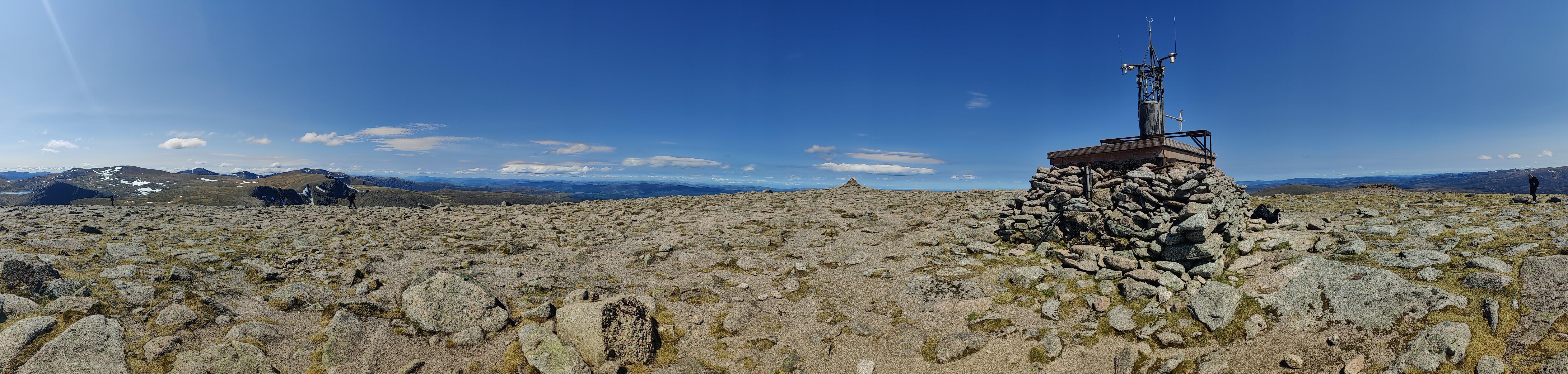
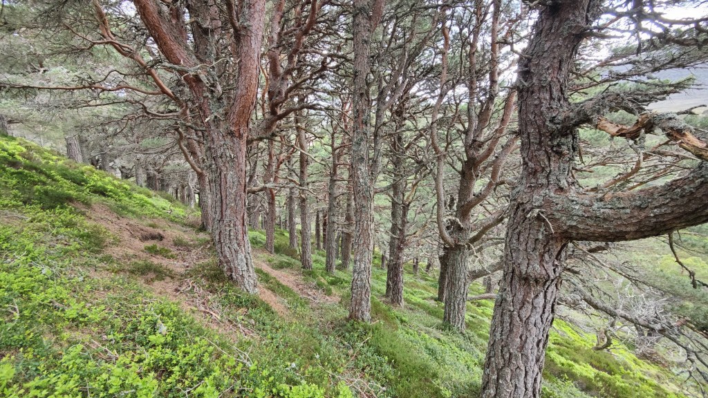


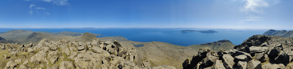


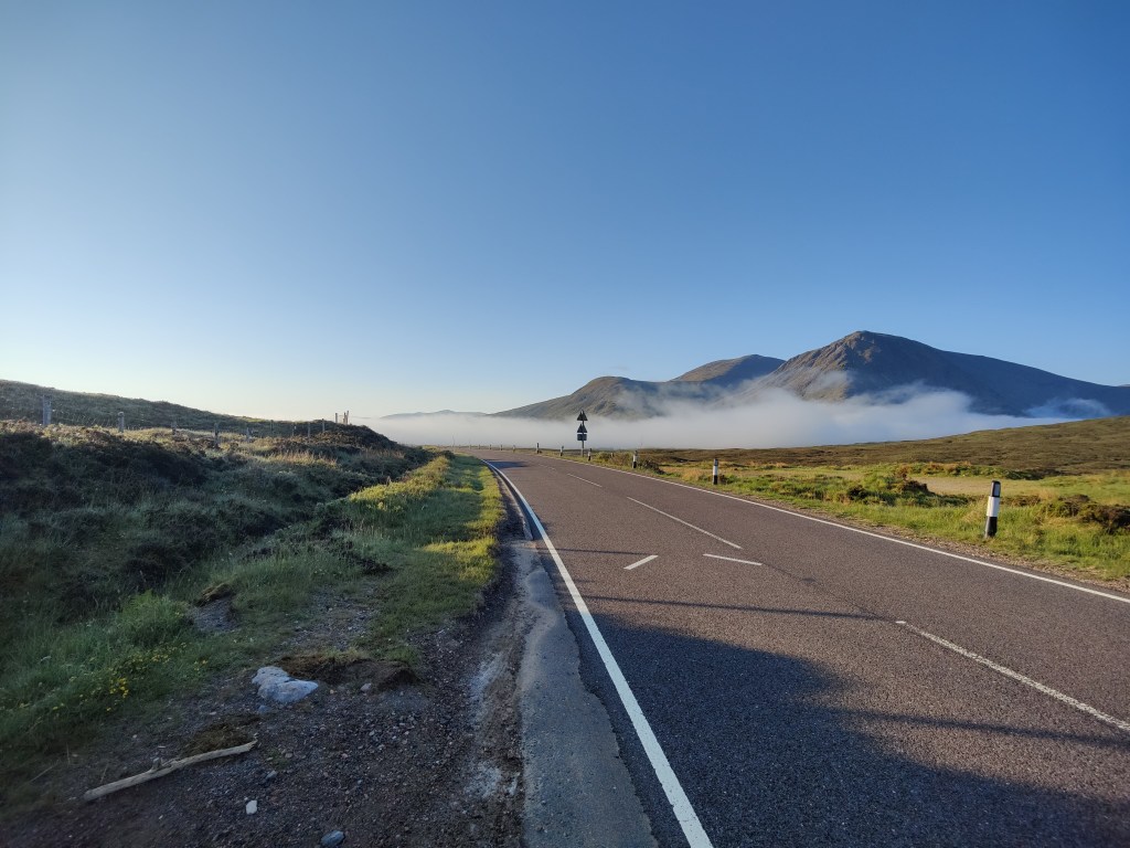
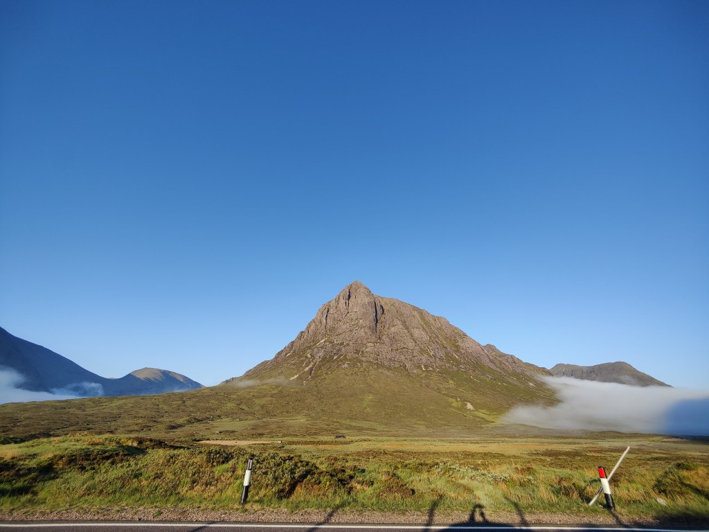


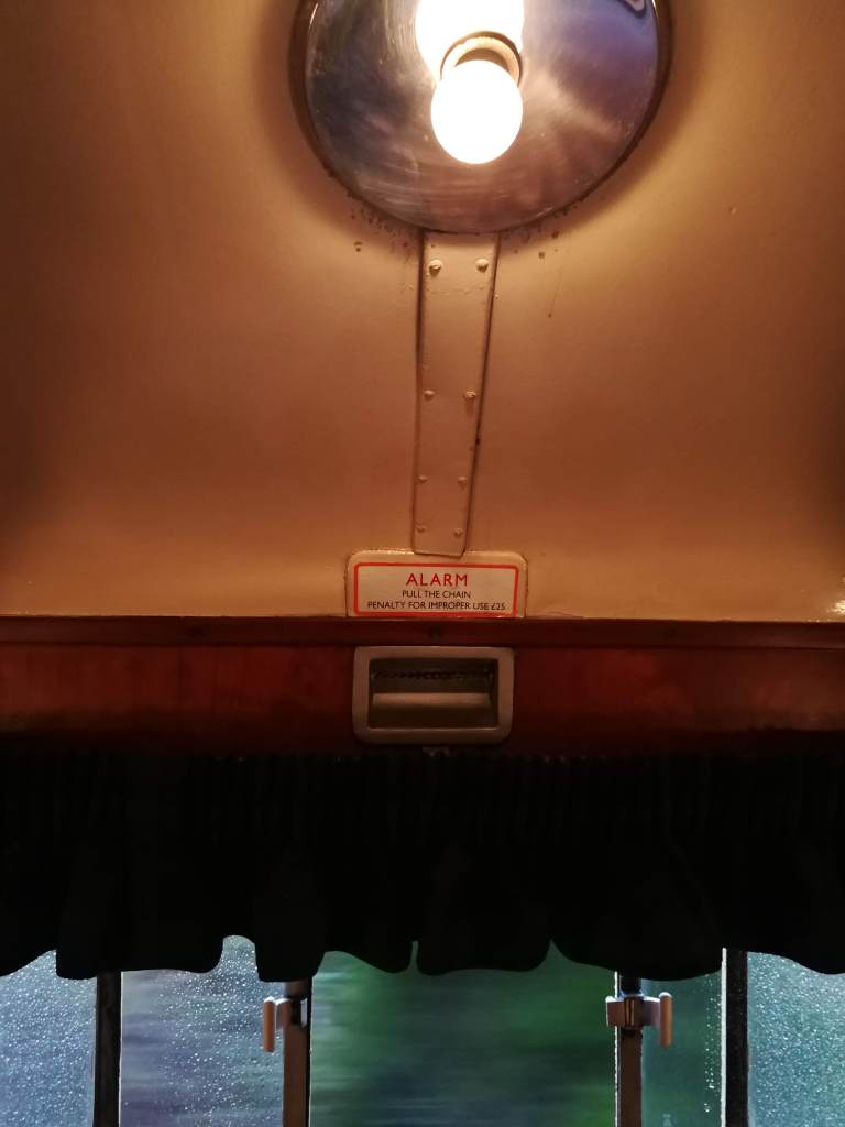

")